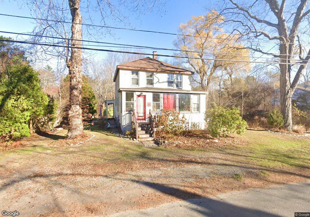
17 Gerrish Rd Salisbury, MA 01952
Estimated Value: $515,973 - $576,000
3
Beds
2
Baths
1,344
Sq Ft
$399/Sq Ft
Est. Value
About This Home
This home is located at 17 Gerrish Rd, Salisbury, MA 01952 and is currently estimated at $536,493, approximately $399 per square foot. 17 Gerrish Rd is a home located in Essex County with nearby schools including Triton Regional High School, River Valley Charter School, and Immaculate Conception School.
Ownership History
Date
Name
Owned For
Owner Type
Purchase Details
Closed on
Dec 11, 2025
Sold by
True Ruth M
Bought by
Ruth M True Irt and Alley
Current Estimated Value
Purchase Details
Closed on
Jun 19, 2003
Sold by
True Ruth Marie and Alley Ruth
Bought by
True Ruth Marie
Home Financials for this Owner
Home Financials are based on the most recent Mortgage that was taken out on this home.
Original Mortgage
$112,900
Interest Rate
5.71%
Mortgage Type
Purchase Money Mortgage
Purchase Details
Closed on
Jun 18, 1998
Sold by
Paquette Joseph F
Bought by
Alley Ruth True
Create a Home Valuation Report for This Property
The Home Valuation Report is an in-depth analysis detailing your home's value as well as a comparison with similar homes in the area
Home Values in the Area
Average Home Value in this Area
Purchase History
| Date | Buyer | Sale Price | Title Company |
|---|---|---|---|
| Ruth M True Irt | -- | -- | |
| True Ruth Marie | -- | -- | |
| Alley Ruth True | $128,000 | -- |
Source: Public Records
Mortgage History
| Date | Status | Borrower | Loan Amount |
|---|---|---|---|
| Previous Owner | Alley Ruth True | $0 | |
| Previous Owner | Alley Ruth True | $120,000 | |
| Previous Owner | Alley Ruth True | $118,000 | |
| Previous Owner | Alley Ruth True | $112,900 |
Source: Public Records
Tax History
| Year | Tax Paid | Tax Assessment Tax Assessment Total Assessment is a certain percentage of the fair market value that is determined by local assessors to be the total taxable value of land and additions on the property. | Land | Improvement |
|---|---|---|---|---|
| 2025 | $4,241 | $420,700 | $160,300 | $260,400 |
| 2024 | $4,272 | $408,800 | $160,300 | $248,500 |
| 2023 | $4,136 | $383,000 | $160,300 | $222,700 |
| 2022 | $3,993 | $358,400 | $144,300 | $214,100 |
| 2021 | $3,817 | $339,000 | $144,300 | $194,700 |
| 2020 | $3,565 | $311,100 | $144,300 | $166,800 |
| 2019 | $3,501 | $295,200 | $140,300 | $154,900 |
| 2018 | $3,305 | $280,600 | $128,400 | $152,200 |
| 2017 | $3,083 | $258,600 | $120,200 | $138,400 |
| 2016 | $2,892 | $247,800 | $116,200 | $131,600 |
| 2015 | $2,986 | $254,100 | $108,200 | $145,900 |
Source: Public Records
Map
Nearby Homes
- 14 Seabrook Rd
- 55 Lafayette Rd
- 9 Meadowview Ln Unit A
- 14 Meadowview Ln Unit B
- 16 Meadowview Ln Unit B
- 42 Kendell Ln
- 6 Mason Ln
- 2 True Rd
- 44 Seabrook Rd
- 154 Lafayette Rd
- 64 Seabrook Rd
- 84 Forest Rd
- 48 Beach Rd Unit C
- 25 Bayberry Ln
- 188 Lafayette Rd
- 100 Forest Rd
- 3 Lighthouse Cir Unit A
- 7 Toll Rd
- 57 Baker Rd
- 135 Beach Rd Unit B114
- 19 Gerrish Rd
- 15 Gerrish Rd
- 18 Gerrish Rd
- 20 Gerrish Rd
- 16 Gerrish Rd
- 21 Gerrish Rd
- 4 Winterberry Cir
- 4 Winterberry Cir
- 14 Gerrish Rd
- 2 Winterberry Cir
- 2 Winterberry Cir
- 22 Gerrish Rd
- 6 Winterberry Cir
- 6 Winterberry Cir
- 23 Gerrish Rd
- 1 Trout Way
- 1 Trout Way Unit A
- 5 Seabrook Rd
- 8 Winterberry Cir
- 1 Winterberry Cir
Your Personal Tour Guide
Ask me questions while you tour the home.