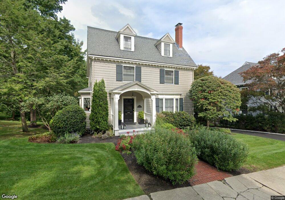
17 Glengarry Rd Winchester, MA 01890
The Flats NeighborhoodEstimated Value: $2,004,000 - $2,451,000
6
Beds
4
Baths
3,266
Sq Ft
$686/Sq Ft
Est. Value
About This Home
This home is located at 17 Glengarry Rd, Winchester, MA 01890 and is currently estimated at $2,241,611, approximately $686 per square foot. 17 Glengarry Rd is a home located in Middlesex County with nearby schools including Ambrose Elementary School, McCall Middle School, and Winchester High School.
Ownership History
Date
Name
Owned For
Owner Type
Purchase Details
Closed on
Jun 28, 1996
Sold by
Sutherland John A and Sutherland Ann M
Bought by
Systrom David M and Martin Kathryn A
Current Estimated Value
Create a Home Valuation Report for This Property
The Home Valuation Report is an in-depth analysis detailing your home's value as well as a comparison with similar homes in the area
Home Values in the Area
Average Home Value in this Area
Purchase History
| Date | Buyer | Sale Price | Title Company |
|---|---|---|---|
| Systrom David M | $510,000 | -- |
Source: Public Records
Mortgage History
| Date | Status | Borrower | Loan Amount |
|---|---|---|---|
| Open | Systrom David M | $150,000 | |
| Closed | Systrom David M | $150,000 |
Source: Public Records
Tax History
| Year | Tax Paid | Tax Assessment Tax Assessment Total Assessment is a certain percentage of the fair market value that is determined by local assessors to be the total taxable value of land and additions on the property. | Land | Improvement |
|---|---|---|---|---|
| 2025 | $231 | $2,084,800 | $1,133,100 | $951,700 |
| 2024 | $22,808 | $2,013,100 | $1,099,800 | $913,300 |
| 2023 | $21,529 | $1,824,500 | $1,033,100 | $791,400 |
| 2022 | $21,122 | $1,688,400 | $933,200 | $755,200 |
| 2021 | $20,165 | $1,571,700 | $816,500 | $755,200 |
| 2020 | $19,473 | $1,571,700 | $816,500 | $755,200 |
| 2019 | $17,822 | $1,471,700 | $716,500 | $755,200 |
| 2018 | $17,517 | $1,437,000 | $699,900 | $737,100 |
| 2017 | $16,914 | $1,377,400 | $665,700 | $711,700 |
| 2016 | $15,809 | $1,353,500 | $665,700 | $687,800 |
| 2015 | $15,519 | $1,278,300 | $604,900 | $673,400 |
| 2014 | $15,486 | $1,223,200 | $549,900 | $673,300 |
Source: Public Records
Map
Nearby Homes
- 6 Ivy Cir
- 36 Middlesex St Unit 38
- 45 Bacon St
- 12 Yale St
- 115 Washington St Unit 2A
- 62 Richardson St
- 200 Swanton St Unit 228
- 200 Swanton St Unit 636
- 200 Swanton St Unit T28
- 49 Spruce St
- 9 Lakeview Terrace
- 27 Everett Ave
- 10 Sheffield W
- 13 Nelson St
- 35 Glen Green
- 263 Highland Ave
- 237 Swanton St
- 89 Wildwood St
- 22 Oak St
- 149 Horn Pond Brook Rd
Your Personal Tour Guide
Ask me questions while you tour the home.