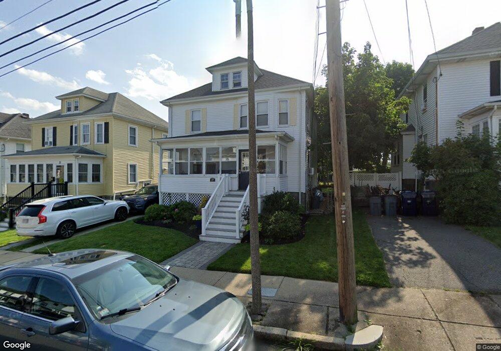
17 Glide St Dorchester, MA 02122
Neponset-Port Norfolk NeighborhoodEstimated Value: $802,639 - $882,000
3
Beds
2
Baths
1,410
Sq Ft
$588/Sq Ft
Est. Value
About This Home
This home is located at 17 Glide St, Dorchester, MA 02122 and is currently estimated at $828,660, approximately $587 per square foot. 17 Glide St is a home located in Suffolk County with nearby schools including Neighborhood House Charter School, Conservatory Lab Upper School, and St Brendan School.
Ownership History
Date
Name
Owned For
Owner Type
Purchase Details
Closed on
Apr 28, 2000
Sold by
Purcell Paul F
Bought by
Dill James O and Dill Christina M
Current Estimated Value
Purchase Details
Closed on
May 17, 1991
Sold by
Coakley Marie E Est
Bought by
Cuddy Deborah A
Create a Home Valuation Report for This Property
The Home Valuation Report is an in-depth analysis detailing your home's value as well as a comparison with similar homes in the area
Home Values in the Area
Average Home Value in this Area
Purchase History
| Date | Buyer | Sale Price | Title Company |
|---|---|---|---|
| Dill James O | $210,000 | -- | |
| Cuddy Deborah A | $120,000 | -- |
Source: Public Records
Mortgage History
| Date | Status | Borrower | Loan Amount |
|---|---|---|---|
| Open | Cuddy Deborah A | $240,000 | |
| Closed | Cuddy Deborah A | $160,000 | |
| Closed | Cuddy Deborah A | $129,000 |
Source: Public Records
Tax History Compared to Growth
Tax History
| Year | Tax Paid | Tax Assessment Tax Assessment Total Assessment is a certain percentage of the fair market value that is determined by local assessors to be the total taxable value of land and additions on the property. | Land | Improvement |
|---|---|---|---|---|
| 2025 | $7,592 | $655,600 | $237,300 | $418,300 |
| 2024 | $6,889 | $632,000 | $227,000 | $405,000 |
| 2023 | $6,342 | $590,500 | $212,100 | $378,400 |
| 2022 | $6,117 | $562,200 | $201,900 | $360,300 |
| 2021 | $5,648 | $529,300 | $196,000 | $333,300 |
| 2020 | $5,267 | $498,800 | $192,400 | $306,400 |
| 2019 | $4,855 | $460,600 | $151,500 | $309,100 |
| 2018 | $4,510 | $430,300 | $151,500 | $278,800 |
| 2017 | $4,338 | $409,600 | $151,500 | $258,100 |
| 2016 | $4,211 | $382,800 | $151,500 | $231,300 |
| 2015 | $3,803 | $314,000 | $126,000 | $188,000 |
| 2014 | $3,725 | $296,100 | $126,000 | $170,100 |
Source: Public Records
Map
Nearby Homes
- 33 Pierce Ave
- 107 Minot St
- 103 Minot St
- 667 Adams St
- 10-12 Charlemont St
- 45 Chickatawbut St Unit 1
- 45 Chickatawbut St Unit 2
- 43 Chickatawbut St
- 51 Coffey St Unit 51C
- 49 B Coffey St Unit B
- 45 Coffey St Unit 45-1
- 48 Coffey St Unit 10D
- 9 Grayson St
- 56 Coffey St Unit 7
- 80 Beaumont St Unit 101
- 285 Neponset Ave Unit 3
- 22 Chickatawbut St Unit 2
- 37 Westmoreland St
- 114 Wrentham St Unit 2
- 217 Neponset Ave Unit 33