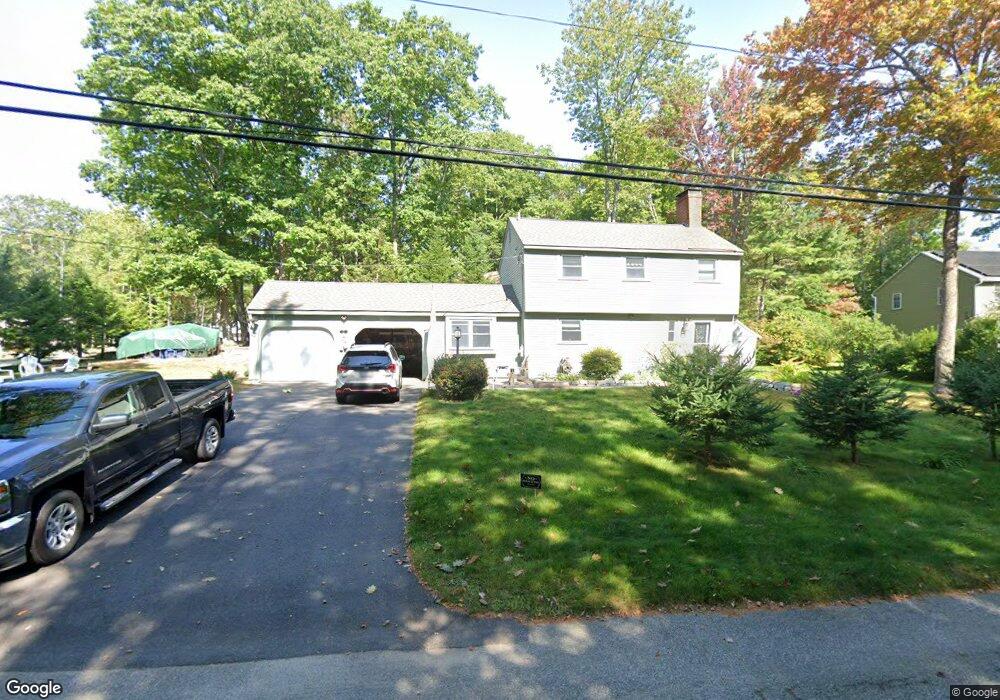
17 Gunstock Rd Scarborough, ME 04074
Estimated Value: $564,000 - $682,000
3
Beds
2
Baths
1,370
Sq Ft
$452/Sq Ft
Est. Value
About This Home
This home is located at 17 Gunstock Rd, Scarborough, ME 04074 and is currently estimated at $619,495, approximately $452 per square foot. 17 Gunstock Rd is a home located in Cumberland County with nearby schools including Scarborough High School, Greater Portland Christian School, and Cornerstone Baptist Academy.
Ownership History
Date
Name
Owned For
Owner Type
Purchase Details
Closed on
Oct 24, 2014
Sold by
Hale Kirsten M
Bought by
Hale Thomas C
Current Estimated Value
Home Financials for this Owner
Home Financials are based on the most recent Mortgage that was taken out on this home.
Original Mortgage
$199,750
Interest Rate
4.1%
Mortgage Type
Commercial
Create a Home Valuation Report for This Property
The Home Valuation Report is an in-depth analysis detailing your home's value as well as a comparison with similar homes in the area
Home Values in the Area
Average Home Value in this Area
Purchase History
| Date | Buyer | Sale Price | Title Company |
|---|---|---|---|
| Hale Thomas C | -- | -- |
Source: Public Records
Mortgage History
| Date | Status | Borrower | Loan Amount |
|---|---|---|---|
| Closed | Hale Thomas C | $199,750 |
Source: Public Records
Tax History Compared to Growth
Tax History
| Year | Tax Paid | Tax Assessment Tax Assessment Total Assessment is a certain percentage of the fair market value that is determined by local assessors to be the total taxable value of land and additions on the property. | Land | Improvement |
|---|---|---|---|---|
| 2025 | $5,748 | $507,300 | $187,900 | $319,400 |
| 2024 | $5,545 | $507,300 | $187,900 | $319,400 |
| 2023 | $5,232 | $327,600 | $122,600 | $205,000 |
| 2022 | $5,042 | $327,600 | $122,600 | $205,000 |
| 2021 | $4,921 | $327,600 | $122,600 | $205,000 |
| 2020 | $4,868 | $327,600 | $122,600 | $205,000 |
| 2019 | $4,816 | $327,600 | $122,600 | $205,000 |
| 2017 | $4,503 | $273,100 | $142,600 | $130,500 |
| 2016 | $4,348 | $273,100 | $142,600 | $130,500 |
| 2015 | $4,230 | $273,100 | $142,600 | $130,500 |
| 2014 | $3,973 | $273,100 | $142,600 | $130,500 |
| 2013 | -- | $273,100 | $142,600 | $130,500 |
Source: Public Records
Map
Nearby Homes
- 162 Fogg Rd
- 190 Pleasant Hill Rd
- 9 Coralburst Ln
- 1 Coralburst Ln
- 131 Spurwink Rd
- Lot 5 Trestle Way
- 10 Highland Ave
- 99 Quarry Rd
- 228 Deerwood St
- 9 Trestle Way
- 245 Deerwood St
- 1 Quarry Rd
- 52 Tamarack Dr
- 1 Teal Point Dr Unit 1
- 1 Stratton Rd Unit 1
- 21 Stratton Rd
- 5 Barnstable Rd
- 11 Second Ave
- 6 Appletree Dr
- 18 Colchester Dr
- 3 Quarter Deck Ln
- 15 Gunstock Rd
- 2 Sextant Ln
- 5 Quarter Deck Ln
- 18 Gunstock Rd
- 2 Quarter Deck Ln
- 13 Gunstock Rd
- 1 Sextant Ln
- 4 Quarter Deck Ln
- 17 Ole Ironside Ln
- 7 Quarter Deck Ln
- 4 Sextant Ln
- 7 Quarterdeck Ln
- 19 Ole Ironside Ln
- 11 Gunstock Rd
- 15 Ole Ironside Ln
- 3 Sextant Ln
- 23 Gunstock Rd
- 26 Gunstock Rd
- 12 Gunstock Rd