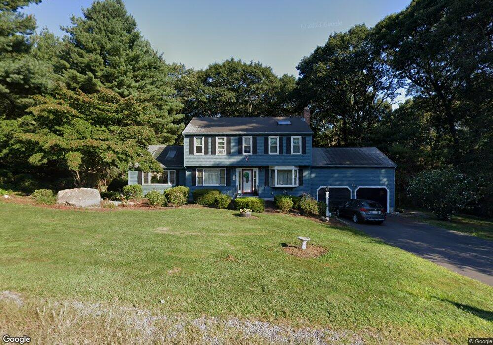
17 Hammond Rd Hopedale, MA 01747
Estimated Value: $633,757 - $710,000
3
Beds
2
Baths
2,631
Sq Ft
$256/Sq Ft
Est. Value
About This Home
This home is located at 17 Hammond Rd, Hopedale, MA 01747 and is currently estimated at $673,189, approximately $255 per square foot. 17 Hammond Rd is a home located in Worcester County with nearby schools including Memorial Elementary School and Hopedale Jr Sr High School.
Ownership History
Date
Name
Owned For
Owner Type
Purchase Details
Closed on
Mar 3, 1986
Bought by
Glenn David P and Glenn Sally A
Current Estimated Value
Create a Home Valuation Report for This Property
The Home Valuation Report is an in-depth analysis detailing your home's value as well as a comparison with similar homes in the area
Home Values in the Area
Average Home Value in this Area
Purchase History
| Date | Buyer | Sale Price | Title Company |
|---|---|---|---|
| Glenn David P | $133,900 | -- |
Source: Public Records
Mortgage History
| Date | Status | Borrower | Loan Amount |
|---|---|---|---|
| Open | Glenn David P | $215,000 | |
| Closed | Glenn David P | $25,000 |
Source: Public Records
Tax History Compared to Growth
Tax History
| Year | Tax Paid | Tax Assessment Tax Assessment Total Assessment is a certain percentage of the fair market value that is determined by local assessors to be the total taxable value of land and additions on the property. | Land | Improvement |
|---|---|---|---|---|
| 2025 | $8,546 | $514,500 | $192,700 | $321,800 |
| 2024 | $7,935 | $478,000 | $183,400 | $294,600 |
| 2023 | $7,290 | $451,400 | $180,300 | $271,100 |
| 2022 | $7,128 | $416,600 | $165,300 | $251,300 |
| 2021 | $2,852 | $383,900 | $150,300 | $233,600 |
| 2020 | $6,684 | $383,900 | $150,300 | $233,600 |
| 2019 | $6,380 | $363,100 | $150,300 | $212,800 |
| 2018 | $2,662 | $351,100 | $143,200 | $207,900 |
| 2017 | $2,424 | $333,900 | $136,500 | $197,400 |
| 2016 | $5,557 | $330,200 | $136,500 | $193,700 |
| 2015 | $5,243 | $316,200 | $127,200 | $189,000 |
Source: Public Records
Map
Nearby Homes
- 8 Union St Unit 8
- 26 Brookview Ln Unit 26
- 108 Laurelwood Dr Unit 108
- 106 Adin St
- 3 Birch Cir
- 116 Adin St
- 164 Greene St
- 2 Crestview Dr
- 11 Heron Ln
- 104 Jones Rd
- 130 Dutcher St
- 15 Tammie Rd
- 6 Correia Cir Unit B
- 7 Ariana Cir Unit 7
- 76 Jones Rd
- 9 Ariana Cir Unit 9
- 59 Lawrence St
- 175 West St
- 318 Main St
- 16 North Ave