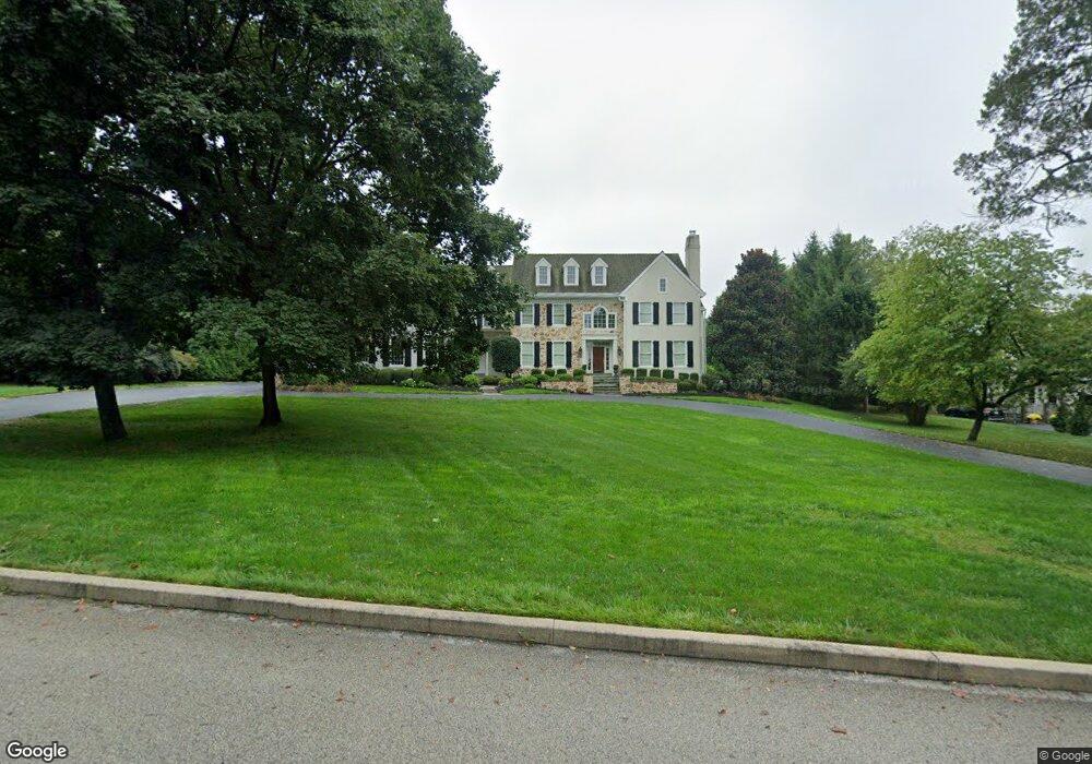
17 Harrison Dr Newtown Square, PA 19073
Estimated Value: $2,351,223 - $2,929,000
5
Beds
5
Baths
7,044
Sq Ft
$387/Sq Ft
Est. Value
About This Home
This home is located at 17 Harrison Dr, Newtown Square, PA 19073 and is currently estimated at $2,727,741, approximately $387 per square foot. 17 Harrison Dr is a home located in Delaware County with nearby schools including Culbertson Elementary School, Paxon Hollow Middle School, and Marple Newtown Senior High School.
Ownership History
Date
Name
Owned For
Owner Type
Purchase Details
Closed on
Jan 19, 1998
Sold by
Chadwell Associates Lp
Bought by
Boyek Timothy J and Poor Leslie H
Current Estimated Value
Home Financials for this Owner
Home Financials are based on the most recent Mortgage that was taken out on this home.
Original Mortgage
$650,000
Interest Rate
6.65%
Mortgage Type
Purchase Money Mortgage
Create a Home Valuation Report for This Property
The Home Valuation Report is an in-depth analysis detailing your home's value as well as a comparison with similar homes in the area
Home Values in the Area
Average Home Value in this Area
Purchase History
| Date | Buyer | Sale Price | Title Company |
|---|---|---|---|
| Boyek Timothy J | $987,200 | -- |
Source: Public Records
Mortgage History
| Date | Status | Borrower | Loan Amount |
|---|---|---|---|
| Closed | Boyek Timothy J | $650,000 |
Source: Public Records
Tax History Compared to Growth
Tax History
| Year | Tax Paid | Tax Assessment Tax Assessment Total Assessment is a certain percentage of the fair market value that is determined by local assessors to be the total taxable value of land and additions on the property. | Land | Improvement |
|---|---|---|---|---|
| 2025 | $26,457 | $1,589,800 | $341,570 | $1,248,230 |
| 2024 | $26,457 | $1,589,800 | $341,570 | $1,248,230 |
| 2023 | $25,622 | $1,589,800 | $341,570 | $1,248,230 |
| 2022 | $25,061 | $1,589,800 | $341,570 | $1,248,230 |
| 2021 | $38,314 | $1,589,800 | $341,570 | $1,248,230 |
| 2020 | $25,995 | $947,680 | $313,280 | $634,400 |
| 2019 | $25,583 | $947,680 | $313,280 | $634,400 |
| 2018 | $25,304 | $947,680 | $0 | $0 |
| 2017 | $25,221 | $947,680 | $0 | $0 |
| 2016 | $5,201 | $947,680 | $0 | $0 |
| 2015 | $5,307 | $947,680 | $0 | $0 |
| 2014 | $5,307 | $947,680 | $0 | $0 |
Source: Public Records
Map
Nearby Homes
- 201 Church Rd
- 1 Dunminning Rd
- 3314 Saint Davids Rd
- 641 Andover Rd
- 718 Lot 1 Waterloo
- 659 Andover Rd
- 409 Timber Ln
- 120 S Devon Ave
- 3111 Sawmill Rd
- 709 Newtown Rd
- 1052 Prescott Rd
- 0 Prescott Rd Unit PACT2110528
- 422 S Waterloo Rd
- 600 Waynesfield Dr
- 203 Church St
- 404 Dorset Rd
- 412 Fairview Dr
- 238 Highland Ave
- 2 Sugartown Rd
- 6 Wingstone Ln