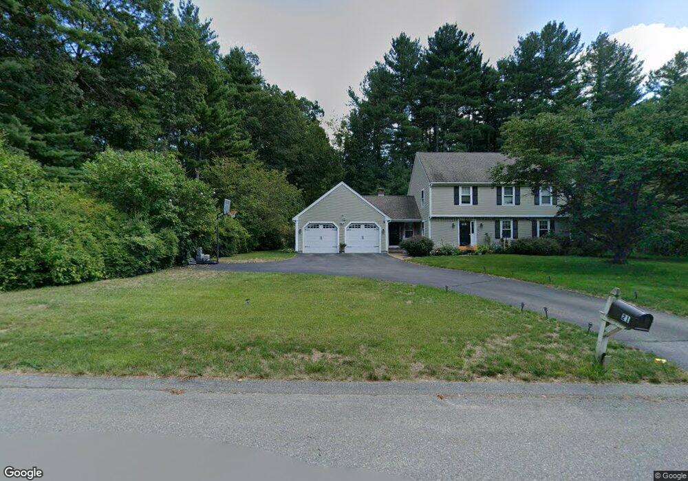
17 Hawtree Way Groton, MA 01450
Estimated Value: $856,000 - $903,000
4
Beds
3
Baths
2,714
Sq Ft
$323/Sq Ft
Est. Value
About This Home
This home is located at 17 Hawtree Way, Groton, MA 01450 and is currently estimated at $875,552, approximately $322 per square foot. 17 Hawtree Way is a home located in Middlesex County with nearby schools including Groton Dunstable Regional High School, Seven Hills At Groton, and Lawrence Academy.
Ownership History
Date
Name
Owned For
Owner Type
Purchase Details
Closed on
Jul 1, 2008
Sold by
Sandman Cindi B and Sandman Mark A
Bought by
Edgar David B and Lamoureux Mara
Current Estimated Value
Home Financials for this Owner
Home Financials are based on the most recent Mortgage that was taken out on this home.
Original Mortgage
$412,000
Interest Rate
6.07%
Mortgage Type
Purchase Money Mortgage
Purchase Details
Closed on
Sep 5, 1996
Sold by
Bernard Lot Nt and Cunningham Barry C
Bought by
Sandman Mark A and Sandman Cindi B
Create a Home Valuation Report for This Property
The Home Valuation Report is an in-depth analysis detailing your home's value as well as a comparison with similar homes in the area
Home Values in the Area
Average Home Value in this Area
Purchase History
| Date | Buyer | Sale Price | Title Company |
|---|---|---|---|
| Edgar David B | $515,000 | -- | |
| Edgar David B | $515,000 | -- | |
| Sandman Mark A | $278,500 | -- | |
| Sandman Mark A | $278,500 | -- |
Source: Public Records
Mortgage History
| Date | Status | Borrower | Loan Amount |
|---|---|---|---|
| Open | Sandman Mark A | $376,000 | |
| Closed | Sandman Mark A | $412,000 | |
| Closed | Edgar David B | $412,000 |
Source: Public Records
Tax History Compared to Growth
Tax History
| Year | Tax Paid | Tax Assessment Tax Assessment Total Assessment is a certain percentage of the fair market value that is determined by local assessors to be the total taxable value of land and additions on the property. | Land | Improvement |
|---|---|---|---|---|
| 2025 | $11,651 | $764,000 | $240,700 | $523,300 |
| 2024 | $11,579 | $767,300 | $240,700 | $526,600 |
| 2023 | $10,989 | $702,600 | $240,700 | $461,900 |
| 2022 | $10,168 | $591,500 | $211,000 | $380,500 |
| 2021 | $10,215 | $580,400 | $204,300 | $376,100 |
| 2020 | $9,872 | $568,000 | $204,300 | $363,700 |
| 2019 | $9,140 | $504,700 | $195,000 | $309,700 |
| 2018 | $8,777 | $470,100 | $185,700 | $284,400 |
| 2017 | $8,584 | $470,100 | $185,700 | $284,400 |
| 2016 | $8,297 | $441,800 | $174,500 | $267,300 |
| 2015 | $8,072 | $441,800 | $174,500 | $267,300 |
Source: Public Records
Map
Nearby Homes
- 91 Chicopee Row
- 208 North St
- 8 Jamie Rd
- 0 Old Dunstable Rd
- 20 B Legacy Ln
- 20 A Legacy Ln Unit 20A
- 573 Longley Rd
- 660 Old Dunstable Rd
- 2 Wildflower Ln
- 82 Martins Pond Rd
- 46 Lowell Rd
- 23 Shawnee Rd Unit 23
- 38 Tarbell St Unit 5B
- 9 Tarbell St
- 34 Shattuck St
- Lot 9A Hayes Woods Ln
- 20 Hayes Woods Ln
- 31 Prospect St
- 5 June St
- 153 Off Pond St