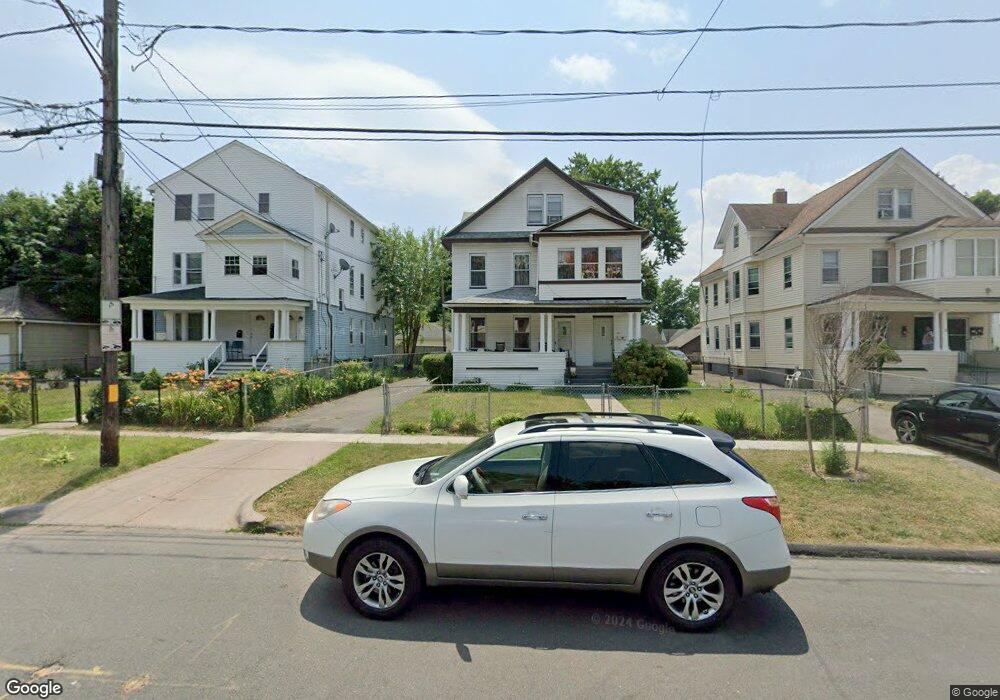
17 Hebron St Unit 19 Hartford, CT 06112
Blue Hills NeighborhoodEstimated Value: $293,908 - $503,000
9
Beds
2
Baths
4,052
Sq Ft
$103/Sq Ft
Est. Value
About This Home
This home is located at 17 Hebron St Unit 19, Hartford, CT 06112 and is currently estimated at $417,727, approximately $103 per square foot. 17 Hebron St Unit 19 is a home located in Hartford County with nearby schools including Rawson School, West Middle School, and Martin Luther King, Jr. Middle School.
Ownership History
Date
Name
Owned For
Owner Type
Purchase Details
Closed on
Jul 26, 2021
Sold by
Harvey Beresford
Bought by
Harvey Beresford and Harvey Clansdel
Current Estimated Value
Home Financials for this Owner
Home Financials are based on the most recent Mortgage that was taken out on this home.
Original Mortgage
$80,000
Outstanding Balance
$60,765
Interest Rate
2.2%
Mortgage Type
Stand Alone Refi Refinance Of Original Loan
Estimated Equity
$356,962
Create a Home Valuation Report for This Property
The Home Valuation Report is an in-depth analysis detailing your home's value as well as a comparison with similar homes in the area
Home Values in the Area
Average Home Value in this Area
Purchase History
| Date | Buyer | Sale Price | Title Company |
|---|---|---|---|
| Harvey Beresford | -- | None Available | |
| Harvey Beresford | -- | None Available |
Source: Public Records
Mortgage History
| Date | Status | Borrower | Loan Amount |
|---|---|---|---|
| Open | Harvey Beresford | $80,000 |
Source: Public Records
Tax History Compared to Growth
Tax History
| Year | Tax Paid | Tax Assessment Tax Assessment Total Assessment is a certain percentage of the fair market value that is determined by local assessors to be the total taxable value of land and additions on the property. | Land | Improvement |
|---|---|---|---|---|
| 2024 | $8,025 | $116,387 | $6,248 | $110,139 |
| 2023 | $8,025 | $116,387 | $6,248 | $110,139 |
| 2022 | $8,025 | $116,388 | $6,248 | $110,140 |
| 2021 | $5,341 | $71,890 | $7,385 | $64,505 |
| 2020 | $5,341 | $71,890 | $7,385 | $64,505 |
| 2019 | $5,341 | $71,890 | $7,385 | $64,505 |
| 2018 | $5,161 | $69,466 | $7,136 | $62,330 |
| 2016 | $4,669 | $62,842 | $6,797 | $56,045 |
| 2015 | $4,447 | $59,857 | $6,474 | $53,383 |
| 2014 | $4,338 | $58,393 | $6,315 | $52,078 |
Source: Public Records
Map
Nearby Homes
- 111 Westbourne Pkwy Unit 113
- 181 Westbourne Pkwy
- 144 Thomaston St
- 157 Pembroke St Unit 159
- 109 Blue Hills Ave
- 25 Cornwall St
- 150 Adams St Unit 152
- 103 Baltimore St
- 180 Andover St
- 297 Branford St
- 131-135,137-145,119- Albany Ave
- 355 Cornwall St Unit 357
- 179 Manchester St
- 1108 Albany Ave
- 90 Manchester St
- 190 Edgewood St Unit 192
- 87 Mansfield St Unit 89
- 287 Westland St
- 243 Terry Rd
- 33 E Raymond St Unit 35
- 15 Hebron St
- 13 Hebron St Unit 15
- 13 Hebron St Unit 1
- 16 Hebron St Unit 18
- 25 Hebron St Unit 27
- 18 Hebron St Unit A
- 215 Blue Hills Ave Unit 217
- 215 Blue Hills Ave Unit 2
- 21 Hebron St Unit 23
- 12 Hebron St
- 20 Hebron St Unit 22
- 8 Hebron St Unit 10
- 207 Blue Hills Ave Unit 209
- 24 Hebron St Unit 26
- 205 Blue Hills Ave
- 229 Blue Hills Ave Unit 231
- 28 Hebron St Unit 30
- 211 Blue Hills Ave Unit 213
- 31 Hebron St
- 20 Sharon St