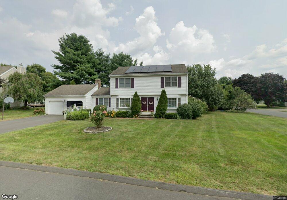
17 High Ridge Rd Cromwell, CT 06416
Estimated Value: $494,361 - $625,000
3
Beds
3
Baths
1,900
Sq Ft
$291/Sq Ft
Est. Value
About This Home
This home is located at 17 High Ridge Rd, Cromwell, CT 06416 and is currently estimated at $553,340, approximately $291 per square foot. 17 High Ridge Rd is a home located in Middlesex County with nearby schools including Edna C. Stevens School, Woodside Intermediate School, and Cromwell Middle School.
Ownership History
Date
Name
Owned For
Owner Type
Purchase Details
Closed on
Nov 29, 2005
Sold by
Hilker Brian L and Hilker Debra A
Bought by
Flowers Veda
Current Estimated Value
Home Financials for this Owner
Home Financials are based on the most recent Mortgage that was taken out on this home.
Original Mortgage
$331,500
Interest Rate
6.06%
Mortgage Type
Purchase Money Mortgage
Purchase Details
Closed on
Jul 1, 2003
Sold by
Prete Timothy L
Bought by
Hilker Brian L and Hilker Debra A
Purchase Details
Closed on
Jul 5, 1994
Sold by
Northeast Svgs
Bought by
Prete Timothy L
Purchase Details
Closed on
Dec 5, 1989
Sold by
Tucci Casper S
Bought by
Anderson Loren D
Create a Home Valuation Report for This Property
The Home Valuation Report is an in-depth analysis detailing your home's value as well as a comparison with similar homes in the area
Home Values in the Area
Average Home Value in this Area
Purchase History
| Date | Buyer | Sale Price | Title Company |
|---|---|---|---|
| Flowers Veda | $349,000 | -- | |
| Hilker Brian L | $322,500 | -- | |
| Prete Timothy L | $192,000 | -- | |
| Flowers Veda | $349,000 | -- | |
| Hilker Brian L | $322,500 | -- | |
| Prete Timothy L | $192,000 | -- | |
| Anderson Loren D | $240,000 | -- |
Source: Public Records
Mortgage History
| Date | Status | Borrower | Loan Amount |
|---|---|---|---|
| Open | Anderson Loren D | $333,000 | |
| Closed | Anderson Loren D | $331,500 |
Source: Public Records
Tax History
| Year | Tax Paid | Tax Assessment Tax Assessment Total Assessment is a certain percentage of the fair market value that is determined by local assessors to be the total taxable value of land and additions on the property. | Land | Improvement |
|---|---|---|---|---|
| 2025 | $7,541 | $244,930 | $98,770 | $146,160 |
| 2024 | $7,365 | $244,930 | $98,770 | $146,160 |
| 2023 | $7,780 | $264,530 | $98,770 | $165,760 |
| 2022 | $6,913 | $207,410 | $89,320 | $118,090 |
| 2021 | $6,913 | $207,410 | $89,320 | $118,090 |
| 2020 | $6,809 | $207,410 | $89,320 | $118,090 |
| 2019 | $6,809 | $207,410 | $89,320 | $118,090 |
| 2018 | $6,809 | $207,410 | $89,320 | $118,090 |
| 2017 | $6,730 | $198,360 | $93,720 | $104,640 |
| 2016 | $6,671 | $198,360 | $93,720 | $104,640 |
| 2015 | $6,225 | $198,360 | $93,720 | $104,640 |
| 2014 | $6,601 | $198,360 | $93,720 | $104,640 |
Source: Public Records
Map
Nearby Homes
- 20 Cherokee Ct
- 30 Larkspur Dr
- 58 Blackhaw Dr
- 1114 Cromwell Hills Dr
- 15 Oxford Ln
- 2113 Cromwell Hills Dr
- 127 Woodland Dr
- 1 Great Oak Ct
- 9 Bayberry Ct
- 3 Bayberry Ct
- 9 Willow Ct
- 10 Dogwood Ct Unit 10
- 7 Willow Ct Unit 7
- 22 Linda Ct Unit 22
- 159 Evergreen Rd
- 23 Crest Dr
- 29 Mountain Laurel Ct Unit 29
- 12 Fairview Heights
- 17 Hemlock Ct Unit 17
- 32 Lincoln Rd
- 10 Windwood Dr
- 15 High Ridge Rd
- 21 High Ridge Rd
- 9 Windwood Dr
- 8 Windwood Dr
- 16 High Ridge Rd
- 18 High Ridge Rd
- 14 High Ridge Rd
- 13 High Ridge Rd
- 20 High Ridge Rd
- 4 Patricia Ln
- 6 Windwood Dr
- 23 High Ridge Rd
- 12 High Ridge Rd
- 5 Windwood Dr
- 22 High Ridge Rd
- 11 High Ridge Rd
- 6 Patricia Ln
- 3 Patricia Ln
- 4 Windwood Dr
Your Personal Tour Guide
Ask me questions while you tour the home.