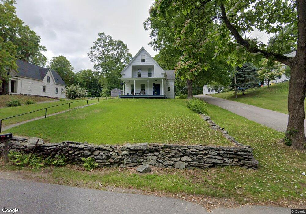
17 High St North Grafton, MA 01536
Estimated Value: $482,000 - $545,000
3
Beds
2
Baths
1,872
Sq Ft
$273/Sq Ft
Est. Value
About This Home
This home is located at 17 High St, North Grafton, MA 01536 and is currently estimated at $511,401, approximately $273 per square foot. 17 High St is a home located in Worcester County with nearby schools including Grafton High School, Silver Spruce Montessori School, and Al-Hamra Academy.
Ownership History
Date
Name
Owned For
Owner Type
Purchase Details
Closed on
Aug 1, 1973
Bought by
Kinch Arthur H and Kinch Christine
Current Estimated Value
Create a Home Valuation Report for This Property
The Home Valuation Report is an in-depth analysis detailing your home's value as well as a comparison with similar homes in the area
Home Values in the Area
Average Home Value in this Area
Purchase History
| Date | Buyer | Sale Price | Title Company |
|---|---|---|---|
| Kinch Arthur H | -- | -- |
Source: Public Records
Mortgage History
| Date | Status | Borrower | Loan Amount |
|---|---|---|---|
| Open | Kinch Arthur H | $150,000 | |
| Closed | Kinch Arthur H | $100,000 |
Source: Public Records
Tax History Compared to Growth
Tax History
| Year | Tax Paid | Tax Assessment Tax Assessment Total Assessment is a certain percentage of the fair market value that is determined by local assessors to be the total taxable value of land and additions on the property. | Land | Improvement |
|---|---|---|---|---|
| 2025 | $5,989 | $429,600 | $158,800 | $270,800 |
| 2024 | $5,853 | $409,000 | $151,300 | $257,700 |
| 2023 | $5,546 | $353,000 | $151,300 | $201,700 |
| 2022 | $5,572 | $330,100 | $129,900 | $200,200 |
| 2021 | $5,386 | $313,500 | $118,100 | $195,400 |
| 2020 | $5,089 | $308,400 | $118,100 | $190,300 |
| 2019 | $4,768 | $286,200 | $113,000 | $173,200 |
| 2018 | $4,486 | $270,400 | $112,800 | $157,600 |
| 2017 | $4,115 | $250,900 | $85,700 | $165,200 |
| 2016 | $3,941 | $235,300 | $89,800 | $145,500 |
| 2015 | $3,911 | $237,000 | $89,800 | $147,200 |
| 2014 | $3,653 | $239,400 | $99,500 | $139,900 |
Source: Public Records
Map
Nearby Homes
- 11 Hovey Pond Dr Unit 11
- 17 Hingham Rd
- 4 Westboro Rd
- 194 Worcester St
- 22 Beverly Rd
- 14 Northgate Ct Unit 14
- 0 East St
- 30 Falmouth Dr
- 15 Windle Ave
- 4 Winslow Ln Unit 1410
- 69 Cortland Grove Dr Unit 69
- 44 Meadow Ln
- 51 Cortland Grove Dr Unit 51
- 2 Winslow Ln Unit 2302
- 2 Winslow Ln Unit 406
- 3 Abby Rd
- Ivywood Plan at Winslow Point - The Building 1 Series
- Hayden Plan at Winslow Point - The Building 1 Series
- 34 Clews St
- 1 Purinton St
- 15 High St
- 21 High St
- 13 High Street B
- 13B High St Unit B
- 13 High St
- 13 High St Unit B
- 13A High St
- 13B High St
- 16 High St
- 23 High St
- 14 High St
- 53 N Main St
- 12 High St Unit 2
- 12 High St Unit 1
- 12 Perry St Unit 18
- 12 Perry St Unit 11
- 12 High St Unit A
- 12 Perry St Unit 17
- 12 Perry St Unit 3
- 12 Perry St Unit 13