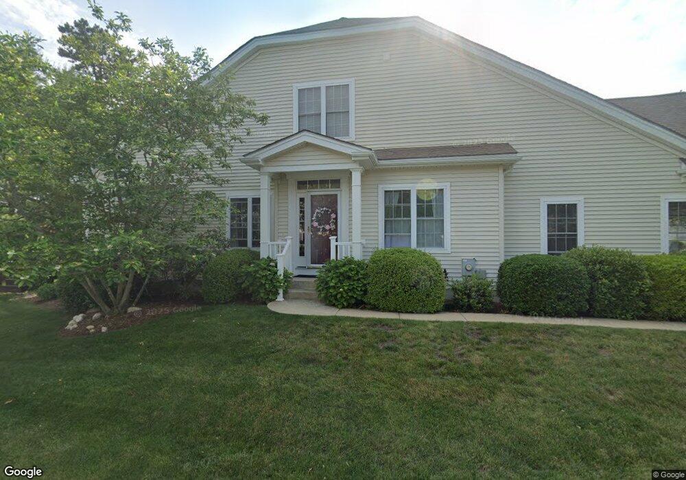
17 Highbank Trail Plymouth, MA 02360
The Pinehills NeighborhoodEstimated Value: $746,000 - $810,000
3
Beds
3
Baths
2,348
Sq Ft
$337/Sq Ft
Est. Value
About This Home
This home is located at 17 Highbank Trail, Plymouth, MA 02360 and is currently estimated at $792,226, approximately $337 per square foot. 17 Highbank Trail is a home located in Plymouth County with nearby schools including Nathaniel Morton Elementary School, Plymouth Community Intermediate, and Plymouth North High School.
Ownership History
Date
Name
Owned For
Owner Type
Purchase Details
Closed on
Dec 28, 2004
Sold by
Great Island Cmnty Llc
Bought by
Dilallo Anthony E and Dilallo Meghan E
Current Estimated Value
Home Financials for this Owner
Home Financials are based on the most recent Mortgage that was taken out on this home.
Original Mortgage
$240,000
Outstanding Balance
$121,092
Interest Rate
5.74%
Mortgage Type
Purchase Money Mortgage
Estimated Equity
$671,134
Create a Home Valuation Report for This Property
The Home Valuation Report is an in-depth analysis detailing your home's value as well as a comparison with similar homes in the area
Home Values in the Area
Average Home Value in this Area
Purchase History
| Date | Buyer | Sale Price | Title Company |
|---|---|---|---|
| Dilallo Anthony E | $350,000 | -- |
Source: Public Records
Mortgage History
| Date | Status | Borrower | Loan Amount |
|---|---|---|---|
| Open | Dilallo Anthony E | $130,000 | |
| Open | Dilallo Anthony E | $240,000 |
Source: Public Records
Tax History Compared to Growth
Tax History
| Year | Tax Paid | Tax Assessment Tax Assessment Total Assessment is a certain percentage of the fair market value that is determined by local assessors to be the total taxable value of land and additions on the property. | Land | Improvement |
|---|---|---|---|---|
| 2025 | $8,000 | $630,400 | $210,000 | $420,400 |
| 2024 | $7,597 | $590,300 | $191,000 | $399,300 |
| 2023 | $7,327 | $534,400 | $159,200 | $375,200 |
| 2022 | $7,295 | $472,800 | $159,200 | $313,600 |
| 2021 | $7,267 | $449,700 | $163,500 | $286,200 |
| 2020 | $6,762 | $413,600 | $163,500 | $250,100 |
| 2019 | $6,722 | $406,400 | $154,900 | $251,500 |
| 2018 | $6,716 | $408,000 | $154,900 | $253,100 |
| 2017 | $6,599 | $398,000 | $154,900 | $243,100 |
| 2016 | $6,222 | $382,400 | $137,700 | $244,700 |
| 2015 | $5,963 | $383,700 | $137,700 | $246,000 |
| 2014 | $5,636 | $372,500 | $134,200 | $238,300 |
Source: Public Records
Map
Nearby Homes
- 14 Valley Front
- 74 Champlain Cir
- 21 Cross Wind
- 43 Champlain Cir
- 4 Millers Joist
- 27 Cross Wind
- 0 Canoe Landing
- 24 Webster Reach
- 45 White Trellis
- 31 Fox Hollow
- 1 Bearberry Path Unit 1
- 12 Weathervane
- 22 Cottage Cove
- 11 Maplewood
- 28 Picket Fence
- 21 Firefly Point Unit 21
- 17 Firefly Point Unit 17
- 39 Woodsong
- 7 Birdsong
- 30 Fairview Ln
- 19 Highbank Trail
- 21 Highbank Trail
- 14 Highbank Trail
- 20 Highbank Trail
- 5 Highbank Trail
- 12 Highbank Trail
- 23 Highbank Trail
- 7 Highbank Trail
- 22 Highbank Trail
- 9 Highbank Trail
- 8 Highbank Trail
- 25 Highbank Trail
- 11 Highbank Trail
- 6 Highbank Trail
- 15 Highbank Trail
- 15 Champlain Cir
- 21 Champlain Cir
- 11 Champlain Cir
- 9 Champlain Cir
- 23 Champlain Cir