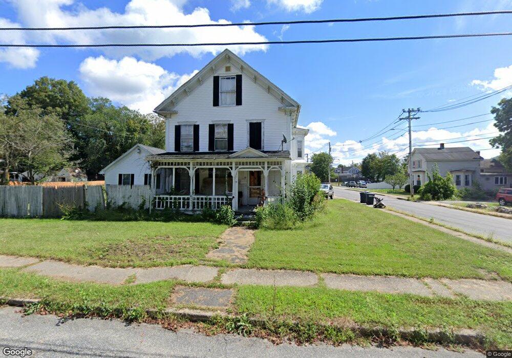
17 Knox St Unit 19 Palmer, MA 01069
Estimated Value: $297,027 - $394,000
5
Beds
2
Baths
2,572
Sq Ft
$129/Sq Ft
Est. Value
About This Home
This home is located at 17 Knox St Unit 19, Palmer, MA 01069 and is currently estimated at $330,507, approximately $128 per square foot. 17 Knox St Unit 19 is a home located in Hampden County with nearby schools including Old Mill Pond Elementary School, Converse Middle School, and Palmer High School.
Ownership History
Date
Name
Owned For
Owner Type
Purchase Details
Closed on
Jun 30, 2020
Sold by
Dill Matthew
Bought by
Dill Matthew and Dill Stacey
Current Estimated Value
Purchase Details
Closed on
Jun 3, 2020
Sold by
Us Bank Na Tr
Bought by
Dill Matthew
Purchase Details
Closed on
Nov 21, 2018
Sold by
Peter Barnard and Us Bank Na Tr
Bought by
Us Bank Na Tr
Purchase Details
Closed on
Oct 28, 2002
Sold by
Est Leblanc Mabel H and Anderson Collette S
Bought by
Barnard Peter A and Barnard Shannon
Home Financials for this Owner
Home Financials are based on the most recent Mortgage that was taken out on this home.
Original Mortgage
$125,000
Interest Rate
6.2%
Mortgage Type
Purchase Money Mortgage
Create a Home Valuation Report for This Property
The Home Valuation Report is an in-depth analysis detailing your home's value as well as a comparison with similar homes in the area
Home Values in the Area
Average Home Value in this Area
Purchase History
| Date | Buyer | Sale Price | Title Company |
|---|---|---|---|
| Dill Matthew | -- | None Available | |
| Dill Matthew | -- | None Available | |
| Dill Matthew | $109,900 | None Available | |
| Us Bank Na Tr | $140,873 | -- | |
| Us Bank Na Tr | $140,873 | -- | |
| Barnard Peter A | $165,000 | -- | |
| Barnard Peter A | $165,000 | -- |
Source: Public Records
Mortgage History
| Date | Status | Borrower | Loan Amount |
|---|---|---|---|
| Previous Owner | Barnard Peter A | $125,000 | |
| Previous Owner | Barnard Peter A | $100,000 |
Source: Public Records
Tax History Compared to Growth
Tax History
| Year | Tax Paid | Tax Assessment Tax Assessment Total Assessment is a certain percentage of the fair market value that is determined by local assessors to be the total taxable value of land and additions on the property. | Land | Improvement |
|---|---|---|---|---|
| 2025 | $4,463 | $245,900 | $52,600 | $193,300 |
| 2024 | $4,167 | $223,200 | $47,800 | $175,400 |
| 2023 | $3,962 | $203,800 | $47,800 | $156,000 |
| 2022 | $3,659 | $171,000 | $41,900 | $129,100 |
| 2021 | $3,363 | $148,600 | $46,500 | $102,100 |
| 2020 | $3,258 | $142,900 | $46,500 | $96,400 |
| 2019 | $3,164 | $142,900 | $46,500 | $96,400 |
| 2018 | $3,093 | $140,100 | $45,100 | $95,000 |
| 2017 | $3,022 | $140,100 | $45,100 | $95,000 |
| 2016 | $3,063 | $144,000 | $43,800 | $100,200 |
| 2015 | $2,971 | $144,000 | $43,800 | $100,200 |
Source: Public Records
Map
Nearby Homes
- 44 Converse St
- 1018-1020 Maple St
- 2034 Pleasant St
- 72 Quaboag Valley Co Op St Unit 70
- Lot 0 Thorndike and Lawrence St
- 62-91 Lawrence St
- Lots 39-42 Lawrence
- 0 St Unit 73414881
- L 65-35-1 Pine Hill Dr
- 1029 Wilson St
- 160 Breckenridge St
- 207 Breckenridge St
- 1682 N Main St
- Lot 8 Breckenridge St
- 1247 Calkins Rd
- 11 Allen St
- 15 Quaboag Valley Co-Op St Unit 15
- 2077 Calkins Rd
- 268 Palmer Rd Unit 59
- 268 Palmer Rd Unit 44
- 19 Knox St
- 1015 Foster St
- 25 Knox St
- Lot 46-1 Foster St
- 11-15 Knox St
- 11 Knox St Unit 15
- 1011 Foster St
- 1020 Foster St
- 29 Knox St
- 16 Knox St
- 20 Knox St
- 12 Knox St
- 1007 Foster St
- 33 Knox St Unit 35
- 33-35 Knox St Unit 1
- 1042 Thorndike St Unit 1044
- 79 Knox St
- 6 Highland St Unit 1
- 1038 Thorndike St
- 5 Highland St