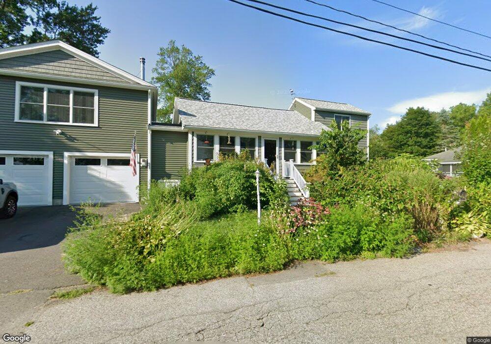
17 Lake Shore Dr Littleton, MA 01460
Littleton Common NeighborhoodEstimated Value: $636,000 - $801,000
2
Beds
1
Bath
2,028
Sq Ft
$346/Sq Ft
Est. Value
About This Home
This home is located at 17 Lake Shore Dr, Littleton, MA 01460 and is currently estimated at $702,397, approximately $346 per square foot. 17 Lake Shore Dr is a home located in Middlesex County with nearby schools including Shaker Lane Elementary School, Russell Street Elementary School, and Littleton Middle School.
Ownership History
Date
Name
Owned For
Owner Type
Purchase Details
Closed on
Mar 24, 2004
Sold by
Building Exchange Co
Bought by
Neild Dustin O and Neild Lynn T
Current Estimated Value
Home Financials for this Owner
Home Financials are based on the most recent Mortgage that was taken out on this home.
Original Mortgage
$287,500
Outstanding Balance
$134,177
Interest Rate
5.65%
Mortgage Type
Purchase Money Mortgage
Estimated Equity
$568,220
Purchase Details
Closed on
Nov 17, 2003
Sold by
Richard Marilyn A
Bought by
Building Exchange Co
Create a Home Valuation Report for This Property
The Home Valuation Report is an in-depth analysis detailing your home's value as well as a comparison with similar homes in the area
Home Values in the Area
Average Home Value in this Area
Purchase History
| Date | Buyer | Sale Price | Title Company |
|---|---|---|---|
| Neild Dustin O | $287,500 | -- | |
| Building Exchange Co | $200,000 | -- |
Source: Public Records
Mortgage History
| Date | Status | Borrower | Loan Amount |
|---|---|---|---|
| Open | Neild Dustin O | $287,500 |
Source: Public Records
Tax History Compared to Growth
Tax History
| Year | Tax Paid | Tax Assessment Tax Assessment Total Assessment is a certain percentage of the fair market value that is determined by local assessors to be the total taxable value of land and additions on the property. | Land | Improvement |
|---|---|---|---|---|
| 2025 | $9,696 | $652,500 | $228,300 | $424,200 |
| 2024 | $8,950 | $603,100 | $191,500 | $411,600 |
| 2023 | $6,450 | $396,900 | $187,800 | $209,100 |
| 2022 | $6,257 | $353,300 | $176,800 | $176,500 |
| 2021 | $5,945 | $335,900 | $173,100 | $162,800 |
| 2020 | $5,589 | $314,500 | $153,900 | $160,600 |
| 2019 | $5,395 | $295,800 | $143,600 | $152,200 |
| 2018 | $5,273 | $290,700 | $143,600 | $147,100 |
| 2017 | $4,873 | $268,500 | $136,200 | $132,300 |
| 2016 | $4,714 | $266,500 | $136,200 | $130,300 |
| 2015 | $4,491 | $248,100 | $117,800 | $130,300 |
Source: Public Records
Map
Nearby Homes
- 18 Long Lake Rd
- 4 Mars Place
- 16 Fletcher Ln
- 115 Goldsmith St
- 35 Queen Rd
- 55 Jennifer St
- 34 Baldwin Hill Rd
- 12 Paula Beth St
- 8 Edsel Rd
- 10 Baldwin Hill Rd
- 336 King St Unit 105
- 305 Harwood Ave
- 17 Hartwell Ave
- 84 Powers Rd
- 25 Grist Mill Rd
- 3 Mill Park Place
- 3 Mill Park Place Unit 3
- 5 Mill Park Place
- 5 Mill Park Place Unit 5
- 18 Pleasant St
- 30 Juniper Rd
- 30 Juniper Rd Unit 1
- 15 Lake Shore Dr
- 15 Lake Shore Dr Unit 1
- 21 Lake Shore Dr
- 28 Juniper Rd
- 22 Juniper Rd
- 3 Grove Rd
- 29 Juniper Rd
- 11 Lake Shore Dr
- 25 Juniper Rd
- 25 Juniper Rd Unit 25
- 25 Juniper Rd
- Lot 70(4) Highland Ln
- LOT 1 Elm Rd
- lot 1 Beaver Brook Rd
- LOT 12 Hill Rd
- LOT11 Powers Rd
- LOT 98 Surrey Dr
- LOT 97 Massasoit Trail