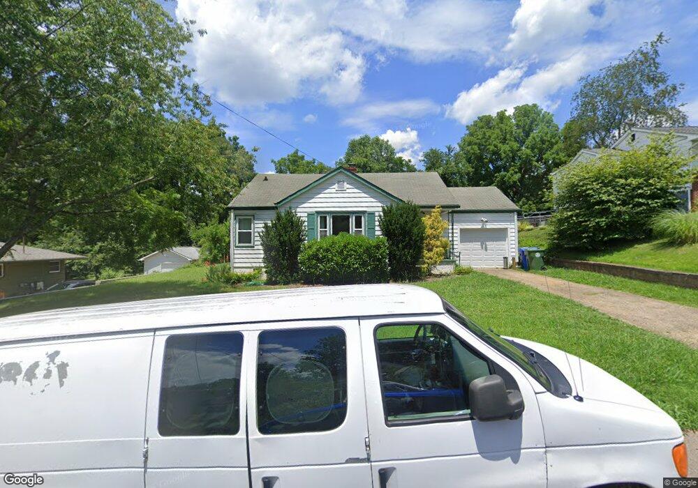
17 Lane Ave Asheville, NC 28806
West Asheville NeighborhoodEstimated Value: $425,666 - $493,000
2
Beds
1
Bath
1,010
Sq Ft
$439/Sq Ft
Est. Value
About This Home
This home is located at 17 Lane Ave, Asheville, NC 28806 and is currently estimated at $443,417, approximately $439 per square foot. 17 Lane Ave is a home located in Buncombe County with nearby schools including Clyde A. Erwin High School, Emma Elementary School, and Clyde A. Erwin Middle School.
Ownership History
Date
Name
Owned For
Owner Type
Purchase Details
Closed on
Aug 6, 2020
Sold by
Keehn Cynthia M
Bought by
Bryant Samuel Edward Pearce and Currier Jennifer
Current Estimated Value
Home Financials for this Owner
Home Financials are based on the most recent Mortgage that was taken out on this home.
Original Mortgage
$232,000
Outstanding Balance
$206,180
Interest Rate
3.1%
Mortgage Type
New Conventional
Estimated Equity
$237,237
Purchase Details
Closed on
Jun 2, 1997
Sold by
Lampros Cyndi R
Bought by
Keehn
Create a Home Valuation Report for This Property
The Home Valuation Report is an in-depth analysis detailing your home's value as well as a comparison with similar homes in the area
Home Values in the Area
Average Home Value in this Area
Purchase History
| Date | Buyer | Sale Price | Title Company |
|---|---|---|---|
| Bryant Samuel Edward Pearce | $290,000 | None Available | |
| Keehn | $65,000 | -- |
Source: Public Records
Mortgage History
| Date | Status | Borrower | Loan Amount |
|---|---|---|---|
| Open | Bryant Samuel Edward Pearce | $232,000 |
Source: Public Records
Tax History Compared to Growth
Tax History
| Year | Tax Paid | Tax Assessment Tax Assessment Total Assessment is a certain percentage of the fair market value that is determined by local assessors to be the total taxable value of land and additions on the property. | Land | Improvement |
|---|---|---|---|---|
| 2025 | $2,883 | $279,100 | $83,500 | $195,600 |
| 2024 | $2,883 | $279,100 | $83,500 | $195,600 |
| 2023 | $2,883 | $279,100 | $83,500 | $195,600 |
| 2022 | $2,783 | $279,100 | $83,500 | $195,600 |
| 2021 | $2,783 | $279,100 | $0 | $0 |
| 2020 | $2,454 | $227,700 | $0 | $0 |
| 2019 | $2,454 | $227,700 | $0 | $0 |
| 2018 | $2,454 | $227,700 | $0 | $0 |
| 2017 | $2,477 | $153,700 | $0 | $0 |
| 2016 | $1,889 | $153,700 | $0 | $0 |
| 2015 | $1,889 | $153,700 | $0 | $0 |
| 2014 | $1,866 | $153,700 | $0 | $0 |
Source: Public Records
Map
Nearby Homes
- 26 Sydney Ln
- 35 Sydney Ln
- 101 Heather Dr
- 29 Toad Dr
- 6 Wisteria Ct
- 118 Heather Dr
- 10 Harrisland Dr
- 47 Timberwood Dr
- 5 Verde Dr
- 31 Verde Dr
- 41 Ben Lippen School Rd
- 4 Boris St
- 42 Celebration Place
- 18 Destination Dr
- 49 Ben Lippen School Rd Unit 2/PH1A
- 17 Denali Dr
- 45 Verde Dr
- 99999 Fallen Spruce Dr
- 61 Ben Lippen School Rd
- 173 Old County Home Rd
- 353 New Leicester Hwy
- 13 Westwood Dr Unit 13
- 3 Westwood Dr
- 355 New Leicester Hwy
- 11 Westwood Dr
- 16 Westwood Dr
- 6 Westwood Dr
- 1 Westwood Dr
- 20 Westwood Dr
- 27 Westwood Dr Unit 13
- 349 New Leicester Hwy
- 4 Westwood Dr
- 2 Westridge Ct
- 2 Westwood Dr
- 376 New Leicester Hwy
- 347 New Leicester Hwy Unit C
- 347 New Leicester Hwy Unit A
- 24 Westwood Dr
- 397 New Leicester Hwy
- 9999 Leicester Hwy