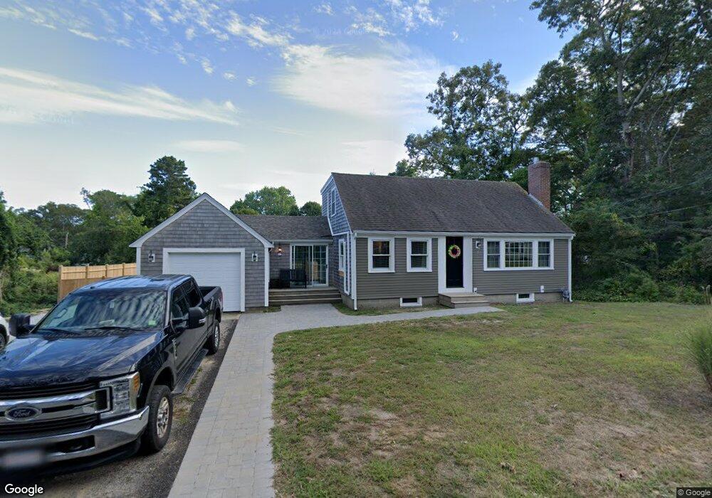
17 Lane Rd Dennis Port, MA 02639
Dennis Port NeighborhoodEstimated Value: $548,000 - $656,000
2
Beds
1
Bath
768
Sq Ft
$784/Sq Ft
Est. Value
About This Home
This home is located at 17 Lane Rd, Dennis Port, MA 02639 and is currently estimated at $602,154, approximately $784 per square foot. 17 Lane Rd is a home located in Barnstable County with nearby schools including Dennis-Yarmouth Regional High School and St. Pius X. School.
Ownership History
Date
Name
Owned For
Owner Type
Purchase Details
Closed on
Jun 18, 2010
Sold by
Moore Jacqueline C and Rider Carole L
Bought by
Peterson Randy and Berical Brielle E
Current Estimated Value
Home Financials for this Owner
Home Financials are based on the most recent Mortgage that was taken out on this home.
Original Mortgage
$157,200
Outstanding Balance
$105,665
Interest Rate
5.03%
Mortgage Type
Purchase Money Mortgage
Estimated Equity
$496,489
Create a Home Valuation Report for This Property
The Home Valuation Report is an in-depth analysis detailing your home's value as well as a comparison with similar homes in the area
Home Values in the Area
Average Home Value in this Area
Purchase History
| Date | Buyer | Sale Price | Title Company |
|---|---|---|---|
| Peterson Randy | $196,500 | -- |
Source: Public Records
Mortgage History
| Date | Status | Borrower | Loan Amount |
|---|---|---|---|
| Open | Peterson Randy | $157,200 |
Source: Public Records
Tax History Compared to Growth
Tax History
| Year | Tax Paid | Tax Assessment Tax Assessment Total Assessment is a certain percentage of the fair market value that is determined by local assessors to be the total taxable value of land and additions on the property. | Land | Improvement |
|---|---|---|---|---|
| 2025 | $2,437 | $562,800 | $127,000 | $435,800 |
| 2024 | $2,385 | $543,200 | $129,300 | $413,900 |
| 2023 | $2,160 | $462,600 | $117,500 | $345,100 |
| 2022 | $2,089 | $373,000 | $117,700 | $255,300 |
| 2021 | $5,822 | $306,100 | $103,800 | $202,300 |
| 2020 | $19,219 | $294,500 | $103,800 | $190,700 |
| 2019 | $1,609 | $260,700 | $101,800 | $158,900 |
| 2018 | $1,591 | $250,900 | $96,900 | $154,000 |
| 2017 | $1,543 | $250,900 | $96,900 | $154,000 |
| 2016 | $1,621 | $248,300 | $107,700 | $140,600 |
| 2015 | $1,410 | $220,300 | $107,700 | $112,600 |
| 2014 | $1,239 | $195,100 | $86,100 | $109,000 |
Source: Public Records
Map
Nearby Homes
- 11 Lane Rd
- 91 Depot Rd W
- 141 Division St
- 141 Division St
- 47 Telegraph Rd Unit 1
- 9 Country Ln
- 24 Indian Trail
- 78 Upper County Rd Unit A&B
- 78 Upper County Rd
- 12 Candlewood Ln Unit 2-9
- 12 Candlewood Ln Unit 1-6
- 10 Candlewood Ln Unit 2-1
- 9 Bells Neck Rd Unit 10
- 45 Route 28
- 537 Depot St
- 9 Mansion St
- 64 Smith St
- 79 Massachusetts 28
- 73 Division St
- 20 Aunt Debbys Rd