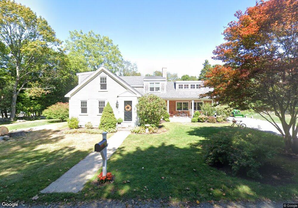
17 Langdon Ln Scituate, MA 02066
Estimated Value: $1,222,000 - $1,516,000
4
Beds
1
Bath
2,349
Sq Ft
$583/Sq Ft
Est. Value
About This Home
This home is located at 17 Langdon Ln, Scituate, MA 02066 and is currently estimated at $1,370,544, approximately $583 per square foot. 17 Langdon Ln is a home located in Plymouth County with nearby schools including Cushing Elementary School, Lester J. Gates Middle School, and Scituate High School.
Ownership History
Date
Name
Owned For
Owner Type
Purchase Details
Closed on
Oct 4, 2010
Sold by
Tower Eugene N
Bought by
Rapalje George J and Rapalje Lisa H
Current Estimated Value
Home Financials for this Owner
Home Financials are based on the most recent Mortgage that was taken out on this home.
Original Mortgage
$334,722
Outstanding Balance
$221,890
Interest Rate
4.44%
Mortgage Type
Purchase Money Mortgage
Estimated Equity
$1,148,654
Create a Home Valuation Report for This Property
The Home Valuation Report is an in-depth analysis detailing your home's value as well as a comparison with similar homes in the area
Home Values in the Area
Average Home Value in this Area
Purchase History
| Date | Buyer | Sale Price | Title Company |
|---|---|---|---|
| Rapalje George J | $295,000 | -- |
Source: Public Records
Mortgage History
| Date | Status | Borrower | Loan Amount |
|---|---|---|---|
| Open | Rapalje George J | $334,722 |
Source: Public Records
Tax History Compared to Growth
Tax History
| Year | Tax Paid | Tax Assessment Tax Assessment Total Assessment is a certain percentage of the fair market value that is determined by local assessors to be the total taxable value of land and additions on the property. | Land | Improvement |
|---|---|---|---|---|
| 2025 | $10,344 | $1,035,400 | $401,600 | $633,800 |
| 2024 | $10,221 | $986,600 | $365,100 | $621,500 |
| 2023 | $9,822 | $892,800 | $350,400 | $542,400 |
| 2022 | $9,822 | $778,300 | $323,600 | $454,700 |
| 2021 | $9,272 | $695,600 | $308,200 | $387,400 |
| 2020 | $8,986 | $665,600 | $296,300 | $369,300 |
| 2019 | $6,621 | $481,900 | $290,500 | $191,400 |
| 2018 | $6,594 | $472,700 | $287,700 | $185,000 |
| 2017 | $6,491 | $460,700 | $275,700 | $185,000 |
| 2016 | $6,079 | $429,900 | $251,700 | $178,200 |
| 2015 | $5,476 | $418,000 | $239,800 | $178,200 |
Source: Public Records
Map
Nearby Homes
- 16 Langdon Ln
- 8 Langdon Ln
- 354 First Parish Rd
- 380 Country Way
- 372 Country Way
- 384 Country Way
- 346 First Parish Rd
- 386 Country Way
- 388 Country Way
- 373 Country Way
- 342 First Parish Rd
- 367 Country Way
- 385 Country Way Unit 1
- 355 First Parish Rd
- 392 Country Way
- 357 First Parish Rd
- 345 First Parish Rd
- 40 Central Park Dr
- 44 Central Park Dr
- 4 Central Park Dr