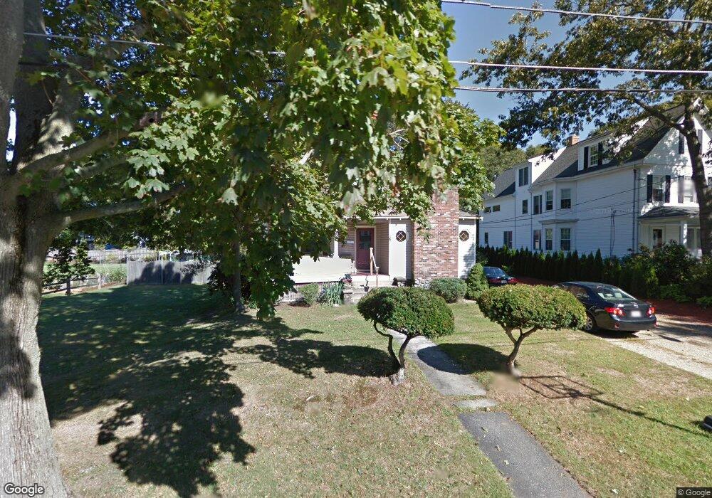
17 Laurel St Wakefield, MA 01880
Greenwood NeighborhoodEstimated Value: $619,000 - $727,486
3
Beds
2
Baths
1,548
Sq Ft
$429/Sq Ft
Est. Value
About This Home
This home is located at 17 Laurel St, Wakefield, MA 01880 and is currently estimated at $664,622, approximately $429 per square foot. 17 Laurel St is a home located in Middlesex County with nearby schools including Wakefield Memorial High School, St Joseph School, and St. Patrick Elementary School.
Ownership History
Date
Name
Owned For
Owner Type
Purchase Details
Closed on
Apr 18, 2025
Sold by
Cook Ralph E Est and Mccormack
Bought by
Cook Kelsey and Tran Andrew
Current Estimated Value
Home Financials for this Owner
Home Financials are based on the most recent Mortgage that was taken out on this home.
Original Mortgage
$415,000
Outstanding Balance
$413,151
Interest Rate
6.63%
Mortgage Type
Purchase Money Mortgage
Estimated Equity
$251,471
Purchase Details
Closed on
Jun 30, 1966
Bought by
Cook Ralph E and Cook Constance E
Create a Home Valuation Report for This Property
The Home Valuation Report is an in-depth analysis detailing your home's value as well as a comparison with similar homes in the area
Home Values in the Area
Average Home Value in this Area
Purchase History
| Date | Buyer | Sale Price | Title Company |
|---|---|---|---|
| Cook Kelsey | $615,000 | None Available | |
| Cook Kelsey | $615,000 | None Available | |
| Cook Ralph E | -- | -- |
Source: Public Records
Mortgage History
| Date | Status | Borrower | Loan Amount |
|---|---|---|---|
| Open | Cook Kelsey | $415,000 | |
| Closed | Cook Kelsey | $415,000 |
Source: Public Records
Tax History
| Year | Tax Paid | Tax Assessment Tax Assessment Total Assessment is a certain percentage of the fair market value that is determined by local assessors to be the total taxable value of land and additions on the property. | Land | Improvement |
|---|---|---|---|---|
| 2025 | $8,089 | $712,700 | $437,900 | $274,800 |
| 2024 | $7,467 | $663,700 | $407,300 | $256,400 |
| 2023 | $7,277 | $620,400 | $380,200 | $240,200 |
| 2022 | $6,840 | $555,200 | $339,500 | $215,700 |
| 2021 | $6,485 | $509,400 | $311,600 | $197,800 |
| 2020 | $6,098 | $477,500 | $292,100 | $185,400 |
| 2019 | $5,718 | $445,700 | $272,700 | $173,000 |
| 2018 | $5,515 | $425,900 | $260,500 | $165,400 |
| 2017 | $5,189 | $398,200 | $243,500 | $154,700 |
| 2016 | $5,322 | $394,500 | $240,700 | $153,800 |
| 2015 | $4,978 | $369,300 | $224,900 | $144,400 |
| 2014 | $4,610 | $360,700 | $219,500 | $141,200 |
Source: Public Records
Map
Nearby Homes
- 824 Main St Unit 1
- 1 Sidney St
- 9 Lovis Ave
- 61 Nahant St
- 12 Lovis Ave
- 34 Stark Ave
- 15 Belmont Rd
- 11 Valdora Dr
- 3 Valley Rd
- 79 W Park Dr
- 55 Bartley St
- 276 Albion St Unit 10
- 1 Traverse St Unit E
- 62 Foundry St Unit 310
- 62 Foundry St Unit 402
- 62 Foundry St Unit 507
- 62 Foundry St Unit 208
- 62 Foundry St Unit 414
- 62 Foundry St Unit 202
- 62 Foundry St Unit 210
Your Personal Tour Guide
Ask me questions while you tour the home.