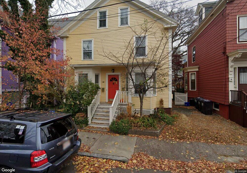
17 Lawrence St Unit 19 Cambridge, MA 02139
Cambridgeport NeighborhoodEstimated Value: $1,710,000 - $2,459,000
4
Beds
3
Baths
3,211
Sq Ft
$660/Sq Ft
Est. Value
About This Home
This home is located at 17 Lawrence St Unit 19, Cambridge, MA 02139 and is currently estimated at $2,118,995, approximately $659 per square foot. 17 Lawrence St Unit 19 is a home located in Middlesex County with nearby schools including Prospect Hill Academy Charter School.
Ownership History
Date
Name
Owned For
Owner Type
Purchase Details
Closed on
May 21, 1993
Sold by
Mcgoldrick John J and Callahan Jane E
Bought by
August William and August Barbara L
Current Estimated Value
Create a Home Valuation Report for This Property
The Home Valuation Report is an in-depth analysis detailing your home's value as well as a comparison with similar homes in the area
Home Values in the Area
Average Home Value in this Area
Purchase History
| Date | Buyer | Sale Price | Title Company |
|---|---|---|---|
| August William | $180,000 | -- |
Source: Public Records
Mortgage History
| Date | Status | Borrower | Loan Amount |
|---|---|---|---|
| Open | August William | $191,000 | |
| Closed | August William | $181,200 | |
| Closed | August William | $15,000 | |
| Closed | August William | $0 |
Source: Public Records
Tax History Compared to Growth
Tax History
| Year | Tax Paid | Tax Assessment Tax Assessment Total Assessment is a certain percentage of the fair market value that is determined by local assessors to be the total taxable value of land and additions on the property. | Land | Improvement |
|---|---|---|---|---|
| 2025 | $10,388 | $1,635,900 | $1,055,800 | $580,100 |
| 2024 | $9,817 | $1,658,300 | $1,100,000 | $558,300 |
| 2023 | $9,249 | $1,578,300 | $1,089,000 | $489,300 |
| 2022 | $8,883 | $1,500,500 | $1,058,900 | $441,600 |
| 2021 | $8,456 | $1,445,400 | $1,000,800 | $444,600 |
| 2020 | $7,979 | $1,387,700 | $951,600 | $436,100 |
| 2019 | $7,366 | $1,240,100 | $830,000 | $410,100 |
| 2018 | $6,977 | $1,109,200 | $729,800 | $379,400 |
| 2017 | $7,203 | $1,109,800 | $715,500 | $394,300 |
| 2016 | $6,509 | $931,200 | $565,200 | $366,000 |
| 2015 | $6,392 | $817,400 | $493,700 | $323,700 |
| 2014 | $6,894 | $822,700 | $468,600 | $354,100 |
Source: Public Records
Map
Nearby Homes
- 6 Perry St
- 118 Pearl St Unit 2
- 73 River St Unit 4B
- 7 Lopez St Unit 7
- 8 Lopez St
- 15 Fairmont St
- 25-29 River St
- 125 Brookline St Unit 4
- 6-8 Watson St Unit 8
- 300 Franklin St Unit 1
- 300 Franklin St Unit 5
- 300 Franklin St Unit 4
- 300 Franklin St Unit 3
- 300 Franklin St Unit 2
- 300 Franklin St Unit 6
- 127 Auburn St
- 8 Watson St Unit 8
- 129 Auburn St
- 332 Franklin St Unit 702
- 203 Franklin St
- 17 Lawrence St Unit 17
- 17 Lawrence St Unit 1
- 15 Lawrence St
- 23 Lawrence St Unit 2
- 23 Lawrence St Unit B
- 23 Lawrence St Unit A
- 21 Lawrence St Unit B
- 21 Lawrence St Unit A
- 21 Lawrence St Unit 1
- 21 Lawrence St Unit 2
- 11 Lawrence St Unit 11-1
- 11 Lawrence St
- 11 Lawrence St Unit 11B
- 11 Lawrence St Unit B
- 11 Lawrence St Unit 1
- 9 Lawrence St
- 27 Lawrence St Unit B
- 27 Lawrence St Unit A
- 29 Lawrence St Unit B
- 29 Lawrence St Unit A