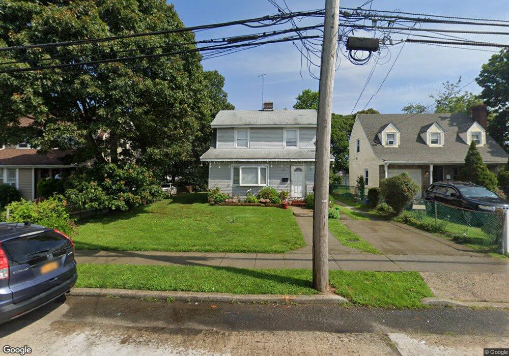
17 Leonard Ave Unit 2nd Fl Freeport, NY 11520
Estimated Value: $652,399 - $710,000
2
Beds
1
Bath
1,586
Sq Ft
$430/Sq Ft
Est. Value
About This Home
This home is located at 17 Leonard Ave Unit 2nd Fl, Freeport, NY 11520 and is currently estimated at $681,200, approximately $429 per square foot. 17 Leonard Ave Unit 2nd Fl is a home located in Nassau County with nearby schools including Caroline G. Atkinson Intermediate School, Columbus Avenue School, and John W Dodd Middle School.
Ownership History
Date
Name
Owned For
Owner Type
Purchase Details
Closed on
Nov 8, 2016
Sold by
Victor James
Bought by
Leonard 17 Corp
Current Estimated Value
Purchase Details
Closed on
Jun 22, 2007
Sold by
Persaud Pooran
Bought by
Victor James
Purchase Details
Closed on
Mar 27, 2007
Sold by
Wells Fargo Bank Na
Purchase Details
Closed on
Aug 29, 2006
Sold by
Carlucci Robert J
Purchase Details
Closed on
Jul 15, 2005
Sold by
Flores Reina
Bought by
Reyes Jennifer
Purchase Details
Closed on
Jul 31, 2003
Sold by
Winn Vera
Bought by
Flores Reina
Create a Home Valuation Report for This Property
The Home Valuation Report is an in-depth analysis detailing your home's value as well as a comparison with similar homes in the area
Home Values in the Area
Average Home Value in this Area
Purchase History
| Date | Buyer | Sale Price | Title Company |
|---|---|---|---|
| Leonard 17 Corp | $2,000 | The Judicial Title Insurance | |
| Victor James | $459,000 | -- | |
| -- | $275,000 | -- | |
| -- | $344,156 | -- | |
| Reyes Jennifer | $360,000 | -- | |
| Flores Reina | $230,000 | -- |
Source: Public Records
Tax History Compared to Growth
Tax History
| Year | Tax Paid | Tax Assessment Tax Assessment Total Assessment is a certain percentage of the fair market value that is determined by local assessors to be the total taxable value of land and additions on the property. | Land | Improvement |
|---|---|---|---|---|
| 2025 | $8,539 | $396 | $144 | $252 |
| 2024 | $894 | $396 | $144 | $252 |
| 2023 | $8,859 | $396 | $144 | $252 |
| 2022 | $8,859 | $396 | $144 | $252 |
| 2021 | $13,464 | $379 | $138 | $241 |
| 2020 | $9,602 | $637 | $372 | $265 |
| 2019 | $9,374 | $637 | $372 | $265 |
| 2018 | $9,224 | $637 | $0 | $0 |
| 2017 | $7,666 | $637 | $372 | $265 |
| 2016 | $8,622 | $637 | $372 | $265 |
| 2015 | $920 | $637 | $372 | $265 |
| 2014 | $920 | $637 | $372 | $265 |
| 2013 | $869 | $637 | $372 | $265 |
Source: Public Records
Map
Nearby Homes
- 12 Prospect Ct
- 63 E Seaman Ave
- 222 N Ocean Ave
- 92 Leonard Ave
- 63 Lincoln Place
- 64 W Milton St
- 101 Harris Ave
- 72 Woodside Ave
- 67 E Dean St
- 110 Woodside Ave
- 27 W Woodbine Dr
- 259 N Columbus Ave
- 247 N Columbus Ave
- 45 Dehnhoff Ave
- 251 N Long Beach Ave
- 365 Wallace St
- 161 Wallace St
- 173 E Seaman Ave
- 117 N Grove St
- 188 Woodside Ave
- 17 Leonard Ave
- 19 Leonard Ave
- 15 Leonard Ave
- 11 Leonard Ave
- 29 Leonard Ave
- 23 Independence Ave
- 21 Independence Ave
- 25 Independence Ave
- 19 Independence Ave
- 27 Independence Ave
- 18 Leonard Ave
- 17 Independence Ave
- 16 Leonard Ave
- 33 Leonard Ave
- 22 Leonard Ave
- 29 Independence Ave
- 304 N Main St
- 306 N Main St
- 306 N Main St
- 302 N Main St