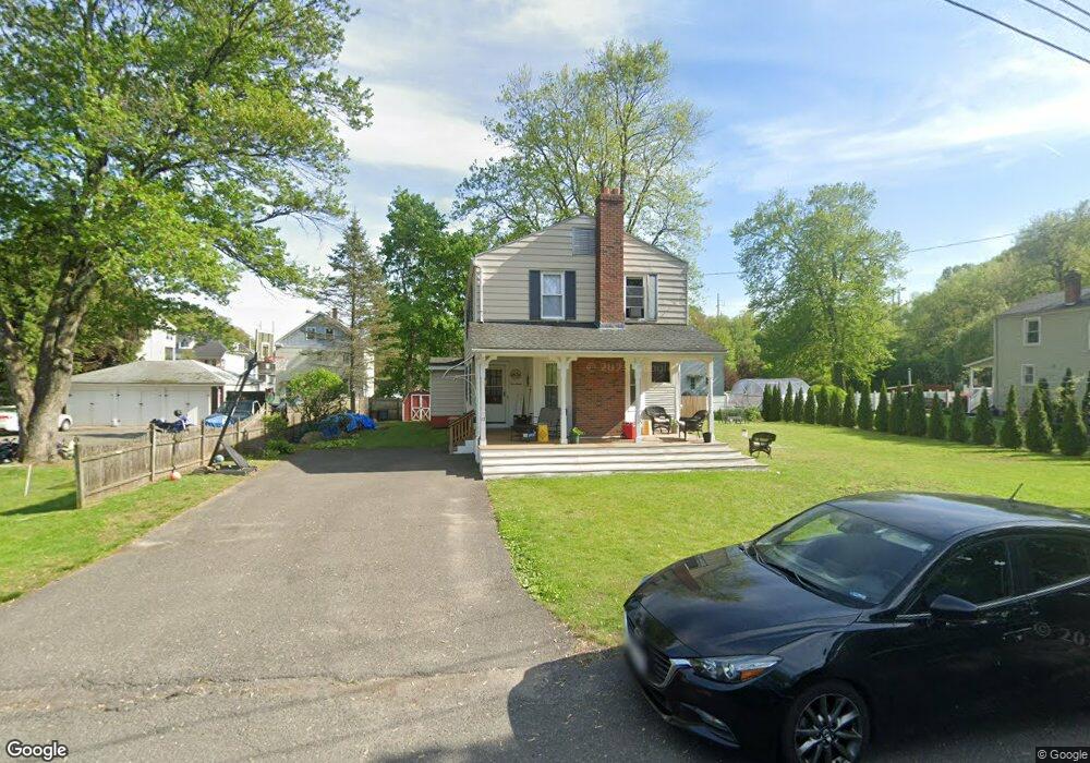
17 Lexington St Agawam, MA 01001
Estimated Value: $338,000 - $400,000
5
Beds
2
Baths
2,138
Sq Ft
$174/Sq Ft
Est. Value
About This Home
This home is located at 17 Lexington St, Agawam, MA 01001 and is currently estimated at $372,764, approximately $174 per square foot. 17 Lexington St is a home located in Hampden County with nearby schools including Agawam Junior High School, Agawam High School, and St Thomas The Apostle School.
Ownership History
Date
Name
Owned For
Owner Type
Purchase Details
Closed on
Nov 24, 2009
Sold by
Mastroianni Winifred M
Bought by
Arnold Michael J
Current Estimated Value
Home Financials for this Owner
Home Financials are based on the most recent Mortgage that was taken out on this home.
Original Mortgage
$163,000
Outstanding Balance
$103,925
Interest Rate
4.86%
Mortgage Type
Purchase Money Mortgage
Estimated Equity
$268,839
Purchase Details
Closed on
Aug 12, 2009
Sold by
Mastroianni Richard J and Mastroianni Winifred M
Bought by
Mastroianni Winifred M
Create a Home Valuation Report for This Property
The Home Valuation Report is an in-depth analysis detailing your home's value as well as a comparison with similar homes in the area
Home Values in the Area
Average Home Value in this Area
Purchase History
| Date | Buyer | Sale Price | Title Company |
|---|---|---|---|
| Arnold Michael J | $183,000 | -- | |
| Mastroianni Winifred M | -- | -- |
Source: Public Records
Mortgage History
| Date | Status | Borrower | Loan Amount |
|---|---|---|---|
| Open | Arnold Michael J | $163,000 |
Source: Public Records
Tax History
| Year | Tax Paid | Tax Assessment Tax Assessment Total Assessment is a certain percentage of the fair market value that is determined by local assessors to be the total taxable value of land and additions on the property. | Land | Improvement |
|---|---|---|---|---|
| 2025 | $4,184 | $285,800 | $101,600 | $184,200 |
| 2024 | $4,055 | $278,900 | $101,600 | $177,300 |
| 2023 | $3,757 | $238,100 | $88,000 | $150,100 |
| 2022 | $3,448 | $214,000 | $88,000 | $126,000 |
| 2021 | $3,281 | $195,300 | $77,800 | $117,500 |
| 2020 | $3,183 | $189,100 | $76,700 | $112,400 |
| 2019 | $3,040 | $182,600 | $75,100 | $107,500 |
| 2018 | $2,908 | $175,100 | $75,100 | $100,000 |
| 2017 | $2,761 | $169,300 | $75,100 | $94,200 |
| 2016 | $2,739 | $169,300 | $75,100 | $94,200 |
| 2015 | $2,605 | $165,500 | $75,100 | $90,400 |
Source: Public Records
Map
Nearby Homes
- 23 Lexington St
- 10 Winthrop St
- 22 Winthrop St Unit 24
- 22-24 Winthrop St
- 194 Walnut St Unit 196
- 198 Walnut St
- 26 Lexington St
- 12 Lexington St
- 208 Walnut St Unit 210
- 188 Walnut St
- LOT 2 Katy's Way
- LOT Alexander Dr
- 41 Lexington St
- 184 Walnut St
- 216 Walnut St Unit 218
- 178 Walnut St
- 21 Winthrop St Unit 23
- 172 Walnut St Unit 174
- 35 Winthrop St
- 224 Walnut St
Your Personal Tour Guide
Ask me questions while you tour the home.