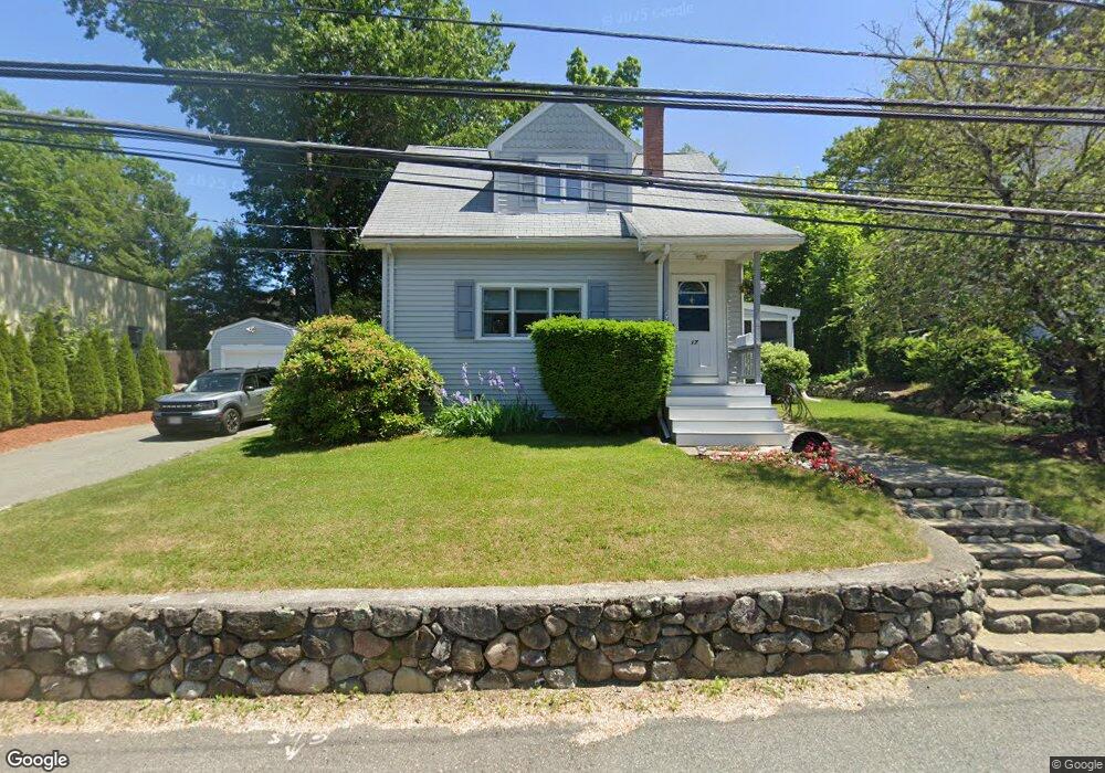
17 Lincoln St Canton, MA 02021
Estimated Value: $558,000 - $594,000
3
Beds
2
Baths
1,104
Sq Ft
$518/Sq Ft
Est. Value
About This Home
This home is located at 17 Lincoln St, Canton, MA 02021 and is currently estimated at $571,414, approximately $517 per square foot. 17 Lincoln St is a home located in Norfolk County with nearby schools including St. John the Evangelist School and Chabad Day School of School.
Ownership History
Date
Name
Owned For
Owner Type
Purchase Details
Closed on
Jul 30, 2025
Sold by
George David E and George Christine R
Bought by
George Ft and George
Current Estimated Value
Purchase Details
Closed on
May 18, 1992
Sold by
Franklin George A and Franklin Ellen M
Bought by
George David E and George Christine R
Home Financials for this Owner
Home Financials are based on the most recent Mortgage that was taken out on this home.
Original Mortgage
$98,091
Interest Rate
8.89%
Mortgage Type
Purchase Money Mortgage
Create a Home Valuation Report for This Property
The Home Valuation Report is an in-depth analysis detailing your home's value as well as a comparison with similar homes in the area
Home Values in the Area
Average Home Value in this Area
Purchase History
| Date | Buyer | Sale Price | Title Company |
|---|---|---|---|
| George Ft | -- | -- | |
| George Ft | -- | -- | |
| George David E | $96,880 | -- | |
| George David E | $96,880 | -- |
Source: Public Records
Mortgage History
| Date | Status | Borrower | Loan Amount |
|---|---|---|---|
| Previous Owner | George David E | $30,000 | |
| Previous Owner | George David E | $97,500 | |
| Previous Owner | George David E | $98,091 |
Source: Public Records
Tax History Compared to Growth
Tax History
| Year | Tax Paid | Tax Assessment Tax Assessment Total Assessment is a certain percentage of the fair market value that is determined by local assessors to be the total taxable value of land and additions on the property. | Land | Improvement |
|---|---|---|---|---|
| 2025 | $4,514 | $456,400 | $264,100 | $192,300 |
| 2024 | $4,376 | $438,900 | $253,900 | $185,000 |
| 2023 | $4,355 | $412,000 | $253,900 | $158,100 |
| 2022 | $4,311 | $379,800 | $241,800 | $138,000 |
| 2021 | $4,208 | $344,900 | $219,800 | $125,100 |
| 2020 | $4,021 | $328,800 | $209,400 | $119,400 |
| 2019 | $3,636 | $293,200 | $179,700 | $113,500 |
| 2018 | $3,378 | $272,000 | $162,700 | $109,300 |
| 2017 | $3,412 | $266,800 | $159,500 | $107,300 |
| 2016 | $3,332 | $260,500 | $155,600 | $104,900 |
| 2015 | $3,231 | $252,000 | $151,100 | $100,900 |
Source: Public Records
Map
Nearby Homes
- 1 Revolution Way Unit 208
- 1 Revolution Way Unit 307
- 30 Coppersmith Way Unit 409
- 30 Coppersmith Way Unit 301
- 30 Coppersmith Way Unit 112
- 30 Coppersmith Way Unit 206
- 30 Coppersmith Way Unit 110
- 30 Coppersmith Way Unit 113
- 30 Coppersmith Way Unit 104
- 30 Coppersmith Way Unit 213
- 30 Coppersmith Way Unit 407
- 30 Coppersmith Way Unit 311
- 30 Coppersmith Way Unit 201
- 30 Coppersmith Way Unit 107
- 30 Coppersmith Way Unit 204
- 30 Coppersmith Way Unit 111
- 30 Coppersmith Way Unit 505
- 30 Coppersmith Way Unit 510
- 119 Revere St Unit C
- 780 Washington St Unit 780
- 9 Lincoln St
- 123 Revere St Unit G
- 123 Revere St Unit F
- 123 Revere St Unit E
- 123 Revere St Unit D
- 123 Revere St Unit C
- 123 Revere St Unit B
- 123 Revere St Unit A
- 123 Revere St Unit 123G
- 18 Lincoln St
- 16 Lincoln St
- 16 Lincoln St Unit 1
- 14 Lincoln St
- 7 Lincoln St
- 10 Lincoln St
- 22 Lincoln St
- 6 Lincoln St
- 24 Lincoln St
- 26 Lincoln St
- 5 Lincoln St