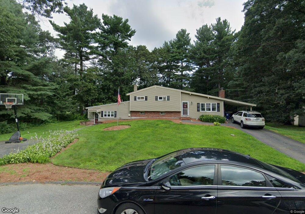
17 Marcus Rd Wilmington, MA 01887
Estimated Value: $715,000 - $901,000
4
Beds
3
Baths
2,197
Sq Ft
$358/Sq Ft
Est. Value
About This Home
This home is located at 17 Marcus Rd, Wilmington, MA 01887 and is currently estimated at $786,730, approximately $358 per square foot. 17 Marcus Rd is a home located in Middlesex County with nearby schools including Wilmington Middle School, Wilmington High School, and N Reading Knowledge Beginnings.
Ownership History
Date
Name
Owned For
Owner Type
Purchase Details
Closed on
Jan 21, 2005
Sold by
Parker Ray G
Bought by
Walker Shawnte D
Current Estimated Value
Home Financials for this Owner
Home Financials are based on the most recent Mortgage that was taken out on this home.
Original Mortgage
$393,000
Outstanding Balance
$196,553
Interest Rate
5.71%
Mortgage Type
Purchase Money Mortgage
Estimated Equity
$590,177
Purchase Details
Closed on
Dec 20, 2002
Sold by
Parker Patricia M and Parker Ray G
Bought by
Parker Ray G
Home Financials for this Owner
Home Financials are based on the most recent Mortgage that was taken out on this home.
Original Mortgage
$300,000
Interest Rate
6.16%
Mortgage Type
Purchase Money Mortgage
Create a Home Valuation Report for This Property
The Home Valuation Report is an in-depth analysis detailing your home's value as well as a comparison with similar homes in the area
Purchase History
| Date | Buyer | Sale Price | Title Company |
|---|---|---|---|
| Walker Shawnte D | $437,000 | -- | |
| Parker Ray G | $375,000 | -- |
Source: Public Records
Mortgage History
| Date | Status | Borrower | Loan Amount |
|---|---|---|---|
| Open | Walker Shawnte D | $393,000 | |
| Previous Owner | Parker Ray G | $300,000 |
Source: Public Records
Tax History
| Year | Tax Paid | Tax Assessment Tax Assessment Total Assessment is a certain percentage of the fair market value that is determined by local assessors to be the total taxable value of land and additions on the property. | Land | Improvement |
|---|---|---|---|---|
| 2025 | $7,919 | $691,600 | $319,100 | $372,500 |
| 2024 | $7,777 | $680,400 | $319,100 | $361,300 |
| 2023 | $7,226 | $605,200 | $290,100 | $315,100 |
| 2022 | $6,922 | $531,200 | $241,600 | $289,600 |
| 2021 | $7,321 | $529,000 | $219,600 | $309,400 |
| 2020 | $6,968 | $513,100 | $219,600 | $293,500 |
| 2019 | $6,302 | $458,300 | $209,200 | $249,100 |
| 2018 | $6,338 | $438,600 | $199,300 | $239,300 |
| 2017 | $6,338 | $438,600 | $199,300 | $239,300 |
| 2016 | $6,175 | $422,100 | $189,900 | $232,200 |
| 2015 | $5,877 | $409,000 | $189,900 | $219,100 |
| 2014 | $5,428 | $381,200 | $180,900 | $200,300 |
Source: Public Records
Map
Nearby Homes
- 41 Marcus Rd
- 21 Marcia Rd
- 17 Carson Ave
- 10 Pilling Rd
- 9 Marie Dr
- 15 Mystic Ave
- 12 Hamlin Ln
- 280 Martins Landing Unit 312
- 220 Martins Landing Unit 309
- 260 Martins Landing Unit 508
- 200 Martins Landing Unit 102
- 250 Martins Landing Unit 402
- 320 Martins Landing Unit 401
- 320 Martins Landing Unit 2410
- 320 Martins Landing Unit 502
- 320 Martins Landing Unit 102
- 320 Martins Landing Unit 107
- 320 Martins Landing Unit 404
- 320 Martins Landing Unit 209
- 28 Nutter Rd
Your Personal Tour Guide
Ask me questions while you tour the home.