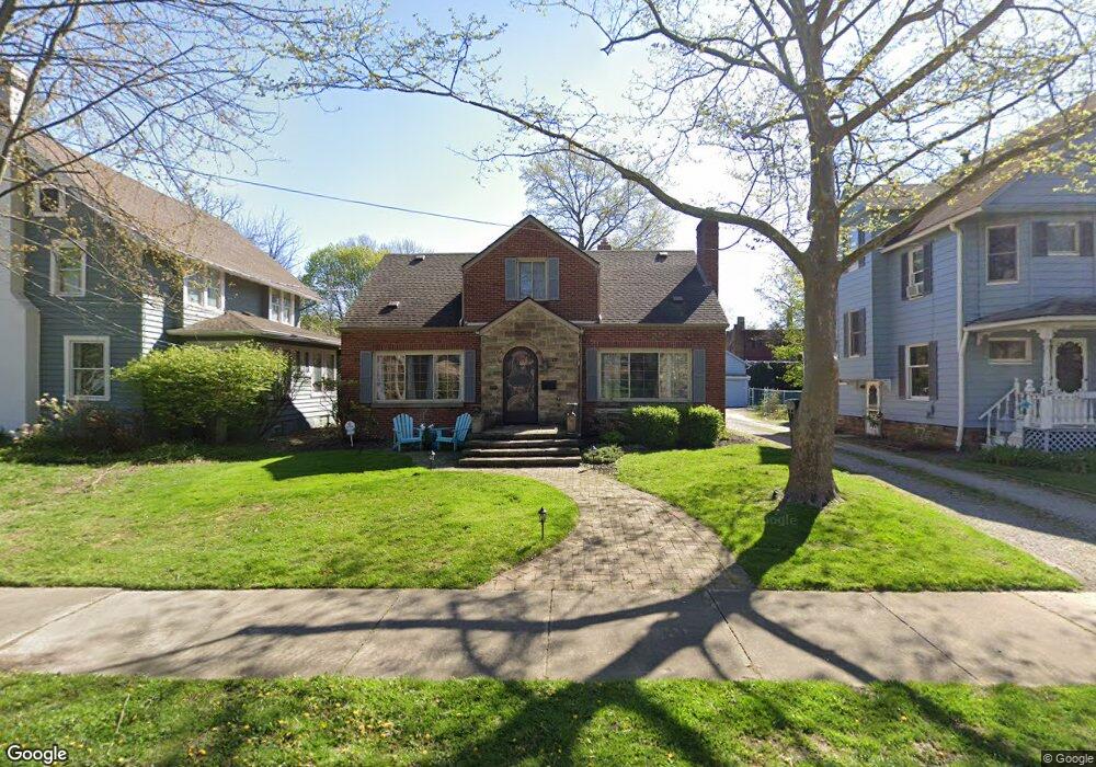
17 Mayfield Ave Akron, OH 44313
Highland Square NeighborhoodEstimated Value: $226,000 - $275,000
4
Beds
3
Baths
1,904
Sq Ft
$131/Sq Ft
Est. Value
About This Home
This home is located at 17 Mayfield Ave, Akron, OH 44313 and is currently estimated at $248,737, approximately $130 per square foot. 17 Mayfield Ave is a home located in Summit County with nearby schools including Case Community Learning Center, Summit Academy School, and Towpath Trail High School.
Ownership History
Date
Name
Owned For
Owner Type
Purchase Details
Closed on
May 1, 2017
Sold by
Brislin Ralph F and Brislin Rebecca C
Bought by
Greger Shari
Current Estimated Value
Home Financials for this Owner
Home Financials are based on the most recent Mortgage that was taken out on this home.
Original Mortgage
$130,950
Interest Rate
4.1%
Mortgage Type
Purchase Money Mortgage
Create a Home Valuation Report for This Property
The Home Valuation Report is an in-depth analysis detailing your home's value as well as a comparison with similar homes in the area
Home Values in the Area
Average Home Value in this Area
Purchase History
| Date | Buyer | Sale Price | Title Company |
|---|---|---|---|
| Greger Shari | $135,000 | None Available |
Source: Public Records
Mortgage History
| Date | Status | Borrower | Loan Amount |
|---|---|---|---|
| Previous Owner | Greger Shari | $130,950 |
Source: Public Records
Tax History
| Year | Tax Paid | Tax Assessment Tax Assessment Total Assessment is a certain percentage of the fair market value that is determined by local assessors to be the total taxable value of land and additions on the property. | Land | Improvement |
|---|---|---|---|---|
| 2024 | $3,726 | $70,994 | $13,671 | $57,323 |
| 2023 | $3,726 | $70,994 | $13,671 | $57,323 |
| 2022 | $3,790 | $56,795 | $10,938 | $45,857 |
| 2021 | $3,794 | $56,795 | $10,938 | $45,857 |
| 2020 | $3,736 | $56,800 | $10,940 | $45,860 |
| 2019 | $3,436 | $47,350 | $8,820 | $38,530 |
| 2018 | $3,389 | $47,350 | $8,820 | $38,530 |
| 2017 | $2,919 | $47,350 | $8,820 | $38,530 |
| 2016 | $2,921 | $39,930 | $8,820 | $31,110 |
| 2015 | $2,919 | $39,930 | $8,820 | $31,110 |
| 2014 | $2,895 | $39,930 | $8,820 | $31,110 |
| 2013 | $3,263 | $46,150 | $8,820 | $37,330 |
Source: Public Records
Map
Nearby Homes
- 50 N Rose Blvd
- 100 Mayfield Ave
- 101 Marvin Ave
- 138 Marvin Ave
- 952 Jefferson Ave
- 166 Marvin Ave
- 255 N Portage Path Unit 409
- 255 N Portage Path Unit 507
- 255 N Portage Path Unit 108
- 100 Corson Ave
- 141 Storer Ave
- 931 Amelia Ave
- 275 N Portage Path Unit 8A
- 275 N Portage Path Unit 7B
- 275 N Portage Path Unit 7g
- 333 N Portage Path Unit 6
- 333 N Portage Path Unit 34
- 333 N Portage Path Unit 25
- 286 Alhambra Way
- 456 Merriman Rd
- 27 Mayfield Ave
- 11 Mayfield Ave
- 7 Mayfield Ave
- 31 Mayfield Ave
- 5 Mayfield Ave
- 35 Mayfield Ave
- 46 N Rose Blvd
- 42 N Rose Blvd
- 1011 W Market St
- 24 N Rose Blvd
- 985 W Market St
- 39 Mayfield Ave
- 56 N Rose Blvd
- 60 N Rose Blvd
- 981 W Market St
- 1017 W Market St
- 41 Mayfield Ave
- 62 N Rose Blvd
- 1025 W Market St
- 46 Mayfield Ave
Your Personal Tour Guide
Ask me questions while you tour the home.