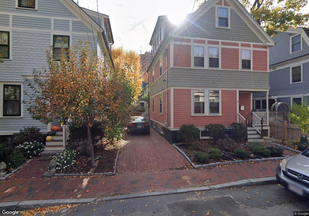
17 Maynard Place Cambridge, MA 02138
West Cambridge NeighborhoodEstimated Value: $1,823,834 - $2,640,000
2
Beds
3
Baths
1,184
Sq Ft
$1,732/Sq Ft
Est. Value
About This Home
This home is located at 17 Maynard Place, Cambridge, MA 02138 and is currently estimated at $2,050,459, approximately $1,731 per square foot. 17 Maynard Place is a home located in Middlesex County with nearby schools including St Peter School, Shady Hill School, and Buckingham Browne & Nichols School.
Ownership History
Date
Name
Owned For
Owner Type
Purchase Details
Closed on
Jun 23, 1994
Sold by
Bahamon Guillermo E
Bought by
Kaysen Suzanna
Current Estimated Value
Home Financials for this Owner
Home Financials are based on the most recent Mortgage that was taken out on this home.
Original Mortgage
$55,000
Interest Rate
8.74%
Mortgage Type
Purchase Money Mortgage
Purchase Details
Closed on
Dec 13, 1988
Sold by
Est E E Mcdonald
Bought by
Bahamon Guillermo E
Create a Home Valuation Report for This Property
The Home Valuation Report is an in-depth analysis detailing your home's value as well as a comparison with similar homes in the area
Home Values in the Area
Average Home Value in this Area
Purchase History
| Date | Buyer | Sale Price | Title Company |
|---|---|---|---|
| Kaysen Suzanna | $455,000 | -- | |
| Kaysen Suzanna | $455,000 | -- | |
| Bahamon Guillermo E | $181,500 | -- |
Source: Public Records
Mortgage History
| Date | Status | Borrower | Loan Amount |
|---|---|---|---|
| Open | Bahamon Guillermo E | $27,100 | |
| Closed | Bahamon Guillermo E | $55,000 | |
| Previous Owner | Bahamon Guillermo E | $452,150 |
Source: Public Records
Tax History Compared to Growth
Tax History
| Year | Tax Paid | Tax Assessment Tax Assessment Total Assessment is a certain percentage of the fair market value that is determined by local assessors to be the total taxable value of land and additions on the property. | Land | Improvement |
|---|---|---|---|---|
| 2025 | $10,570 | $1,664,500 | $962,600 | $701,900 |
| 2024 | $9,862 | $1,665,800 | $993,600 | $672,200 |
| 2023 | $9,494 | $1,620,100 | $948,900 | $671,200 |
| 2022 | $9,525 | $1,608,900 | $1,014,200 | $594,700 |
| 2021 | $8,929 | $1,526,400 | $973,100 | $553,300 |
| 2020 | $8,408 | $1,462,300 | $937,400 | $524,900 |
| 2019 | $7,767 | $1,307,600 | $822,100 | $485,500 |
| 2018 | $8,235 | $1,309,200 | $817,300 | $491,900 |
| 2017 | $8,375 | $1,290,500 | $817,300 | $473,200 |
| 2016 | $8,131 | $1,163,300 | $718,700 | $444,600 |
| 2015 | $8,280 | $1,058,800 | $661,000 | $397,800 |
| 2014 | $8,325 | $993,400 | $600,900 | $392,500 |
Source: Public Records
Map
Nearby Homes
- 20 Maynard Place
- 1010 Memorial Dr Unit 6G
- 15 Hubbard Park Rd
- 48 Hubbard Park Rd
- 158 Brattle St
- 153 Brattle St
- 172 Brattle St
- 32 Hawthorn St
- 3 Berkeley Place
- 988 Memorial Dr Unit 386
- 5 Brewer St Unit 5
- 12 Berkeley St
- 986 Memorial Dr Unit 404
- 984 Memorial Dr Unit 984-503
- 983 Memorial Dr Unit 502
- 234 Huron Ave
- 22 Concord Ave Unit 10
- 130 Mount Auburn St Unit 108
- 44 Garden St
- 52 Garden St Unit B2
- 13 Maynard Place Unit 1
- 27 Gibson St Unit 38 - 5D
- 27 Gibson St Unit 5
- 27 Gibson St Unit 5D
- 27 Gibson St Unit 6D
- 27 Gibson St
- 25 Gibson St
- 8 Kenway St
- 18 Maynard Place
- 6 Kenway St
- 10 Kenway St
- 21 Gibson St
- 21 Gibson St Unit 3
- 14 Maynard Place
- 12 Maynard Place
- 4 Kenway St
- 9 Maynard Place
- 15 Gibson St
- 2 Kenway St
- 9 Kenway St