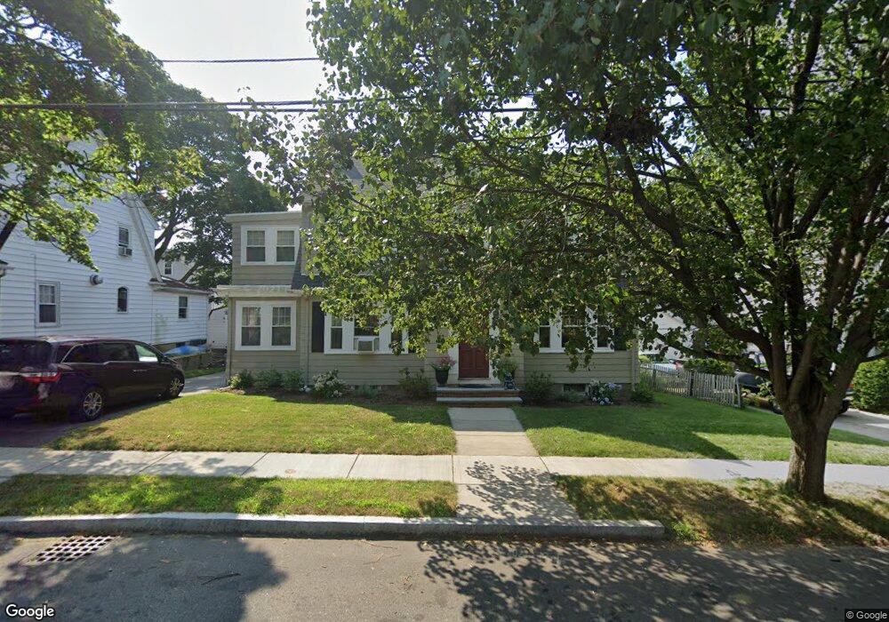
17 Merrill Rd Watertown, MA 02472
West Watertown NeighborhoodEstimated Value: $1,161,000 - $1,412,000
4
Beds
2
Baths
2,111
Sq Ft
$602/Sq Ft
Est. Value
About This Home
This home is located at 17 Merrill Rd, Watertown, MA 02472 and is currently estimated at $1,270,291, approximately $601 per square foot. 17 Merrill Rd is a home located in Middlesex County with nearby schools including The Kendall School and Beacon High School.
Ownership History
Date
Name
Owned For
Owner Type
Purchase Details
Closed on
Jun 4, 2024
Sold by
Oconnor Thomas and Oconnor Marylinn
Bought by
Oconnor Ft and Oconnor
Current Estimated Value
Purchase Details
Closed on
May 9, 2006
Sold by
Romantz Allison K and Romantz Gary M
Bought by
Oconnor Marilynn and Oconnor Thomas
Purchase Details
Closed on
Jun 1, 1998
Sold by
Thompson George L and Thompson Linda T
Bought by
Romantz Gary M and Romantz Allison K
Purchase Details
Closed on
Sep 2, 1988
Sold by
Sher Michael
Bought by
Thompson George L
Create a Home Valuation Report for This Property
The Home Valuation Report is an in-depth analysis detailing your home's value as well as a comparison with similar homes in the area
Home Values in the Area
Average Home Value in this Area
Purchase History
| Date | Buyer | Sale Price | Title Company |
|---|---|---|---|
| Oconnor Ft | -- | None Available | |
| Oconnor Ft | -- | None Available | |
| Oconnor Ft | -- | None Available | |
| Oconnor Marilynn | $605,000 | -- | |
| Oconnor Marilynn | $605,000 | -- | |
| Oconnor Marilynn | $605,000 | -- | |
| Romantz Gary M | $324,250 | -- | |
| Thompson George L | $299,000 | -- |
Source: Public Records
Mortgage History
| Date | Status | Borrower | Loan Amount |
|---|---|---|---|
| Previous Owner | Thompson George L | $380,000 | |
| Previous Owner | Thompson George L | $389,000 |
Source: Public Records
Tax History Compared to Growth
Tax History
| Year | Tax Paid | Tax Assessment Tax Assessment Total Assessment is a certain percentage of the fair market value that is determined by local assessors to be the total taxable value of land and additions on the property. | Land | Improvement |
|---|---|---|---|---|
| 2025 | $12,079 | $1,034,200 | $599,200 | $435,000 |
| 2024 | $11,303 | $966,100 | $574,000 | $392,100 |
| 2023 | $11,965 | $881,100 | $538,100 | $343,000 |
| 2022 | $10,925 | $824,500 | $495,000 | $329,500 |
| 2021 | $9,662 | $788,700 | $459,200 | $329,500 |
| 2020 | $9,571 | $788,400 | $459,200 | $329,200 |
| 2019 | $9,356 | $726,400 | $459,200 | $267,200 |
| 2018 | $9,312 | $691,300 | $459,200 | $232,100 |
| 2017 | $9,402 | $676,900 | $444,800 | $232,100 |
| 2016 | $8,378 | $612,400 | $401,800 | $210,600 |
| 2015 | $8,611 | $572,900 | $362,300 | $210,600 |
| 2014 | $8,357 | $558,600 | $348,000 | $210,600 |
Source: Public Records
Map
Nearby Homes
- 30 Merrill Rd
- 46 Hall Ave Unit 2
- 91 Standish Rd
- 532 Belmont St
- 121 Channing Rd
- 18 Wilson Ave Unit 2
- 125 Trapelo Rd Unit 23
- 125 Trapelo Rd Unit 21
- 52-54 Vincent Ave
- 47 Fuller Rd Unit 47
- 152 Bellevue Rd
- 88 Palfrey Rd Unit 88
- 2 Bartlett Ave Unit 1
- 50 York Ave Unit 50
- 11 Payson Rd Unit 11
- 748 Belmont St
- 456 Belmont St Unit 10
- 98 Carroll St Unit 98
- 50 Hammond Rd
- 50 Carroll St Unit 50
- 23 Merrill Rd
- 15 Merrill Rd
- 80 Poplar St
- 76 Poplar St
- 76 Poplar St Unit 2
- 84 Poplar St
- 84 Poplar St Unit 1
- 70 Poplar St
- 31 Merrill Rd
- 9 Merrill Rd
- 14 Merrill Rd
- 24 Merrill Rd
- 20 Merrill Rd
- 66 Poplar St
- 88 Poplar St Unit 2
- 10 Merrill Rd
- 90 Poplar St Unit 2
- 90 Poplar St Unit 1
- 33 Merrill Rd
- 33 Merrill Rd Unit 33