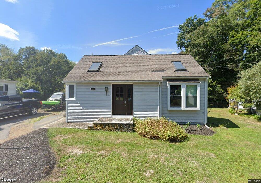
17 Monadnock Ave Taunton, MA 02780
Whittenton Junction NeighborhoodEstimated Value: $387,000 - $451,000
2
Beds
1
Bath
1,361
Sq Ft
$300/Sq Ft
Est. Value
About This Home
This home is located at 17 Monadnock Ave, Taunton, MA 02780 and is currently estimated at $408,893, approximately $300 per square foot. 17 Monadnock Ave is a home located in Bristol County with nearby schools including Mulcahey Elementary School, Benjamin Friedman Middle School, and Taunton High School.
Ownership History
Date
Name
Owned For
Owner Type
Purchase Details
Closed on
Sep 8, 2006
Sold by
Brandon William
Bought by
Brandon William M
Current Estimated Value
Purchase Details
Closed on
Mar 21, 1994
Sold by
Baker Malcolm C and Baker Malcom A
Bought by
Hillshire Rt and Boyden
Home Financials for this Owner
Home Financials are based on the most recent Mortgage that was taken out on this home.
Original Mortgage
$0
Interest Rate
7.76%
Mortgage Type
Purchase Money Mortgage
Create a Home Valuation Report for This Property
The Home Valuation Report is an in-depth analysis detailing your home's value as well as a comparison with similar homes in the area
Home Values in the Area
Average Home Value in this Area
Purchase History
| Date | Buyer | Sale Price | Title Company |
|---|---|---|---|
| Brandon William M | -- | -- | |
| Hillshire Rt | $18,000 | -- |
Source: Public Records
Mortgage History
| Date | Status | Borrower | Loan Amount |
|---|---|---|---|
| Previous Owner | Hillshire Rt | $109,000 | |
| Previous Owner | Hillshire Rt | $71,500 | |
| Previous Owner | Hillshire Rt | $35,000 | |
| Previous Owner | Hillshire Rt | $0 |
Source: Public Records
Tax History Compared to Growth
Tax History
| Year | Tax Paid | Tax Assessment Tax Assessment Total Assessment is a certain percentage of the fair market value that is determined by local assessors to be the total taxable value of land and additions on the property. | Land | Improvement |
|---|---|---|---|---|
| 2025 | $3,767 | $344,300 | $113,300 | $231,000 |
| 2024 | $3,392 | $303,100 | $113,300 | $189,800 |
| 2023 | $3,378 | $280,300 | $118,500 | $161,800 |
| 2022 | $3,066 | $232,600 | $91,800 | $140,800 |
| 2021 | $2,937 | $206,800 | $83,500 | $123,300 |
| 2020 | $2,777 | $186,900 | $83,500 | $103,400 |
| 2019 | $2,725 | $172,900 | $83,500 | $89,400 |
| 2018 | $2,633 | $159,100 | $84,100 | $75,000 |
| 2017 | $2,396 | $152,500 | $70,600 | $81,900 |
| 2016 | $2,396 | $152,800 | $68,600 | $84,200 |
| 2015 | $2,363 | $157,400 | $69,900 | $87,500 |
| 2014 | $2,143 | $146,700 | $65,800 | $80,900 |
Source: Public Records
Map
Nearby Homes
- 137 Tremont St
- 108 Tremont St
- 99 Tremont St
- 17 Davis St
- 0 Norton Ave Unit 73445127
- 55 Highland Ave
- 20 Grand Ave
- 79 Fremont St
- 26 Kilmer Ave
- 16 Kilton St
- 22 Southway
- 110 Eldridge St Unit B
- 25 Quequechan Rd
- 45 Fisher St
- 2 Upland Rd
- 214 Eldridge St
- 39 Myrtle St
- 96 Danforth St Unit 49
- 170 Highland St Unit 320
- 19 Mason St
- 15 Monadnock Ave
- 19 Monadnock Ave
- 19 Monadock Ave
- 25 Monadnock Ave
- 18 Monadnock Ave
- 18 Monadnock Ave Unit 2
- 5 Monadnock Ave
- 6 Monadnock Ave
- 14 Oakland Ave
- 15 Cleveland Rd
- 11 Cleveland Rd
- 17 Cleveland Rd
- 7 Cleveland Rd
- 160 Tremont St
- 18 Oakland Ave
- 158 Tremont St
- 164 Tremont St
- 3 Cleveland Rd
- 156 Tremont St
- 14 Cleveland Rd