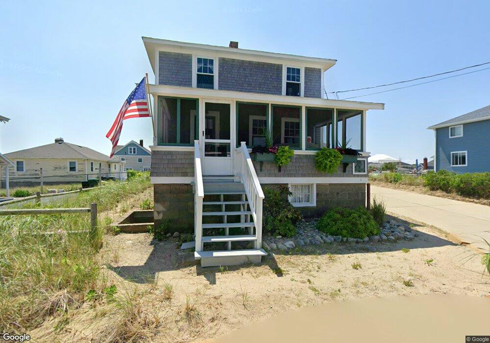
17 Monitor Rd Marshfield, MA 02050
Ocean Bluff-Brant Rock NeighborhoodEstimated Value: $714,773 - $864,000
4
Beds
1
Bath
1,144
Sq Ft
$693/Sq Ft
Est. Value
About This Home
This home is located at 17 Monitor Rd, Marshfield, MA 02050 and is currently estimated at $792,443, approximately $692 per square foot. 17 Monitor Rd is a home with nearby schools including Daniel Webster, Furnace Brook Middle School, and Marshfield High School.
Create a Home Valuation Report for This Property
The Home Valuation Report is an in-depth analysis detailing your home's value as well as a comparison with similar homes in the area
Home Values in the Area
Average Home Value in this Area
Tax History Compared to Growth
Tax History
| Year | Tax Paid | Tax Assessment Tax Assessment Total Assessment is a certain percentage of the fair market value that is determined by local assessors to be the total taxable value of land and additions on the property. | Land | Improvement |
|---|---|---|---|---|
| 2025 | $6,933 | $700,300 | $500,400 | $199,900 |
| 2024 | $6,910 | $665,100 | $476,600 | $188,500 |
| 2023 | $6,816 | $596,300 | $436,900 | $159,400 |
| 2022 | $6,816 | $526,300 | $397,100 | $129,200 |
| 2021 | $6,525 | $494,700 | $371,300 | $123,400 |
| 2020 | $6,333 | $475,100 | $357,400 | $117,700 |
| 2019 | $6,279 | $469,300 | $357,400 | $111,900 |
| 2018 | $5,797 | $433,600 | $321,700 | $111,900 |
| 2017 | $5,856 | $426,800 | $321,700 | $105,100 |
| 2016 | $5,530 | $398,400 | $297,900 | $100,500 |
| 2015 | $5,611 | $422,200 | $321,700 | $100,500 |
| 2014 | $5,466 | $411,300 | $317,700 | $93,600 |
Source: Public Records
Map
Nearby Homes
- 13 Monitor Rd
- 18 Monitor Rd
- 12 Monitor Rd
- 12 Monitor Rd
- 21 Monitor Rd
- 21 Monitor Rd Unit R
- 12 Farragut Rd
- 24 Monitor Rd
- 22 Farragut Rd
- 16R Monitor Rd
- 16 Monitor Rd
- 26 Farragut Rd
- 26 Farragut Rd Unit 1
- 17 Constellation Rd
- 29 Monitor Rd
- 23 Constellation Rd
- 23 Constellation Rd Unit 1
- 30 Monitor Rd
- 11 Constellation Rd
- 11 Farragut Rd