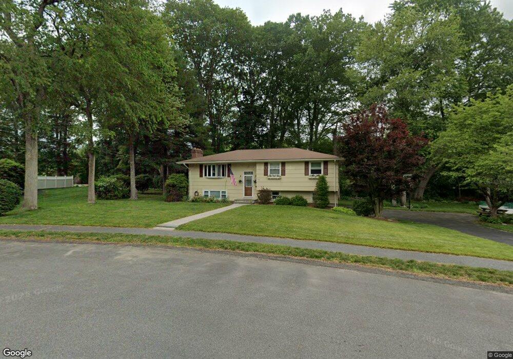
17 Morningside Dr Norwood, MA 02062
North Norwood NeighborhoodEstimated Value: $803,000 - $848,004
3
Beds
3
Baths
1,666
Sq Ft
$497/Sq Ft
Est. Value
About This Home
This home is located at 17 Morningside Dr, Norwood, MA 02062 and is currently estimated at $828,751, approximately $497 per square foot. 17 Morningside Dr is a home located in Norfolk County with nearby schools including Norwood High School, Norwood Montessori School, and St Catherine Of Siena School.
Ownership History
Date
Name
Owned For
Owner Type
Purchase Details
Closed on
Oct 31, 2002
Sold by
Orourke Robert E and Orourke Carol A
Bought by
Howard Stephen M
Current Estimated Value
Home Financials for this Owner
Home Financials are based on the most recent Mortgage that was taken out on this home.
Original Mortgage
$380,000
Outstanding Balance
$159,985
Interest Rate
6.09%
Mortgage Type
Purchase Money Mortgage
Estimated Equity
$668,766
Purchase Details
Closed on
Aug 18, 1999
Sold by
Doyle Nicholas E
Bought by
Parise Robert A
Home Financials for this Owner
Home Financials are based on the most recent Mortgage that was taken out on this home.
Original Mortgage
$189,600
Interest Rate
7.6%
Mortgage Type
Purchase Money Mortgage
Create a Home Valuation Report for This Property
The Home Valuation Report is an in-depth analysis detailing your home's value as well as a comparison with similar homes in the area
Home Values in the Area
Average Home Value in this Area
Purchase History
| Date | Buyer | Sale Price | Title Company |
|---|---|---|---|
| Howard Stephen M | $431,500 | -- | |
| Parise Robert A | $237,000 | -- |
Source: Public Records
Mortgage History
| Date | Status | Borrower | Loan Amount |
|---|---|---|---|
| Open | Parise Robert A | $182,000 | |
| Open | Howard Stephen M | $380,000 | |
| Previous Owner | Parise Robert A | $189,600 |
Source: Public Records
Tax History Compared to Growth
Tax History
| Year | Tax Paid | Tax Assessment Tax Assessment Total Assessment is a certain percentage of the fair market value that is determined by local assessors to be the total taxable value of land and additions on the property. | Land | Improvement |
|---|---|---|---|---|
| 2025 | $78 | $739,500 | $365,200 | $374,300 |
| 2024 | $7,258 | $693,200 | $365,200 | $328,000 |
| 2023 | $6,355 | $615,800 | $301,600 | $314,200 |
| 2022 | $6,260 | $582,300 | $274,200 | $308,100 |
| 2021 | $5,840 | $515,000 | $264,300 | $250,700 |
| 2020 | $5,633 | $505,200 | $262,000 | $243,200 |
| 2019 | $5,080 | $466,500 | $253,900 | $212,600 |
| 2018 | $5,210 | $469,800 | $254,500 | $215,300 |
| 2017 | $4,986 | $447,200 | $254,500 | $192,700 |
| 2016 | $4,720 | $424,500 | $254,500 | $170,000 |
| 2015 | $4,713 | $410,900 | $231,300 | $179,600 |
| 2014 | $4,491 | $387,800 | $218,400 | $169,400 |
Source: Public Records
Map
Nearby Homes
- 34 Orleans Rd
- 26 Garden Pkwy
- 531 Walpole St
- 3 Endicott St Unit 1
- 49-51 Davis Ave
- 152 Albemarle Rd
- 144 Devon Rd
- 10 Pettees Pond Ln
- 10 Victoria Cir
- 1080 North St
- 115 Alder Rd
- 42 Tamarack Rd
- 8 Old Fisher Ln
- 303 Oak St
- 20-22 Cedar St Unit 3
- 14 Alandale Pkwy
- 144 Fensview Dr
- 1274 Washington St
- 49 Hound Pack Cir
- 45 Endean Dr
- 13 Morningside Dr
- 21 Morningside Dr
- 20 Morningside Dr
- 14 Morningside Dr
- 25 Morningside Dr
- 9 Morningside Dr
- 24 Morningside Dr
- 5 Morningside Dr
- 141 Wilson St
- 29 Morningside Dr
- 117 Wilson St
- 28 Morningside Dr
- 145 Wilson St
- 121 Wilson St
- 132 Wilson St
- 33 Morningside Dr
- 138 Wilson St
- 105 Garden Pkwy
- 128 Wilson St
- 32 Morningside Dr