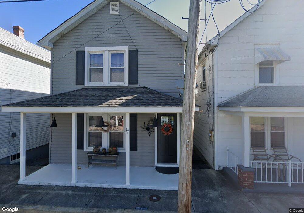
17 N Martin St Clear Spring, MD 21722
Estimated Value: $153,000 - $215,000
Studio
1
Bath
1,112
Sq Ft
$161/Sq Ft
Est. Value
About This Home
This home is located at 17 N Martin St, Clear Spring, MD 21722 and is currently estimated at $179,375, approximately $161 per square foot. 17 N Martin St is a home located in Washington County with nearby schools including Clear Spring Elementary School, Clear Spring Middle School, and Clear Spring High School.
Ownership History
Date
Name
Owned For
Owner Type
Purchase Details
Closed on
Apr 25, 2017
Sold by
Turner Samuel A and Cessna Rena M
Bought by
Cessna Rena M
Current Estimated Value
Home Financials for this Owner
Home Financials are based on the most recent Mortgage that was taken out on this home.
Original Mortgage
$102,767
Outstanding Balance
$85,766
Interest Rate
4.23%
Mortgage Type
FHA
Estimated Equity
$93,609
Purchase Details
Closed on
May 28, 1996
Sold by
Moore Douglas E and Moore Cynthia R
Bought by
Turner Samuel A and Turner Rena M
Purchase Details
Closed on
Aug 23, 1988
Sold by
Hull Todd M and Lee Ann
Bought by
Moore Douglas E and Moore Cynthia R
Home Financials for this Owner
Home Financials are based on the most recent Mortgage that was taken out on this home.
Original Mortgage
$42,000
Interest Rate
10.71%
Purchase Details
Closed on
Apr 23, 1987
Sold by
Kelley Robert A and I P
Bought by
Hull Todd M and Lee Ann
Home Financials for this Owner
Home Financials are based on the most recent Mortgage that was taken out on this home.
Original Mortgage
$25,000
Interest Rate
10.27%
Create a Home Valuation Report for This Property
The Home Valuation Report is an in-depth analysis detailing your home's value as well as a comparison with similar homes in the area
Purchase History
| Date | Buyer | Sale Price | Title Company |
|---|---|---|---|
| Cessna Rena M | -- | Title Source Inc | |
| Turner Samuel A | $71,500 | -- | |
| Moore Douglas E | $51,000 | -- | |
| Hull Todd M | $45,000 | -- |
Source: Public Records
Mortgage History
| Date | Status | Borrower | Loan Amount |
|---|---|---|---|
| Open | Cessna Rena M | $102,767 | |
| Previous Owner | Moore Douglas E | $42,000 | |
| Previous Owner | Hull Todd M | $25,000 |
Source: Public Records
Tax History
| Year | Tax Paid | Tax Assessment Tax Assessment Total Assessment is a certain percentage of the fair market value that is determined by local assessors to be the total taxable value of land and additions on the property. | Land | Improvement |
|---|---|---|---|---|
| 2025 | $1,020 | $121,933 | $0 | $0 |
| 2024 | $1,020 | $111,967 | $0 | $0 |
| 2023 | $929 | $102,000 | $38,200 | $63,800 |
| 2022 | $887 | $97,400 | $0 | $0 |
| 2021 | $821 | $92,800 | $0 | $0 |
| 2020 | $821 | $88,200 | $38,200 | $50,000 |
| 2019 | $825 | $88,200 | $38,200 | $50,000 |
| 2018 | $825 | $88,200 | $38,200 | $50,000 |
| 2017 | $870 | $93,100 | $0 | $0 |
| 2016 | -- | $91,967 | $0 | $0 |
| 2015 | $951 | $90,833 | $0 | $0 |
| 2014 | $951 | $89,700 | $0 | $0 |
Source: Public Records
Map
Nearby Homes
- 0 Mulberry St
- 13407 Rhodes Ct
- 11868 National Pike
- 11717 Ashton Rd
- 11705 Ashton Rd
- 11430 National Pike
- 13100 Saint Paul Rd
- 12136 Big Pool Rd
- Block 139 Lot 56 Boo Blvd
- Block 87 Lot 4 Pikers Peak Dr
- 12333 Mummert Rd
- Lot 9 Boo Blvd Unit BLOCK 1
- Block 11 Lot 14 Hot Springs Ave
- Block 90 Lot 8 Ranger Rd
- Block 7 Lot 30 & 31 Campfire Blvd
- Block 8 Lot 16 & 17 Campfire Blvd
- 0 Block 10 Lot 2 Deadwood Dr Unit WVBE2040636
- Block 12 Lot 41 Ranger Rd
- Block 1 Lot 27 Boo Blvd
- Block 18 Lot 44 Hollow Log
- 15 N Martin St
- 19 N Martin St
- 13 N Martin St
- 13 N Martin St
- 21 N Martin St
- 35 Martin 35-37 St S
- 11 N Martin St
- 18 N Martin St
- 25 N Martin St
- 22 N Martin St
- 24 N Martin St
- 14 N Martin St
- 12 N Martin St
- 108 Cumberland St
- 102 Cumberland St
- 114 Cumberland St
- 34 Cumberland St
- 10 N Hawbaker Cir
- 32 Cumberland St
- 106 Cumberland St
Your Personal Tour Guide
Ask me questions while you tour the home.