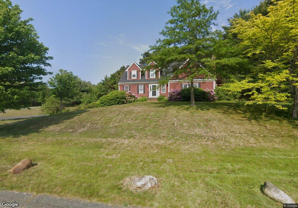
17 Noreast Ln Plymouth, MA 02360
Estimated Value: $713,880 - $953,000
3
Beds
3
Baths
2,146
Sq Ft
$376/Sq Ft
Est. Value
About This Home
This home is located at 17 Noreast Ln, Plymouth, MA 02360 and is currently estimated at $807,220, approximately $376 per square foot. 17 Noreast Ln is a home located in Plymouth County with nearby schools including Indian Brook, Plymouth South Middle School, and Plymouth South High School.
Ownership History
Date
Name
Owned For
Owner Type
Purchase Details
Closed on
Sep 16, 2009
Sold by
Okeefe Jonathan D and Okeefe David
Bought by
Okeefe Jonathan D
Current Estimated Value
Purchase Details
Closed on
Mar 1, 2002
Sold by
Cendant Mobility Fncl
Bought by
Okeefe David
Purchase Details
Closed on
Jul 27, 1999
Sold by
Melkonian Dev Corp
Bought by
Gatlin Clifford L
Create a Home Valuation Report for This Property
The Home Valuation Report is an in-depth analysis detailing your home's value as well as a comparison with similar homes in the area
Home Values in the Area
Average Home Value in this Area
Purchase History
| Date | Buyer | Sale Price | Title Company |
|---|---|---|---|
| Okeefe Jonathan D | -- | -- | |
| Okeefe David | $339,900 | -- | |
| Cendant Mobility Fincl | $339,900 | -- | |
| Gatlin Clifford L | $247,206 | -- |
Source: Public Records
Mortgage History
| Date | Status | Borrower | Loan Amount |
|---|---|---|---|
| Open | Gatlin Clifford L | $275,900 | |
| Previous Owner | Gatlin Clifford L | $128,400 |
Source: Public Records
Tax History Compared to Growth
Tax History
| Year | Tax Paid | Tax Assessment Tax Assessment Total Assessment is a certain percentage of the fair market value that is determined by local assessors to be the total taxable value of land and additions on the property. | Land | Improvement |
|---|---|---|---|---|
| 2025 | $7,650 | $602,800 | $214,600 | $388,200 |
| 2024 | $7,867 | $611,300 | $210,200 | $401,100 |
| 2023 | $7,606 | $554,800 | $183,800 | $371,000 |
| 2022 | $7,070 | $458,200 | $167,100 | $291,100 |
| 2021 | $6,734 | $416,700 | $167,100 | $249,600 |
| 2020 | $6,687 | $409,000 | $162,700 | $246,300 |
| 2019 | $6,497 | $392,800 | $145,100 | $247,700 |
| 2018 | $6,270 | $380,900 | $134,100 | $246,800 |
| 2017 | $5,861 | $353,500 | $134,100 | $219,400 |
| 2016 | $5,597 | $344,000 | $123,100 | $220,900 |
| 2015 | $5,369 | $345,500 | $123,100 | $222,400 |
| 2014 | $5,112 | $337,900 | $123,100 | $214,800 |
Source: Public Records
Map
Nearby Homes
- 375 Little Sandy Pond Rd
- 455 Lunns Way
- 110 Valley Rd
- 10 Shore Rd
- 7 Central Ave
- 4 Oriole Way
- 28 Paulette Terrace
- 63 Pioneer Trail
- 520 Raymond Rd
- 9 Headlands Dr
- 7 Tadpole Way
- 4 Tadpole Way
- 215 Roxy Cahoon Rd
- 65 Lakewood Dr
- 12 Tradewind Ln
- 44 Pisces Ln
- 1 Kara's Way
- 671 Lunns Way
- 137 Sandy Beach Rd
- 242 Hedges Pond Rd
- 25 Noreast Ln
- 15 Wyndham Hill Dr
- 19 Wyndham Hill Dr
- 11 Wyndham Hill Dr
- 20 Noreast Ln
- 29 Wyndham Hill Dr
- 29 Wyndham Hill Dr Unit 1
- 7 Wyndham Hill Dr
- 24 Noreast Ln
- 33 Wyndham Hill Dr
- 28 Noreast Ln
- 28 Noreast Ln Unit Single Fam
- 29 Noreast Ln
- 14 Noreast Ln
- 24-18 Whyndam Hill Rd
- 24-12 Whyndam Hill Rd
- 24 Wyndham Hill Dr
- 24 Wyndham Hill Dr
- 24 Wyndham Hill Dr
- 24 Wyndham Hill Dr