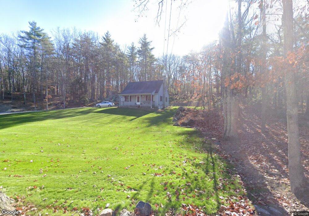
17 Oaklands Rd Exeter, NH 03833
Estimated Value: $585,000 - $680,000
2
Beds
3
Baths
1,568
Sq Ft
$408/Sq Ft
Est. Value
About This Home
This home is located at 17 Oaklands Rd, Exeter, NH 03833 and is currently estimated at $639,873, approximately $408 per square foot. 17 Oaklands Rd is a home located in Rockingham County with nearby schools including Main Street School, Lincoln Street Elementary School, and Cooperative Middle School.
Ownership History
Date
Name
Owned For
Owner Type
Purchase Details
Closed on
Jun 24, 1996
Sold by
Markie S Christopher A
Bought by
White Robert and White Donna
Current Estimated Value
Home Financials for this Owner
Home Financials are based on the most recent Mortgage that was taken out on this home.
Original Mortgage
$100,000
Interest Rate
8.21%
Create a Home Valuation Report for This Property
The Home Valuation Report is an in-depth analysis detailing your home's value as well as a comparison with similar homes in the area
Home Values in the Area
Average Home Value in this Area
Purchase History
We collect this data history from publicly available records. To have your information removed, we recommend requesting removal directly through your county’s website.
| Date | Buyer | Sale Price | Title Company |
|---|---|---|---|
| White Robert | $125,000 | -- |
Source: Public Records
Mortgage History
We collect this data history from publicly available records. To have your information removed, we recommend requesting removal directly through your county’s website.
| Date | Status | Borrower | Loan Amount |
|---|---|---|---|
| Open | White Robert | $60,000 | |
| Closed | White Robert | $20,000 | |
| Closed | White Robert | $100,000 |
Source: Public Records
Tax History
| Year | Tax Paid | Tax Assessment Tax Assessment Total Assessment is a certain percentage of the fair market value that is determined by local assessors to be the total taxable value of land and additions on the property. | Land | Improvement |
|---|---|---|---|---|
| 2025 | $10,438 | $556,400 | $309,800 | $246,600 |
| 2024 | $9,898 | $556,400 | $309,800 | $246,600 |
| 2023 | $9,694 | $362,000 | $195,300 | $166,700 |
| 2022 | $8,960 | $362,000 | $195,300 | $166,700 |
| 2021 | $8,692 | $362,000 | $195,300 | $166,700 |
| 2020 | $7,840 | $362,100 | $195,300 | $166,800 |
| 2019 | $8,426 | $362,100 | $195,300 | $166,800 |
| 2018 | $8,638 | $314,100 | $152,100 | $162,000 |
| 2017 | $4,427 | $314,100 | $152,100 | $162,000 |
| 2016 | $8,242 | $314,100 | $152,100 | $162,000 |
| 2015 | $8,022 | $314,100 | $152,100 | $162,000 |
| 2014 | $8,503 | $326,300 | $152,100 | $174,200 |
| 2013 | $8,494 | $326,300 | $152,100 | $174,200 |
| 2011 | $8,249 | $326,300 | $152,100 | $174,200 |
Source: Public Records
Map
Nearby Homes
- 1 Stonewall Way Unit D
- 28 Beech Hill Rd
- 20 Beech Hill Rd Unit 5
- 12 Runaway Rd
- 00 Piscassic & Oaklands Rd Unit 1
- 37 Signature Cir Unit Lot 7
- 38 Signature Cir Unit Lot 8
- 221 Piscassic Rd
- 5 Ridge Rd
- 7 Redberry Rd
- 43 Bassett Ln
- 38 Bassett Ln
- 19 Halls Mill Rd
- 104 Piscassic Rd
- 36 Bassett Ln
- 7 Captains Way
- 7 Willey Creek Rd Unit 205
- 29 Overlook Dr
- 120 Exeter Rd
- 7 Chapman Way
Your Personal Tour Guide
Ask me questions while you tour the home.