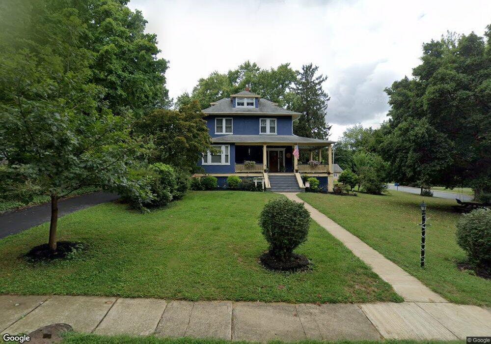
17 Osborne Ave Catonsville, MD 21228
Estimated Value: $724,000 - $797,000
--
Bed
3
Baths
3,130
Sq Ft
$238/Sq Ft
Est. Value
About This Home
This home is located at 17 Osborne Ave, Catonsville, MD 21228 and is currently estimated at $745,300, approximately $238 per square foot. 17 Osborne Ave is a home located in Baltimore County with nearby schools including Hillcrest Elementary School, Catonsville Middle School, and Catonsville High School.
Ownership History
Date
Name
Owned For
Owner Type
Purchase Details
Closed on
Aug 31, 1995
Sold by
Harding Michael B
Bought by
Quinn John
Current Estimated Value
Home Financials for this Owner
Home Financials are based on the most recent Mortgage that was taken out on this home.
Original Mortgage
$214,000
Interest Rate
7.61%
Purchase Details
Closed on
Jun 16, 1993
Sold by
Bauman Paul
Bought by
Harding Michael B
Create a Home Valuation Report for This Property
The Home Valuation Report is an in-depth analysis detailing your home's value as well as a comparison with similar homes in the area
Home Values in the Area
Average Home Value in this Area
Purchase History
| Date | Buyer | Sale Price | Title Company |
|---|---|---|---|
| Quinn John | $238,000 | -- | |
| Harding Michael B | $220,000 | -- |
Source: Public Records
Mortgage History
| Date | Status | Borrower | Loan Amount |
|---|---|---|---|
| Closed | Quinn John | $214,000 |
Source: Public Records
Tax History Compared to Growth
Tax History
| Year | Tax Paid | Tax Assessment Tax Assessment Total Assessment is a certain percentage of the fair market value that is determined by local assessors to be the total taxable value of land and additions on the property. | Land | Improvement |
|---|---|---|---|---|
| 2025 | $6,681 | $536,667 | -- | -- |
| 2024 | $6,681 | $518,600 | $151,600 | $367,000 |
| 2023 | $3,230 | $503,800 | $0 | $0 |
| 2022 | $6,565 | $489,000 | $0 | $0 |
| 2021 | $5,784 | $474,200 | $151,600 | $322,600 |
| 2020 | $5,784 | $444,000 | $0 | $0 |
| 2019 | $5,573 | $413,800 | $0 | $0 |
| 2018 | $5,525 | $383,600 | $109,600 | $274,000 |
| 2017 | $6,565 | $375,600 | $0 | $0 |
| 2016 | $5,577 | $367,600 | $0 | $0 |
| 2015 | $5,577 | $359,600 | $0 | $0 |
| 2014 | $5,577 | $359,600 | $0 | $0 |
Source: Public Records
Map
Nearby Homes
- 17 N Beaumont Ave
- 2 N Beechwood Ave
- 2 Park Dr
- 112 Melvin Ave
- 42 Winters Ln
- 38A Winters Ln
- 0 Melvin Ave
- 201 Suter Rd
- 16 Locust Dr
- 1703 Frederick Rd
- 133 Wesley Ave
- 206 S Rolling Rd
- 8 Seminole Ave
- 172 Winters Ln
- 15 Shipley Ave
- 206 Winters Ln
- 1326 Brook Rd
- 343 N Beaumont Ave
- 423 Ingleside Ave
- 353 N Beaumont Ave
- 15 Osborne Ave
- 1201 Summit Ave
- 21 Wyndcrest Ave
- 101 Osborne Ave
- 1200 Summit Ave
- 13 Osborne Ave
- 18 Osborne Ave
- 103 Osborne Ave
- 16 Osborne Ave
- 105 Osborne Ave
- 1301 Summit Ave
- 100 Osborne Ave
- 107 Osborne Ave
- 19 Wyndcrest Ave
- 14 Osborne Ave
- 11 Osborne Ave
- 109 Osborne Ave
- 26 Wyndcrest Ave
- 104 Osborne Ave
- 1300 Summit Ave