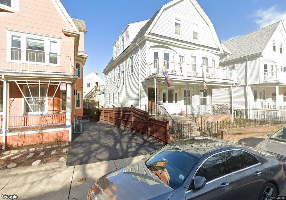
17 Ossipee Rd Unit 1 Somerville, MA 02144
Davis Square NeighborhoodEstimated Value: $1,183,913 - $1,661,000
3
Beds
1
Bath
1,350
Sq Ft
$1,031/Sq Ft
Est. Value
About This Home
This home is located at 17 Ossipee Rd Unit 1, Somerville, MA 02144 and is currently estimated at $1,392,228, approximately $1,031 per square foot. 17 Ossipee Rd Unit 1 is a home located in Middlesex County with nearby schools including Somerville High School, St. Clement Elementary School, and International School of Boston.
Ownership History
Date
Name
Owned For
Owner Type
Purchase Details
Closed on
Jul 19, 2005
Sold by
Sirignano Louis J
Bought by
Sirignano Louis J
Current Estimated Value
Home Financials for this Owner
Home Financials are based on the most recent Mortgage that was taken out on this home.
Original Mortgage
$311,000
Outstanding Balance
$162,451
Interest Rate
5.67%
Mortgage Type
Purchase Money Mortgage
Estimated Equity
$1,229,777
Create a Home Valuation Report for This Property
The Home Valuation Report is an in-depth analysis detailing your home's value as well as a comparison with similar homes in the area
Home Values in the Area
Average Home Value in this Area
Purchase History
| Date | Buyer | Sale Price | Title Company |
|---|---|---|---|
| Sirignano Louis J | $615,000 | -- |
Source: Public Records
Mortgage History
| Date | Status | Borrower | Loan Amount |
|---|---|---|---|
| Open | Sirignano Louis J | $311,000 |
Source: Public Records
Tax History
| Year | Tax Paid | Tax Assessment Tax Assessment Total Assessment is a certain percentage of the fair market value that is determined by local assessors to be the total taxable value of land and additions on the property. | Land | Improvement |
|---|---|---|---|---|
| 2025 | $14,876 | $1,363,500 | $693,900 | $669,600 |
| 2024 | $14,038 | $1,334,400 | $693,900 | $640,500 |
| 2023 | $13,732 | $1,328,000 | $693,900 | $634,100 |
| 2022 | $13,064 | $1,283,300 | $660,800 | $622,500 |
| 2021 | $12,405 | $1,217,400 | $656,000 | $561,400 |
| 2020 | $11,906 | $1,180,000 | $656,400 | $523,600 |
| 2019 | $11,282 | $1,048,500 | $597,600 | $450,900 |
| 2018 | $10,420 | $921,300 | $543,200 | $378,100 |
| 2017 | $10,258 | $879,000 | $512,500 | $366,500 |
| 2016 | $10,072 | $803,800 | $457,700 | $346,100 |
| 2015 | $9,585 | $760,100 | $422,700 | $337,400 |
Source: Public Records
Map
Nearby Homes
- 1004 Broadway Unit 3
- 55 Packard Ave Unit 1
- 42 Packard Ave Unit 42
- 69 Electric Ave Unit 3
- 106 Electric Ave Unit 3
- 30 Clarendon Ave
- 34 Elmwood St Unit 2
- 1188 Broadway Unit 403
- 111 Pearson Rd
- 183 Powder House Blvd
- 202 Powder House Blvd Unit 1
- 202 Powder House Blvd Unit 2
- 14 Farragut Ave Unit 1
- 3 Tannery Brook Row Unit 11
- 11 Tannery Brook Row Unit 3
- 12 Upland Rd
- 43 Grove St
- 68 Winslow Ave
- 25 Upland Rd
- 233 Powder House Blvd
- 17 Ossipee Rd Unit 2
- 11 Ossipee Rd
- 19 Ossipee Rd Unit 3
- 19 Ossipee Rd
- 19 Ossipee Rd Unit 2
- 9 Ossipee Rd
- 23 Ossipee Rd
- 23 Ossipee Rd Unit 1
- 94 Powder House Blvd
- 94 Powder House Blvd Unit 2
- 96 Powder House Blvd Unit 1
- 96 Powder House Blvd
- 96 Powder House Blvd Unit 3
- 96 Powder House Blvd Unit 2
- 92 Powder House Blvd
- 92 Powder House Blvd Unit 3
- 92 Powder House Blvd
- 92 Powder House Blvd Unit 2
- 92 Powder House Blvd Unit 1
- 100 Powder House Blvd
Your Personal Tour Guide
Ask me questions while you tour the home.