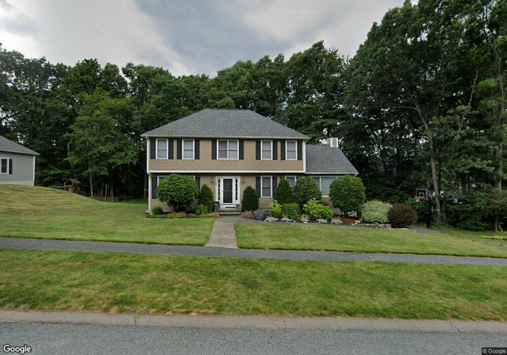
17 Pheasant Hollow Rd Natick, MA 01760
Estimated Value: $1,349,990 - $1,637,000
5
Beds
4
Baths
3,300
Sq Ft
$459/Sq Ft
Est. Value
About This Home
This home is located at 17 Pheasant Hollow Rd, Natick, MA 01760 and is currently estimated at $1,514,998, approximately $459 per square foot. 17 Pheasant Hollow Rd is a home located in Middlesex County with nearby schools including Natick High School, J F Kennedy Middle School, and Johnson Elementary School.
Ownership History
Date
Name
Owned For
Owner Type
Purchase Details
Closed on
Jul 1, 2002
Sold by
Sachs Jonathan M and Sachs Amy F
Bought by
Stahl Jonathan and Stahl Jacqueline
Current Estimated Value
Purchase Details
Closed on
Dec 30, 1996
Sold by
Roger Kuhn T
Bought by
Sachs Jonathan M and Sachs Amy F
Purchase Details
Closed on
Dec 8, 1994
Sold by
Tysan Dev Corp
Bought by
Roger Kuhn T
Create a Home Valuation Report for This Property
The Home Valuation Report is an in-depth analysis detailing your home's value as well as a comparison with similar homes in the area
Home Values in the Area
Average Home Value in this Area
Purchase History
| Date | Buyer | Sale Price | Title Company |
|---|---|---|---|
| Stahl Jonathan | $625,000 | -- | |
| Sachs Jonathan M | $315,000 | -- | |
| Roger Kuhn T | $295,000 | -- |
Source: Public Records
Mortgage History
| Date | Status | Borrower | Loan Amount |
|---|---|---|---|
| Open | Roger Kuhn T | $281,240 | |
| Closed | Roger Kuhn T | $291,000 | |
| Closed | Roger Kuhn T | $300,000 |
Source: Public Records
Tax History Compared to Growth
Tax History
| Year | Tax Paid | Tax Assessment Tax Assessment Total Assessment is a certain percentage of the fair market value that is determined by local assessors to be the total taxable value of land and additions on the property. | Land | Improvement |
|---|---|---|---|---|
| 2025 | $12,894 | $1,078,100 | $487,000 | $591,100 |
| 2024 | $12,509 | $1,020,300 | $461,300 | $559,000 |
| 2023 | $11,526 | $911,900 | $429,500 | $482,400 |
| 2022 | $11,346 | $850,500 | $387,600 | $462,900 |
| 2021 | $13,200 | $813,600 | $382,500 | $431,100 |
| 2020 | $10,865 | $798,300 | $367,200 | $431,100 |
| 2019 | $10,146 | $798,300 | $367,200 | $431,100 |
| 2018 | $9,229 | $707,200 | $354,500 | $352,700 |
| 2017 | $9,287 | $688,400 | $342,100 | $346,300 |
| 2016 | $9,298 | $685,200 | $342,100 | $343,100 |
| 2015 | $9,076 | $656,700 | $342,100 | $314,600 |
Source: Public Records
Map
Nearby Homes
- 26 Walden Dr Unit 4
- 4 Sylvia Ave
- 46 Silver Hill Ln Unit 1
- 9 Silver Hill Ln Unit 19
- 12 Walden Dr Unit 19
- 40 Silver Hill Ln Unit 4
- 32 Silver Hill Ln Unit 1
- 57 Village Brook Ln Unit 5
- 50 Village Brook Ln Unit 4
- 91 Speen St
- 51 Village Brook Ln Unit 16
- 4 Village Rock Ln Unit 9
- 6 Village Rock Ln Unit 17
- 5 Village Rock Ln Unit 24
- 1 Glen St Unit B
- 38 Ranger Rd
- 1 Fern St
- 2 Lodge Rd
- 10 Kelsey Rd
- 150 2nd St Unit 310
- 4 Autumn Ln
- 4 Autumn Ln
- 19 Pheasant Hollow Rd
- 6 Autumn Ln
- 6 Autumn Ln
- 15 Pheasant Hollow Rd
- 14 Pheasant Hollow Rd
- 8 Autumn Ln
- 12 Pheasant Hollow Rd L-B
- 12 Pheasant Hollow Rd
- 16 Pheasant Hollow Rd
- 21 Pheasant Hollow Rd
- 5 Autumn Ln
- 10 Autumn Ln
- 10 Pheasant Hollow Rd
- 18 Pheasant Hollow Rd
- 25 Prescott Ave
- 3 Autumn Ln
- 2 Autumn Ln
- 29 Prescott Ave