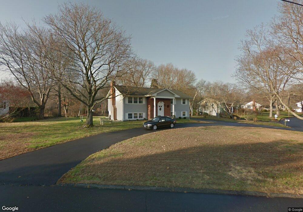
17 Pheasant Ln Norwalk, CT 06854
Brookside NeighborhoodEstimated Value: $793,000 - $879,754
3
Beds
3
Baths
1,400
Sq Ft
$607/Sq Ft
Est. Value
About This Home
This home is located at 17 Pheasant Ln, Norwalk, CT 06854 and is currently estimated at $849,189, approximately $606 per square foot. 17 Pheasant Ln is a home located in Fairfield County with nearby schools including Brookside Elementary School, Roton Middle School, and Brien Mcmahon High School.
Ownership History
Date
Name
Owned For
Owner Type
Purchase Details
Closed on
Aug 12, 2021
Sold by
Cottontail Road Llc
Bought by
Pheasant Lane Llc
Current Estimated Value
Purchase Details
Closed on
Jun 22, 2021
Sold by
17 Cottontail Llc
Bought by
Cottontail Road Llc
Purchase Details
Closed on
Sep 5, 2012
Sold by
Thomas Joanne
Bought by
17 Cottontail Llc
Create a Home Valuation Report for This Property
The Home Valuation Report is an in-depth analysis detailing your home's value as well as a comparison with similar homes in the area
Home Values in the Area
Average Home Value in this Area
Purchase History
| Date | Buyer | Sale Price | Title Company |
|---|---|---|---|
| Pheasant Lane Llc | -- | None Available | |
| Pheasant Lane Llc | -- | None Available | |
| Cottontail Road Llc | $662,500 | None Available | |
| Cottontail Road Llc | $662,500 | None Available | |
| 17 Cottontail Llc | -- | -- | |
| 17 Cottontail Llc | -- | -- |
Source: Public Records
Tax History Compared to Growth
Tax History
| Year | Tax Paid | Tax Assessment Tax Assessment Total Assessment is a certain percentage of the fair market value that is determined by local assessors to be the total taxable value of land and additions on the property. | Land | Improvement |
|---|---|---|---|---|
| 2025 | $11,905 | $497,180 | $282,000 | $215,180 |
| 2024 | $11,729 | $497,180 | $282,000 | $215,180 |
| 2023 | $10,222 | $406,280 | $238,610 | $167,670 |
| 2022 | $10,032 | $406,270 | $238,600 | $167,670 |
| 2021 | $9,771 | $406,280 | $238,610 | $167,670 |
| 2020 | $9,766 | $406,280 | $238,610 | $167,670 |
| 2019 | $9,492 | $406,280 | $238,610 | $167,670 |
| 2018 | $10,199 | $382,520 | $239,880 | $142,640 |
| 2017 | $9,848 | $382,520 | $239,880 | $142,640 |
| 2016 | $9,754 | $382,520 | $239,880 | $142,640 |
| 2015 | $9,727 | $382,520 | $239,880 | $142,640 |
| 2014 | $9,601 | $382,520 | $239,880 | $142,640 |
Source: Public Records
Map
Nearby Homes
- 73 Devils Garden Rd
- 19 Woodchuck Ct
- 5 Wakeman Rd
- 9 Hollow Spring Rd
- 40 Arnold Ln
- 19 Littlebrook Rd
- 105 Richards Ave Unit 2305
- 97 Richards Ave Unit B10
- 97 Richards Ave Unit E12
- 133 Rowayton Woods Dr
- 171 Rowayton Woods Dr Unit 171
- 7 Hadik Pkwy
- 13 Joemar Rd
- 47 Glasser St
- 10 Pine Brook Ln
- 17 Pine Brook Ln Unit 17
- 181 Highland Ave
- 9 Observatory Place Unit A
- 17 Woodlawn Ave
- 5 Rockland Rd Unit A8
- 17 Cottontail Rd
- 19 Pheasant Ln
- 15 Cottontail Rd
- 18 Pheasant Ln
- 16 Cottontail Rd
- 15 Pheasant Ln
- 20 Cottontail Rd
- 11 Cottontail Rd
- 25 Cottontail Rd
- 13 Pheasant Ln
- 10 Cottontail Rd
- 9 Cottontail Rd
- 25 Pheasant Ln
- 27 Cottontail Rd
- 22 Cottontail Rd
- 12 Pheasant Ln
- 24 Pheasant Ln
- 7 Cottontail Rd
- 24 Cottontail Rd
- 26 Pheasant Ln