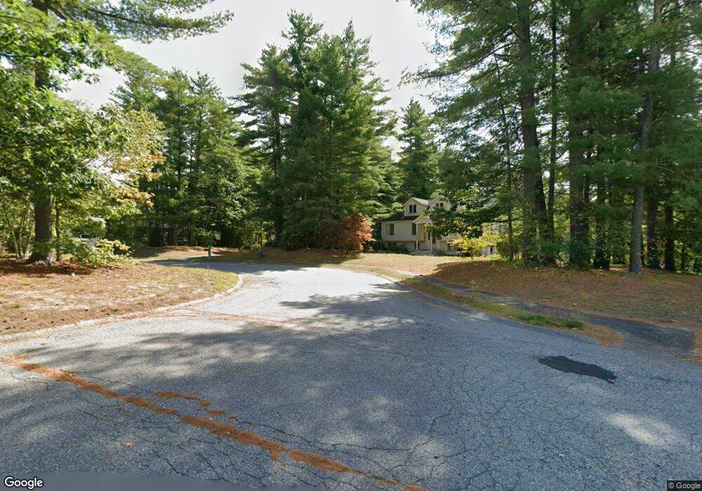
17 Pheasant Ridge Rd Townsend, MA 01469
Estimated Value: $589,000 - $718,000
3
Beds
2
Baths
2,690
Sq Ft
$238/Sq Ft
Est. Value
About This Home
This home is located at 17 Pheasant Ridge Rd, Townsend, MA 01469 and is currently estimated at $640,872, approximately $238 per square foot. 17 Pheasant Ridge Rd is a home located in Middlesex County with nearby schools including North Middlesex Regional High School.
Ownership History
Date
Name
Owned For
Owner Type
Purchase Details
Closed on
Apr 24, 2023
Sold by
Townsend Conservation Lan
Bought by
Townsend Town Of
Current Estimated Value
Purchase Details
Closed on
Apr 27, 2001
Sold by
Lurvey Brian D and Lurvey Deanna
Bought by
Avison David W and Avison Kathleen
Home Financials for this Owner
Home Financials are based on the most recent Mortgage that was taken out on this home.
Original Mortgage
$300,000
Interest Rate
6.88%
Mortgage Type
Purchase Money Mortgage
Create a Home Valuation Report for This Property
The Home Valuation Report is an in-depth analysis detailing your home's value as well as a comparison with similar homes in the area
Home Values in the Area
Average Home Value in this Area
Purchase History
| Date | Buyer | Sale Price | Title Company |
|---|---|---|---|
| Townsend Town Of | -- | None Available | |
| Avison David W | $384,900 | -- |
Source: Public Records
Mortgage History
| Date | Status | Borrower | Loan Amount |
|---|---|---|---|
| Previous Owner | Avison David W | $196,000 | |
| Previous Owner | Avison David W | $300,000 |
Source: Public Records
Tax History
| Year | Tax Paid | Tax Assessment Tax Assessment Total Assessment is a certain percentage of the fair market value that is determined by local assessors to be the total taxable value of land and additions on the property. | Land | Improvement |
|---|---|---|---|---|
| 2025 | $8,432 | $580,700 | $97,300 | $483,400 |
| 2024 | $7,934 | $550,600 | $97,300 | $453,300 |
| 2023 | $7,976 | $522,700 | $84,300 | $438,400 |
| 2022 | $7,585 | $430,700 | $76,600 | $354,100 |
| 2021 | $7,484 | $408,300 | $75,900 | $332,400 |
| 2020 | $7,324 | $375,200 | $68,500 | $306,700 |
| 2019 | $7,208 | $372,900 | $68,500 | $304,400 |
| 2018 | $6,637 | $327,600 | $61,800 | $265,800 |
| 2017 | $6,169 | $313,600 | $64,700 | $248,900 |
| 2016 | $6,011 | $303,600 | $64,700 | $238,900 |
| 2015 | $5,842 | $305,700 | $71,700 | $234,000 |
| 2014 | $5,775 | $295,100 | $67,400 | $227,700 |
Source: Public Records
Map
Nearby Homes
- 18 Emery Rd
- 1 Depot Street Extension Unit 1
- 1 Depot Street Extension Unit 3
- 1 Depot Street Extension Unit 5
- 1 Depot Street Extension Unit 2
- 1 Depot Street Extension Unit 4
- 16 Worcester Rd
- 5 Turnpike Rd Unit 213 TWO
- 8 Old Meetinghouse Rd
- 00 Tyler Rd
- 0 Tyler Rd Unit 72560808
- 18 Beech St
- 7 Balsam Dr
- 11 Maplewood Dr
- 45 Maplewood Dr
- 86 W Elm Lunenburg Rd Blood Rd
- 51 Old City Rd
- 3 New Fitchburg Rd
- 4 Koski Way
- 0 Brookline St
- 19 Pheasant Ridge Rd
- 13 Pheasant Ridge Rd
- 15 Pheasant Ridge Rd
- 11 Pheasant Ridge Rd
- 21 Pheasant Ridge Rd
- 20 Pheasant Ridge Rd
- 14 Pheasant Ridge Rd
- 16 Pheasant Ridge Rd
- 18 Pheasant Ridge Rd
- 12 Pheasant Ridge Rd
- 4 Partridge Cir
- 10 Pheasant Ridge Rd
- 6 Partridge Cir
- 3 Partridge Cir
- 8 Pheasant Ridge Rd
- 7 Partridge Cir
- 5 Partridge Cir
- 7 Pheasant Ridge Rd
- 6 Pheasant Ridge Rd
- 4 Pheasant Ridge Rd
Your Personal Tour Guide
Ask me questions while you tour the home.