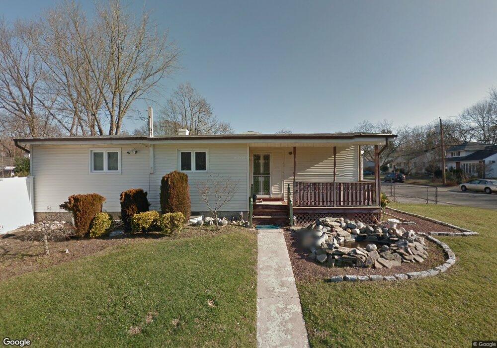
17 Philip Ct Huntington Station, NY 11746
Estimated Value: $601,000 - $715,000
3
Beds
2
Baths
--
Sq Ft
6,098
Sq Ft Lot
About This Home
This home is located at 17 Philip Ct, Huntington Station, NY 11746 and is currently estimated at $677,924. 17 Philip Ct is a home located in Suffolk County with nearby schools including Woodhull Intermediate School, Washington School, and J Taylor Finley Middle School.
Ownership History
Date
Name
Owned For
Owner Type
Purchase Details
Closed on
Feb 5, 2021
Sold by
17 Philip Court Llc
Bought by
Jimenez Jorge M and Jimenez Gabriel
Current Estimated Value
Home Financials for this Owner
Home Financials are based on the most recent Mortgage that was taken out on this home.
Original Mortgage
$344,000
Interest Rate
2.73%
Mortgage Type
Purchase Money Mortgage
Purchase Details
Closed on
May 27, 2019
Sold by
Fuentes Inocencia Est
Bought by
17 Philip Court Lc
Purchase Details
Closed on
Nov 21, 2017
Sold by
Tj Montana Enterprises
Bought by
17 Philip Court Llc
Purchase Details
Closed on
Jul 2, 2009
Sold by
Centoni Adrian
Bought by
T J Montana Enterprises Llc
Purchase Details
Closed on
May 9, 2005
Create a Home Valuation Report for This Property
The Home Valuation Report is an in-depth analysis detailing your home's value as well as a comparison with similar homes in the area
Home Values in the Area
Average Home Value in this Area
Purchase History
| Date | Buyer | Sale Price | Title Company |
|---|---|---|---|
| Jimenez Jorge M | $430,000 | None Available | |
| 17 Philip Court Lc | $160,000 | -- | |
| 17 Philip Court Llc | $98,750 | -- | |
| T J Montana Enterprises Llc | $168,040 | Emerald Examiners | |
| -- | -- | -- |
Source: Public Records
Mortgage History
| Date | Status | Borrower | Loan Amount |
|---|---|---|---|
| Previous Owner | Jimenez Jorge M | $344,000 |
Source: Public Records
Tax History Compared to Growth
Tax History
| Year | Tax Paid | Tax Assessment Tax Assessment Total Assessment is a certain percentage of the fair market value that is determined by local assessors to be the total taxable value of land and additions on the property. | Land | Improvement |
|---|---|---|---|---|
| 2024 | $11,463 | $3,000 | $300 | $2,700 |
| 2023 | $5,732 | $3,000 | $300 | $2,700 |
| 2022 | $11,395 | $3,000 | $300 | $2,700 |
| 2021 | $10,929 | $3,000 | $300 | $2,700 |
| 2020 | $11,035 | $2,900 | $300 | $2,600 |
| 2019 | $22,069 | $0 | $0 | $0 |
| 2018 | $10,276 | $2,900 | $300 | $2,600 |
| 2017 | $10,276 | $2,900 | $300 | $2,600 |
| 2016 | $10,146 | $2,900 | $300 | $2,600 |
| 2015 | -- | $2,900 | $300 | $2,600 |
| 2014 | -- | $2,900 | $300 | $2,600 |
Source: Public Records
Map
Nearby Homes
- 12 Foxdale Ct
- 217 Broadway
- 71 Biltmore Cir
- 2202 Townhome Way
- 12 Canyon St
- 148 Lenox Rd
- 22 Meadowood Ct
- 78 Hayloft Ct
- 62 Lowndes Ave
- 98 Woodhull Rd
- 26 Townhouse Rd S Unit 26
- 11 Spring Ct
- 200 Lowndes Ave Unit A
- 280 Lowndes Ave Unit 208
- 280 Lowndes Ave Unit 305G
- 280 Lowndes Ave Unit 111G
- 634 Park Ave
- 2 Spring Ct
- 6 Albermarle Ave
- 95 E Pulaski Rd