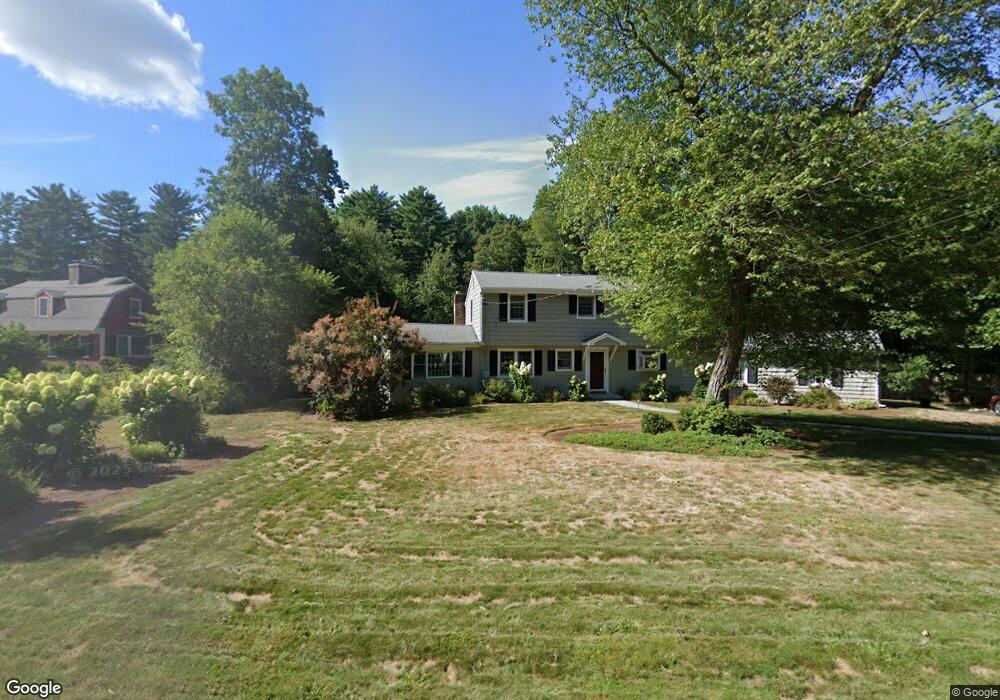
17 Pine Tree Dr Hanover, MA 02339
Estimated Value: $812,000 - $867,000
3
Beds
3
Baths
2,151
Sq Ft
$390/Sq Ft
Est. Value
About This Home
This home is located at 17 Pine Tree Dr, Hanover, MA 02339 and is currently estimated at $839,500, approximately $390 per square foot. 17 Pine Tree Dr is a home located in Plymouth County with nearby schools including Hanover High School, Cadence Academy Preschool - Hanover, and The Master's Academy.
Create a Home Valuation Report for This Property
The Home Valuation Report is an in-depth analysis detailing your home's value as well as a comparison with similar homes in the area
Home Values in the Area
Average Home Value in this Area
Tax History
| Year | Tax Paid | Tax Assessment Tax Assessment Total Assessment is a certain percentage of the fair market value that is determined by local assessors to be the total taxable value of land and additions on the property. | Land | Improvement |
|---|---|---|---|---|
| 2025 | $8,263 | $669,100 | $269,400 | $399,700 |
| 2024 | $8,112 | $631,800 | $269,400 | $362,400 |
| 2023 | $7,583 | $562,100 | $244,900 | $317,200 |
| 2022 | $8,232 | $539,800 | $244,900 | $294,900 |
| 2021 | $8,103 | $496,200 | $222,600 | $273,600 |
| 2020 | $7,907 | $484,800 | $222,600 | $262,200 |
| 2019 | $7,691 | $468,700 | $222,600 | $246,100 |
| 2018 | $7,263 | $446,100 | $222,600 | $223,500 |
| 2017 | $6,988 | $423,000 | $209,500 | $213,500 |
| 2016 | $6,736 | $399,500 | $190,500 | $209,000 |
| 2015 | $6,452 | $399,500 | $190,500 | $209,000 |
Source: Public Records
Map
Nearby Homes
- 35 Sproul Rd
- 250 Center St
- 51 Cervelli Farm Dr
- 37 Dr
- 23 Cervelli Farm Dr
- 38 Cervelli Farm Dr
- 9 Cervelli Farm Dr
- 70 Bardin St
- 36 Grove St
- 114 Graham Hill Dr
- 33 1st Parish Ln
- 365 Broadway
- 62 Larchmont Ln
- 68 East St
- 51 Farmside Dr
- 95 Tecumseh Dr
- 60 Summer Path Way
- 7 Farmside Dr
- 285 W Elm St
- 506 Main St
- 27 Pine Tree Dr
- 155 Spring St
- 43 Pine Tree Dr
- 143 Spring St
- 20 Pine Tree Dr
- 175 Spring St
- 32 Pine Tree Dr
- 129 Spring St
- 158 Spring St
- 164 Spring St
- 133 Spring St
- 99 Candlewood Ln
- 46 Pine Tree Dr
- 174 Spring St
- 55 Pine Tree Dr
- 87 Candlewood Ln
- 125 Spring St
- 142 Spring St
- 109 Candlewood Ln
- 125 Spring St
Your Personal Tour Guide
Ask me questions while you tour the home.