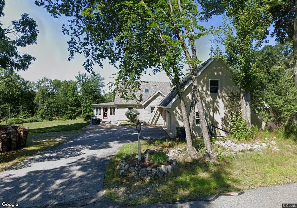
17 Plimpton Rd Goffstown, NH 03045
Estimated Value: $622,871 - $678,000
3
Beds
2
Baths
2,562
Sq Ft
$255/Sq Ft
Est. Value
About This Home
This home is located at 17 Plimpton Rd, Goffstown, NH 03045 and is currently estimated at $652,468, approximately $254 per square foot. 17 Plimpton Rd is a home with nearby schools including Mountain View Middle School and Goffstown High School.
Ownership History
Date
Name
Owned For
Owner Type
Purchase Details
Closed on
Aug 1, 2007
Sold by
Sirois Dennis P and Sirois Patricia S
Bought by
Sullivan Patrick
Current Estimated Value
Create a Home Valuation Report for This Property
The Home Valuation Report is an in-depth analysis detailing your home's value as well as a comparison with similar homes in the area
Home Values in the Area
Average Home Value in this Area
Purchase History
| Date | Buyer | Sale Price | Title Company |
|---|---|---|---|
| Sullivan Patrick | $250,500 | -- |
Source: Public Records
Mortgage History
| Date | Status | Borrower | Loan Amount |
|---|---|---|---|
| Open | Sullivan Patrick | $120,000 | |
| Closed | Sullivan Patrick | $105,000 | |
| Closed | Sullivan Patrick | $101,000 | |
| Closed | Sullivan Patrick | $90,000 |
Source: Public Records
Tax History
| Year | Tax Paid | Tax Assessment Tax Assessment Total Assessment is a certain percentage of the fair market value that is determined by local assessors to be the total taxable value of land and additions on the property. | Land | Improvement |
|---|---|---|---|---|
| 2025 | $11,574 | $554,300 | $188,400 | $365,900 |
| 2024 | $11,330 | $554,300 | $188,400 | $365,900 |
| 2023 | $10,454 | $554,300 | $188,400 | $365,900 |
| 2022 | $9,893 | $376,000 | $124,200 | $251,800 |
| 2021 | $9,332 | $376,000 | $124,200 | $251,800 |
| 2020 | $9,332 | $376,000 | $124,200 | $251,800 |
| 2019 | $9,242 | $376,000 | $124,200 | $251,800 |
| 2018 | $6,690 | $359,700 | $124,200 | $235,500 |
| 2017 | $8,454 | $308,300 | $102,800 | $205,500 |
| 2016 | $8,148 | $308,300 | $102,800 | $205,500 |
| 2015 | $8,496 | $301,700 | $96,700 | $205,000 |
| 2014 | $8,146 | $301,700 | $96,700 | $205,000 |
Source: Public Records
Map
Nearby Homes
- 23 Tamar Dr
- 43 Snow Rd
- 234 Paige Hill Rd
- 87 Juniper Dr
- 64 Peppermint St
- 33 Elva Dr
- 130 Elm St
- 101 Elm St
- 0 Fairway Dr Unit 11
- 19 My Way
- 163 Woodview Way Unit 2
- 120 S Mast St
- 264 Woodview Way
- 47 E Union St
- 179 Donald Dr
- 109 Woodview Way
- 41 Mathew Cir
- 24 Donald Dr
- 25 Forestedge Way Unit 25
- 46 Riverledge Dr
- 344 Tibbetts Hill Rd
- 35 Plimpton Rd
- 339 Tibbetts Hill Rd
- 370 Tibbetts Hill Rd
- 297 Tibbetts Hill Rd
- 300 Tibbetts Hill Rd
- 372 Tibbetts Hill Rd
- 371 Tibbetts Hill Rd
- 292 Tibbetts Hill Rd
- 287 Tibbetts Hill Rd
- 16 Hoyt Rd
- 288 Tibbetts Hill Rd
- 6 Horizon Dr
- 18 Horizon Dr
- 4 Horizon Dr
- 19 Hoyt Rd
- 11 Hoyt Rd
- 26 Horizon Dr
- 33 Hoyt Rd
- 15 Hoyt Rd
Your Personal Tour Guide
Ask me questions while you tour the home.