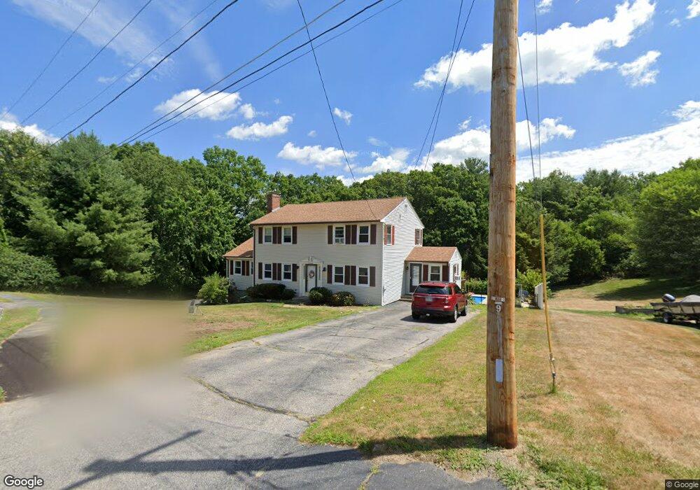
17 Powerline Dr Grafton, MA 01519
Estimated Value: $654,000 - $794,000
4
Beds
2
Baths
2,184
Sq Ft
$327/Sq Ft
Est. Value
About This Home
This home is located at 17 Powerline Dr, Grafton, MA 01519 and is currently estimated at $714,283, approximately $327 per square foot. 17 Powerline Dr is a home located in Worcester County with nearby schools including Grafton High School and Silver Spruce Montessori School.
Ownership History
Date
Name
Owned For
Owner Type
Purchase Details
Closed on
Aug 21, 2009
Sold by
Rand Robert W and Rand Mauri L
Bought by
Browk Derek A and Browk Robin
Current Estimated Value
Home Financials for this Owner
Home Financials are based on the most recent Mortgage that was taken out on this home.
Original Mortgage
$297,000
Interest Rate
5.19%
Mortgage Type
Purchase Money Mortgage
Purchase Details
Closed on
Jul 14, 2005
Sold by
Cox Karen M and Farrell Roberta M
Bought by
Rand Mauri L and Rand Robert W
Purchase Details
Closed on
Oct 26, 1994
Sold by
Mahoney Richard D and Mahoney Alice
Bought by
Cox Karen M and Farrell Roberta
Create a Home Valuation Report for This Property
The Home Valuation Report is an in-depth analysis detailing your home's value as well as a comparison with similar homes in the area
Home Values in the Area
Average Home Value in this Area
Purchase History
| Date | Buyer | Sale Price | Title Company |
|---|---|---|---|
| Browk Derek A | $330,000 | -- | |
| Browk Derek A | $330,000 | -- | |
| Browk Derek A | $330,000 | -- | |
| Rand Mauri L | $443,900 | -- | |
| Rand Mauri L | $443,900 | -- | |
| Rand Mauri L | $443,900 | -- | |
| Cox Karen M | $185,000 | -- |
Source: Public Records
Mortgage History
| Date | Status | Borrower | Loan Amount |
|---|---|---|---|
| Open | Cox Karen M | $298,000 | |
| Closed | Browk Derek A | $297,000 |
Source: Public Records
Tax History Compared to Growth
Tax History
| Year | Tax Paid | Tax Assessment Tax Assessment Total Assessment is a certain percentage of the fair market value that is determined by local assessors to be the total taxable value of land and additions on the property. | Land | Improvement |
|---|---|---|---|---|
| 2025 | $8,219 | $589,600 | $184,400 | $405,200 |
| 2024 | $8,061 | $563,300 | $175,600 | $387,700 |
| 2023 | $7,550 | $480,600 | $175,600 | $305,000 |
| 2022 | $7,047 | $417,500 | $150,700 | $266,800 |
| 2021 | $6,829 | $397,500 | $137,100 | $260,400 |
| 2020 | $6,478 | $392,600 | $137,100 | $255,500 |
| 2019 | $5,961 | $357,800 | $132,500 | $225,300 |
| 2018 | $5,601 | $337,600 | $131,800 | $205,800 |
| 2017 | $5,409 | $329,800 | $124,000 | $205,800 |
| 2016 | $4,777 | $285,200 | $99,700 | $185,500 |
| 2015 | $4,719 | $286,000 | $98,500 | $187,500 |
| 2014 | $4,518 | $296,100 | $116,300 | $179,800 |
Source: Public Records
Map
Nearby Homes
- 144 Pleasant St
- 18 Barbara Jean St
- 8 Danielle Dr
- 151 Providence Rd Unit 24
- 151 Providence Rd Unit 15
- 58 Fisherville Terrace
- 51 Fisherville Terrace
- 47 Fisherville Terrace
- 13 Pullard Rd Unit 38
- 44 Fisherville Terrace
- 55 Fisherville Terrace
- 18 Pullard Rd
- 54 Elliot Trail
- 42 Gordon Cir Unit 42
- 52 Fisherville Terrace
- 24 Coventry Rd
- 4 Greenlawn Ave
- 81 Millbury St
- 30 Nottingham Rd
- 185 Main St
- 19 Powerline Dr
- 16 Powerline Dr
- 13 Powerline Dr
- 17 Trinity Ave
- 19 Trinity Ave
- 13 Trinity Ave
- 21 Trinity Ave
- 14 Powerline Dr
- 9 Spanish River Rd
- 11 Spanish River Rd
- 7 Spanish River Rd
- 23 Trinity Ave
- 18 Trinity Ave
- 20 Trinity Ave
- 12 Powerline Dr
- 5 Spanish River Rd
- 16 Trinity Ave
- 22 Trinity Ave
- 14 Trinity Ave
- 18 Sunrise Ave