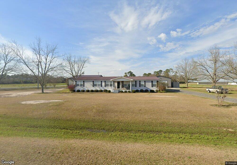
17 Raymond D Bland Rd Glennville, GA 30427
Estimated Value: $165,000 - $232,000
--
Bed
2
Baths
2,560
Sq Ft
$78/Sq Ft
Est. Value
About This Home
This home is located at 17 Raymond D Bland Rd, Glennville, GA 30427 and is currently estimated at $199,994, approximately $78 per square foot. 17 Raymond D Bland Rd is a home located in Tattnall County with nearby schools including Tattnall County High School.
Ownership History
Date
Name
Owned For
Owner Type
Purchase Details
Closed on
Dec 18, 2009
Sold by
Davis Michelle B
Bought by
Davis Michelle B
Current Estimated Value
Home Financials for this Owner
Home Financials are based on the most recent Mortgage that was taken out on this home.
Original Mortgage
$54,117
Interest Rate
4.82%
Mortgage Type
New Conventional
Purchase Details
Closed on
Oct 15, 2002
Sold by
Davis Michelle B
Bought by
Davis Michelle B and Davis Dennis
Purchase Details
Closed on
Jun 5, 2002
Sold by
Bland Delorise R
Bought by
Davis Michelle B
Create a Home Valuation Report for This Property
The Home Valuation Report is an in-depth analysis detailing your home's value as well as a comparison with similar homes in the area
Home Values in the Area
Average Home Value in this Area
Purchase History
| Date | Buyer | Sale Price | Title Company |
|---|---|---|---|
| Davis Michelle B | -- | -- | |
| Davis Michelle B | -- | -- | |
| Davis Michelle B | -- | -- |
Source: Public Records
Mortgage History
| Date | Status | Borrower | Loan Amount |
|---|---|---|---|
| Closed | Davis Michelle B | $54,117 |
Source: Public Records
Tax History Compared to Growth
Tax History
| Year | Tax Paid | Tax Assessment Tax Assessment Total Assessment is a certain percentage of the fair market value that is determined by local assessors to be the total taxable value of land and additions on the property. | Land | Improvement |
|---|---|---|---|---|
| 2024 | $1,175 | $43,968 | $2,120 | $41,848 |
| 2023 | $401 | $34,328 | $2,120 | $32,208 |
| 2022 | $764 | $29,288 | $2,120 | $27,168 |
| 2021 | $757 | $29,876 | $2,120 | $27,756 |
| 2020 | $758 | $29,876 | $2,120 | $27,756 |
| 2019 | $834 | $32,096 | $2,120 | $29,976 |
| 2018 | $849 | $32,096 | $2,120 | $29,976 |
| 2017 | $834 | $32,096 | $2,120 | $29,976 |
| 2016 | $809 | $30,500 | $2,120 | $28,380 |
| 2015 | -- | $30,860 | $2,120 | $28,740 |
| 2014 | -- | $33,796 | $2,120 | $31,676 |
| 2013 | -- | $33,796 | $2,120 | $31,676 |
Source: Public Records
Map
Nearby Homes
- 431 Floyd Bland Rd
- 0 Sam Anderson Rd Unit 10509288
- Rd
- 0 Robert Chapel Cemetery Rd Unit 10519584
- 314 George McLeod Rd
- 0 Stoney Hill Church Rd Unit 10611264
- 0 Stoney Hill Church Rd Unit 7653853
- 93 Georgia 169
- 93 Shirley Lane Hwy 169
- 00 Bass Rd
- 46 Georgia 178
- 714 Riverbank Rd
- 90 River Moss Rd
- 239 River Moss Rd
- 0 River Ridge Rd Unit 10616036
- 1014 Jiggs Harden Rd
- 0 Stoney Brook Way Unit 10523300
- 97 Shirley Ln
- 410 A N Caswell St Unit A
- LOT #128 Fate Rd Unit LOT 128
- 217 Raymond D Bland Rd
- 3498 Ga Highway 121
- 3796 Ga Highway 121
- 3659 Ga Highway 121
- 267 Jimmy Todd Rd
- 276 Jimmy Todd Rd
- 4179 Ga Highway 121
- 4176 Ga Highway 121
- 3027 Ga Highway 121
- 4355 Ga Highway 121
- 311 Mount Zion Church Rd
- 4448 Ga Highway 121
- 1.86Ac Stoney Hill Church Rd
- 2808 Ga Highway 121
- 1497 Slim Ray Rd
- 404 Bobby Ray Rd
- 242 Bobby Ray Rd
- 161 Stoney Hill Church Rd
- 367 Bobby Ray Rd
- 219 Stoney Hill Church Rd