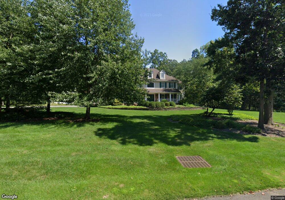
17 Raymond Ln Belle Mead, NJ 08502
Estimated Value: $1,427,000 - $1,784,000
--
Bed
--
Bath
4,961
Sq Ft
$316/Sq Ft
Est. Value
About This Home
This home is located at 17 Raymond Ln, Belle Mead, NJ 08502 and is currently estimated at $1,569,248, approximately $316 per square foot. 17 Raymond Ln is a home located in Somerset County with nearby schools including Orchard Hill Elementary School, Montgomery Lower Mid School, and Village Elementary School.
Ownership History
Date
Name
Owned For
Owner Type
Purchase Details
Closed on
Jun 26, 2008
Sold by
Ryan Francis J and Ryan Margaret
Bought by
Ryan Margaret F and Ryan Frank J
Current Estimated Value
Purchase Details
Closed on
Oct 2, 2001
Sold by
Rr Land Deve
Bought by
Ryan Francis and Ryan Margaret
Home Financials for this Owner
Home Financials are based on the most recent Mortgage that was taken out on this home.
Original Mortgage
$300,000
Outstanding Balance
$117,774
Interest Rate
6.93%
Estimated Equity
$1,451,474
Create a Home Valuation Report for This Property
The Home Valuation Report is an in-depth analysis detailing your home's value as well as a comparison with similar homes in the area
Home Values in the Area
Average Home Value in this Area
Purchase History
| Date | Buyer | Sale Price | Title Company |
|---|---|---|---|
| Ryan Margaret F | -- | None Available | |
| Ryan Francis | $1,150,000 | -- |
Source: Public Records
Mortgage History
| Date | Status | Borrower | Loan Amount |
|---|---|---|---|
| Open | Ryan Francis | $300,000 |
Source: Public Records
Tax History Compared to Growth
Tax History
| Year | Tax Paid | Tax Assessment Tax Assessment Total Assessment is a certain percentage of the fair market value that is determined by local assessors to be the total taxable value of land and additions on the property. | Land | Improvement |
|---|---|---|---|---|
| 2025 | $37,141 | $1,084,100 | $370,400 | $713,700 |
| 2024 | $37,141 | $1,084,100 | $370,400 | $713,700 |
| 2023 | $37,109 | $1,084,100 | $370,400 | $713,700 |
| 2022 | $34,930 | $1,084,100 | $370,400 | $713,700 |
| 2021 | $34,411 | $1,084,100 | $370,400 | $713,700 |
| 2020 | $34,355 | $1,084,100 | $370,400 | $713,700 |
| 2019 | $34,127 | $1,084,100 | $370,400 | $713,700 |
| 2018 | $33,336 | $1,084,100 | $370,400 | $713,700 |
| 2017 | $39,655 | $1,312,200 | $510,800 | $801,400 |
| 2016 | $38,959 | $1,312,200 | $510,800 | $801,400 |
| 2015 | $38,067 | $1,312,200 | $510,800 | $801,400 |
| 2014 | $37,608 | $1,312,200 | $510,800 | $801,400 |
Source: Public Records
Map
Nearby Homes
- 00 W Dutchtown Harlingen Rd
- 21 Harlingen Rd
- 44 Bridle Path
- 68 Johnson Dr
- 40 Johnson Dr
- 74 Harlingen Rd
- 74 Dublin Rd
- 16 Dorland Farm Ct
- 125 Tomahawk Ct
- 52 Ketcham Rd
- 163 Trent Place
- 43 Dead Tree Run Rd
- 1105 Rhoads Dr Unit 1105
- 15 Bedle St
- 11 Briar Hill Ct
- 1723 Us Highway 206
- 100 Knickerbocker Dr
- 167 Dead Tree Run Rd
- 161 Grayson Dr
- 37 Arthur Rd
- 16 Raymond Ln
- 9 Raymond Ln
- 10 Raymond Ln
- 26 Raymond Ln
- 5 Raymond Ln
- 80 Fisher Farm Rd
- 3 Raymond Ln
- 4 Raymond Ln
- 8 Silver Maple Ct
- 6 Silver Maple Ct
- 44 Saddlewood Ct
- 66 Fisher Farm Rd
- 73 Fisher Farm Rd
- 0 Us-206 Unit 3403658
- 57 Dutchtown Harlingen Rd
- 57 W Dutchtown Harlingen Rd
- 29 Reid Ave Unit 604
- 39 Reid Ave Unit 604
- 43 Reid Ave Unit 604
- 47 Dutchtown Harlingen Rd