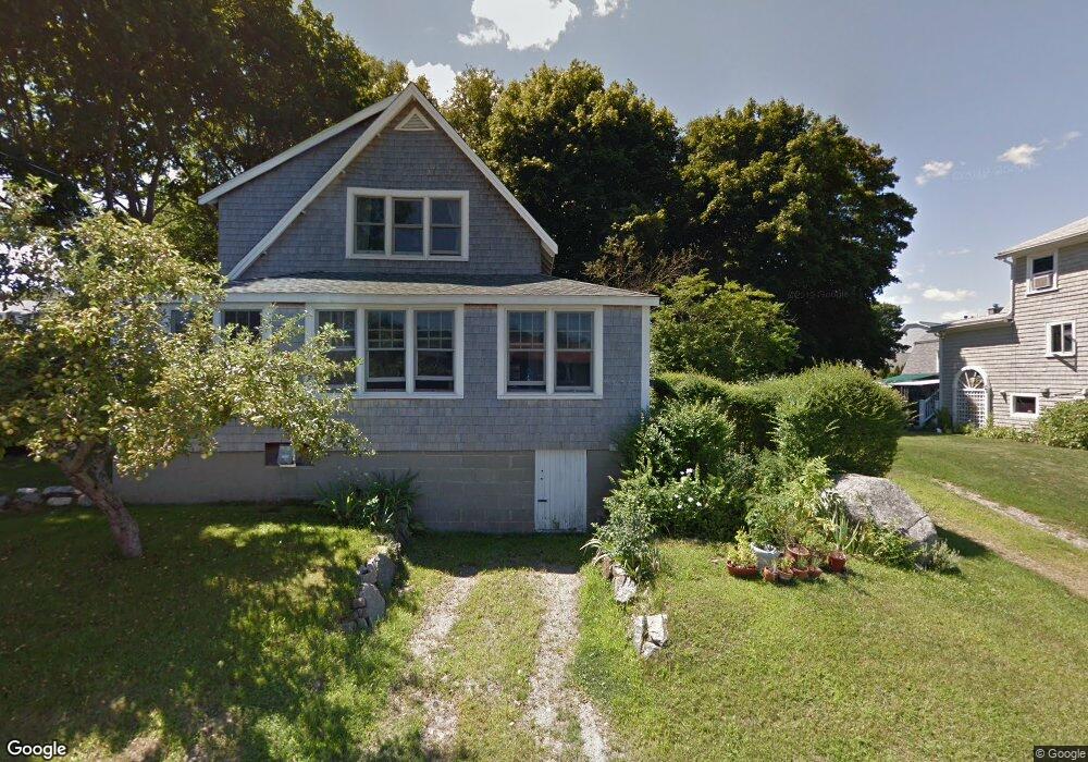
17 Riverside Rd Gloucester, MA 01930
Riverview NeighborhoodEstimated Value: $675,321 - $733,000
2
Beds
2
Baths
1,250
Sq Ft
$568/Sq Ft
Est. Value
About This Home
This home is located at 17 Riverside Rd, Gloucester, MA 01930 and is currently estimated at $709,830, approximately $567 per square foot. 17 Riverside Rd is a home located in Essex County with nearby schools including Beeman Memorial, Ralph B O'maley Middle School, and Gloucester High School.
Ownership History
Date
Name
Owned For
Owner Type
Purchase Details
Closed on
Jul 6, 2018
Sold by
Wieckowski Holly L and Wieckowski Stephen C
Bought by
Caruso Joseph
Current Estimated Value
Purchase Details
Closed on
Apr 6, 2018
Sold by
Wieckowski Holly L
Bought by
Wieckowski Holly L and Wieckowski Stephen C
Purchase Details
Closed on
Oct 22, 2010
Sold by
Hollis Jayne U Est
Bought by
Wieckowski Holly L S
Home Financials for this Owner
Home Financials are based on the most recent Mortgage that was taken out on this home.
Original Mortgage
$190,000
Interest Rate
4.24%
Create a Home Valuation Report for This Property
The Home Valuation Report is an in-depth analysis detailing your home's value as well as a comparison with similar homes in the area
Home Values in the Area
Average Home Value in this Area
Purchase History
| Date | Buyer | Sale Price | Title Company |
|---|---|---|---|
| Caruso Joseph | $424,000 | -- | |
| Wieckowski Holly L | -- | -- | |
| Wieckowski Holly L S | $200,000 | -- |
Source: Public Records
Mortgage History
| Date | Status | Borrower | Loan Amount |
|---|---|---|---|
| Previous Owner | Wieckowski Holly L S | $186,000 | |
| Previous Owner | Wieckowski Holly L S | $190,000 | |
| Previous Owner | Wieckowski Holly L S | $200,000 |
Source: Public Records
Tax History
| Year | Tax Paid | Tax Assessment Tax Assessment Total Assessment is a certain percentage of the fair market value that is determined by local assessors to be the total taxable value of land and additions on the property. | Land | Improvement |
|---|---|---|---|---|
| 2025 | $5,680 | $584,400 | $227,200 | $357,200 |
| 2024 | $5,581 | $573,600 | $216,400 | $357,200 |
| 2023 | $5,356 | $505,800 | $193,200 | $312,600 |
| 2022 | $5,145 | $438,600 | $164,200 | $274,400 |
| 2021 | $4,880 | $392,300 | $149,300 | $243,000 |
| 2020 | $4,775 | $387,300 | $149,300 | $238,000 |
| 2019 | $4,551 | $358,600 | $149,300 | $209,300 |
| 2018 | $4,373 | $338,200 | $149,300 | $188,900 |
| 2017 | $4,226 | $320,400 | $142,200 | $178,200 |
| 2016 | $4,079 | $299,700 | $142,600 | $157,100 |
| 2015 | $3,931 | $288,000 | $142,600 | $145,400 |
Source: Public Records
Map
Nearby Homes
- 2 Breezy Point Rd
- 13 Honeysuckle Rd
- 672 Washington St
- 3 Deacon Farm Ln
- 31 Echo Ave
- 167 Atlantic St
- 178 Atlantic St
- 226 Atlantic St
- 136 Leonard St
- 3 Rockland St
- 13 Mystic Ave
- 8 Mystic Ave
- 6 Monroe Ct
- 98 Maplewood Ave
- 9 Cleveland Place
- 12 Arthur St
- 40 Sargent St
- 4 Ciaramitaro Ct
- 19 Trask St Unit 2
- 15 Harvard St
- 17 Riverside Rd
- 13 Riverside Rd
- 19 Riverside Rd
- 10 Riverside Rd
- 14 Riverside Rd
- 14 Riverside Road (Wheelers Pt)
- 19R Riverside Rd
- 16 Riverside Rd
- 9 Riverside Rd
- 8 Riverside Rd
- 143 Wheeler St
- 18 Riverside Rd
- 4 Breezy Point Rd
- 7 Riverside Rd
- 8 Wheelers Point Rd
- 23 Riverside Rd
- 3 Riverside Rd
- 6 Riverside Rd
- 22 Riverside Rd
- 145 Wheeler St
Your Personal Tour Guide
Ask me questions while you tour the home.