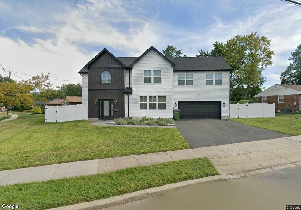
17 Roger Rd Edison, NJ 08817
Estimated Value: $665,000 - $1,042,000
Studio
--
Bath
2,816
Sq Ft
$287/Sq Ft
Est. Value
About This Home
This home is located at 17 Roger Rd, Edison, NJ 08817 and is currently estimated at $807,590, approximately $286 per square foot. 17 Roger Rd is a home located in Middlesex County with nearby schools including Benjamin Franklin Elementary School, Herbert Hoover Middle School, and Edison High School.
Ownership History
Date
Name
Owned For
Owner Type
Purchase Details
Closed on
Jul 16, 2018
Sold by
Bluestein Paul J
Bought by
Barot Ankur and Patel Amruta
Current Estimated Value
Home Financials for this Owner
Home Financials are based on the most recent Mortgage that was taken out on this home.
Original Mortgage
$211,500
Outstanding Balance
$183,296
Interest Rate
4.5%
Mortgage Type
New Conventional
Estimated Equity
$624,294
Purchase Details
Closed on
Mar 21, 2005
Sold by
Varady Deborah Ann
Bought by
Bluestein Paul
Home Financials for this Owner
Home Financials are based on the most recent Mortgage that was taken out on this home.
Original Mortgage
$212,000
Interest Rate
5.37%
Mortgage Type
Adjustable Rate Mortgage/ARM
Create a Home Valuation Report for This Property
The Home Valuation Report is an in-depth analysis detailing your home's value as well as a comparison with similar homes in the area
Home Values in the Area
Average Home Value in this Area
Purchase History
We collect this data history from publicly available records. To have your information removed, we recommend requesting removal directly through your county’s website.
| Date | Buyer | Sale Price | Title Company |
|---|---|---|---|
| Barot Ankur | $235,000 | Allied Title Llc | |
| Bluestein Paul | $265,000 | -- |
Source: Public Records
Mortgage History
We collect this data history from publicly available records. To have your information removed, we recommend requesting removal directly through your county’s website.
| Date | Status | Borrower | Loan Amount |
|---|---|---|---|
| Open | Barot Ankur | $211,500 | |
| Previous Owner | Bluestein Paul | $212,000 |
Source: Public Records
Tax History
| Year | Tax Paid | Tax Assessment Tax Assessment Total Assessment is a certain percentage of the fair market value that is determined by local assessors to be the total taxable value of land and additions on the property. | Land | Improvement |
|---|---|---|---|---|
| 2025 | $14,257 | $239,500 | $78,200 | $161,300 |
| 2024 | $14,181 | $239,500 | $78,200 | $161,300 |
| 2023 | $14,181 | $239,500 | $78,200 | $161,300 |
| 2022 | $14,186 | $239,500 | $78,200 | $161,300 |
| 2021 | $7,337 | $124,300 | $78,200 | $46,100 |
| 2020 | $7,270 | $124,300 | $78,200 | $46,100 |
| 2019 | $6,861 | $124,300 | $78,200 | $46,100 |
| 2018 | $6,741 | $124,300 | $78,200 | $46,100 |
| 2017 | $6,679 | $124,300 | $78,200 | $46,100 |
| 2016 | $6,558 | $124,300 | $78,200 | $46,100 |
| 2015 | $6,307 | $124,300 | $78,200 | $46,100 |
| 2014 | $6,123 | $124,300 | $78,200 | $46,100 |
Source: Public Records
Map
Nearby Homes
- 31 Stevens Rd
- 144 Garden Terrace
- 130 Garden Terrace
- 213 Old Post Rd
- 25 Hill Rd
- 165 Old Post Rd
- 22 Meyer Rd
- 4 Conover Ct
- 12 Old Post Rd
- 2505 Woodbridge Ave Unit 8L
- 2505 Woodbridge Ave Unit 19L
- 2505 Woodbridge Ave Unit 16L
- 2505 Woodbridge Ave Unit 36M
- 2505 Woodbridge Ave
- 24 Woodedge Ave Unit 8
- 340 Old Post Rd
- 55 Market St
- 21 Market St
- 56 Ferris Rd
- 31 Pacific St
Your Personal Tour Guide
Ask me questions while you tour the home.