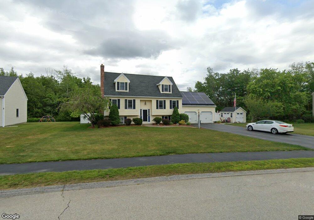
17 Rollie Shepard Dr Millbury, MA 01527
Estimated Value: $615,915 - $644,000
3
Beds
3
Baths
1,748
Sq Ft
$361/Sq Ft
Est. Value
About This Home
This home is located at 17 Rollie Shepard Dr, Millbury, MA 01527 and is currently estimated at $630,229, approximately $360 per square foot. 17 Rollie Shepard Dr is a home located in Worcester County with nearby schools including Elmwood Street Elementary School, Raymond E. Shaw Elementary School, and Millbury Junior/Senior High School.
Ownership History
Date
Name
Owned For
Owner Type
Purchase Details
Closed on
Mar 24, 2014
Sold by
Pulaski Tina L and Pulaski William J
Bought by
Pulaski William J
Current Estimated Value
Home Financials for this Owner
Home Financials are based on the most recent Mortgage that was taken out on this home.
Original Mortgage
$223,000
Outstanding Balance
$159,489
Interest Rate
3%
Mortgage Type
Adjustable Rate Mortgage/ARM
Estimated Equity
$470,740
Create a Home Valuation Report for This Property
The Home Valuation Report is an in-depth analysis detailing your home's value as well as a comparison with similar homes in the area
Home Values in the Area
Average Home Value in this Area
Purchase History
| Date | Buyer | Sale Price | Title Company |
|---|---|---|---|
| Pulaski William J | -- | -- | |
| Pulaski William J | -- | -- | |
| Pulaski William J | -- | -- |
Source: Public Records
Mortgage History
| Date | Status | Borrower | Loan Amount |
|---|---|---|---|
| Open | Pulaski William J | $223,000 | |
| Closed | Pulaski William J | $223,000 |
Source: Public Records
Tax History Compared to Growth
Tax History
| Year | Tax Paid | Tax Assessment Tax Assessment Total Assessment is a certain percentage of the fair market value that is determined by local assessors to be the total taxable value of land and additions on the property. | Land | Improvement |
|---|---|---|---|---|
| 2025 | $6,869 | $513,000 | $120,900 | $392,100 |
| 2024 | $6,315 | $477,300 | $111,900 | $365,400 |
| 2023 | $5,620 | $388,900 | $78,500 | $310,400 |
| 2022 | $5,456 | $363,700 | $78,500 | $285,200 |
| 2021 | $6,652 | $345,800 | $78,500 | $267,300 |
| 2020 | $6,980 | $336,800 | $78,500 | $258,300 |
| 2019 | $5,291 | $333,800 | $78,100 | $255,700 |
| 2018 | $3,732 | $317,400 | $78,100 | $239,300 |
| 2017 | $4,576 | $278,500 | $78,100 | $200,400 |
| 2016 | $4,517 | $274,400 | $78,100 | $196,300 |
| 2015 | $4,461 | $271,000 | $79,500 | $191,500 |
| 2014 | $4,237 | $247,800 | $83,100 | $164,700 |
Source: Public Records
Map
Nearby Homes
- 90 Macarthur Dr
- 3 May St
- 86 Wheelock Ave
- 2 Diane St
- 12 Irene Ct
- 11 Westview Ave
- 1 Pineland Ave
- 1 Broadmeadow Ave
- 12 Alstead Path
- 46 John Dr Unit 46
- 5 Edward Dr
- 28 Lincoln Ln
- 21 Lordvale Blvd Unit 406
- 5 Lincoln Ln Unit 5
- 76 Samuel Dr
- 123 Riverlin St
- 330 Millbury Ave
- 11 Maplewood Rd
- 64 Millbury Ave
- 27 A-B Grafton St
- 19 Rollie Shepard Dr
- 15 Rollie Shepard Dr
- 18 Rollie Shepard Dr
- 21 Rollie Shepard Dr
- 20 Rollie Shepard Dr
- 16 Rollie Shepard Dr
- 13 Rollie Shepard Dr
- 4 Bill Graham Ln
- 2 Bill Graham Ln
- 14 Rollie Shepard Dr
- 6 Bill Graham Ln
- 5 Montgomery Dr
- 23 Rollie Shepard Dr
- 7 Montgomery Dr
- 3 Montgomery Dr
- 8 Bill Graham Ln
- 12 Rollie Shepard Dr
- 25 Rollie Shepard Dr
- 5 Bill Graham Ln
- 3 Bill Graham Ln