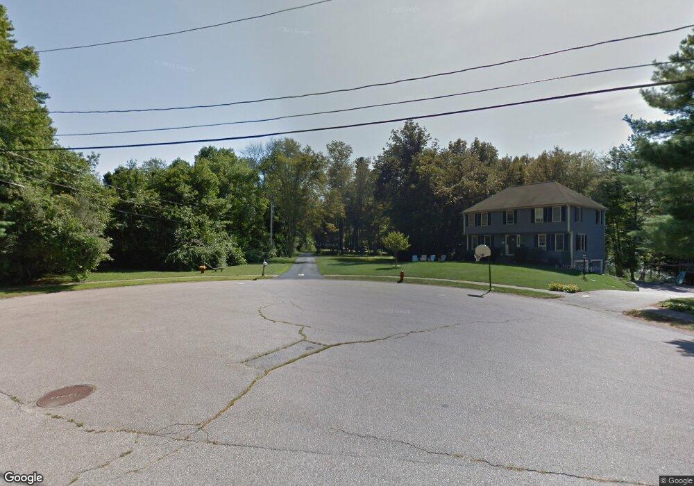
17 Rosenfeld Rd Millis, MA 02054
Estimated Value: $916,000 - $997,000
4
Beds
4
Baths
3,217
Sq Ft
$296/Sq Ft
Est. Value
About This Home
This home is located at 17 Rosenfeld Rd, Millis, MA 02054 and is currently estimated at $952,005, approximately $295 per square foot. 17 Rosenfeld Rd is a home located in Norfolk County with nearby schools including Clyde F Brown, Millis Middle School, and Millis High School.
Ownership History
Date
Name
Owned For
Owner Type
Purchase Details
Closed on
Aug 11, 2014
Sold by
Barr Russell J and Barr Heather J
Bought by
Wilcox 3Rd Reginald B and Wilcox Kristin M
Current Estimated Value
Home Financials for this Owner
Home Financials are based on the most recent Mortgage that was taken out on this home.
Original Mortgage
$400,000
Outstanding Balance
$305,341
Interest Rate
4.14%
Mortgage Type
New Conventional
Estimated Equity
$646,664
Purchase Details
Closed on
Oct 13, 1998
Sold by
Rosenfeld Jon
Bought by
Barr Russell J and Barr Hether J
Home Financials for this Owner
Home Financials are based on the most recent Mortgage that was taken out on this home.
Original Mortgage
$227,000
Interest Rate
6.92%
Mortgage Type
Purchase Money Mortgage
Create a Home Valuation Report for This Property
The Home Valuation Report is an in-depth analysis detailing your home's value as well as a comparison with similar homes in the area
Home Values in the Area
Average Home Value in this Area
Purchase History
| Date | Buyer | Sale Price | Title Company |
|---|---|---|---|
| Wilcox 3Rd Reginald B | $526,000 | -- | |
| Barr Russell J | $296,000 | -- |
Source: Public Records
Mortgage History
| Date | Status | Borrower | Loan Amount |
|---|---|---|---|
| Open | Wilcox 3Rd Reginald B | $400,000 | |
| Previous Owner | Barr Russell J | $262,500 | |
| Previous Owner | Barr Russell J | $261,000 | |
| Previous Owner | Barr Russell J | $227,000 |
Source: Public Records
Tax History Compared to Growth
Tax History
| Year | Tax Paid | Tax Assessment Tax Assessment Total Assessment is a certain percentage of the fair market value that is determined by local assessors to be the total taxable value of land and additions on the property. | Land | Improvement |
|---|---|---|---|---|
| 2025 | $12,325 | $751,500 | $313,600 | $437,900 |
| 2024 | $11,620 | $707,700 | $294,300 | $413,400 |
| 2023 | $11,288 | $645,400 | $239,100 | $406,300 |
| 2022 | $9,986 | $528,900 | $211,800 | $317,100 |
| 2021 | $9,755 | $497,200 | $184,900 | $312,300 |
| 2020 | $9,550 | $474,200 | $172,800 | $301,400 |
| 2019 | $8,611 | $460,500 | $159,400 | $301,100 |
| 2018 | $8,298 | $460,500 | $159,400 | $301,100 |
| 2017 | $7,976 | $433,000 | $158,600 | $274,400 |
| 2016 | $7,552 | $433,000 | $158,600 | $274,400 |
| 2015 | $7,361 | $433,000 | $158,600 | $274,400 |
Source: Public Records
Map
Nearby Homes
- 27 Pollard Dr
- 22 May Rd
- 28 Key St Unit 28
- 6 April Way
- 10 April Way
- 1380 Main St
- 20 Hemlock Cir
- 25 Bayberry Cir Unit 25
- 2 Country Village Way Unit 2
- 33 Spencer St
- 6 Rivendell Ln
- 64 Village St
- 60 Spencer St
- 227 Village St
- 50 Walnut St
- 119 Middlesex St
- 6 Glen Ellen Blvd Unit 6
- 18 Lansing Way Unit 18
- 20 Jameson Dr Unit 20
- 86 Glen Ellen Blvd Unit 86