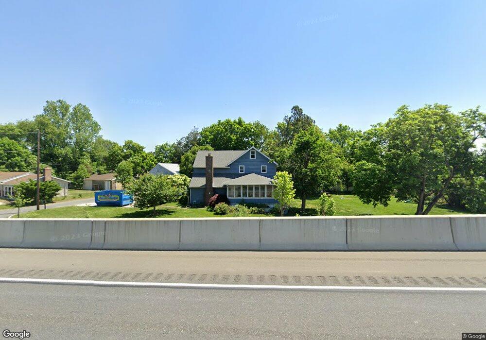
17 Route 130 Bridgeport, NJ 08014
Logan Township NeighborhoodEstimated Value: $307,993 - $475,000
--
Bed
--
Bath
2,310
Sq Ft
$174/Sq Ft
Est. Value
About This Home
This home is located at 17 Route 130, Bridgeport, NJ 08014 and is currently estimated at $401,248, approximately $173 per square foot. 17 Route 130 is a home with nearby schools including Logan Township Elementary School.
Ownership History
Date
Name
Owned For
Owner Type
Purchase Details
Closed on
Feb 26, 2021
Sold by
Nunes Christian H and Nunes Tiffany
Bought by
Nunes Christian H and Nunes Tiffany
Current Estimated Value
Home Financials for this Owner
Home Financials are based on the most recent Mortgage that was taken out on this home.
Original Mortgage
$166,000
Outstanding Balance
$123,042
Interest Rate
2.7%
Mortgage Type
New Conventional
Estimated Equity
$278,206
Purchase Details
Closed on
Mar 27, 2004
Sold by
Pedrick Nancy T
Bought by
Kane Brent and Kane Jennifer
Home Financials for this Owner
Home Financials are based on the most recent Mortgage that was taken out on this home.
Original Mortgage
$176,000
Interest Rate
5.58%
Mortgage Type
Purchase Money Mortgage
Create a Home Valuation Report for This Property
The Home Valuation Report is an in-depth analysis detailing your home's value as well as a comparison with similar homes in the area
Home Values in the Area
Average Home Value in this Area
Purchase History
| Date | Buyer | Sale Price | Title Company |
|---|---|---|---|
| Nunes Christian H | -- | National Integrity Llc | |
| Nunes Christian H | -- | National Integrity | |
| Kane Brent | $220,000 | -- |
Source: Public Records
Mortgage History
| Date | Status | Borrower | Loan Amount |
|---|---|---|---|
| Open | Nunes Christian H | $166,000 | |
| Closed | Nunes Christian H | $166,000 | |
| Previous Owner | Kane Brent | $176,000 |
Source: Public Records
Tax History Compared to Growth
Tax History
| Year | Tax Paid | Tax Assessment Tax Assessment Total Assessment is a certain percentage of the fair market value that is determined by local assessors to be the total taxable value of land and additions on the property. | Land | Improvement |
|---|---|---|---|---|
| 2025 | $4,040 | $310,800 | $26,200 | $284,600 |
| 2024 | $3,763 | $310,800 | $26,200 | $284,600 |
| 2023 | $3,763 | $187,200 | $10,500 | $176,700 |
| 2022 | $3,911 | $187,200 | $10,500 | $176,700 |
| 2021 | $4,053 | $187,200 | $10,500 | $176,700 |
| 2020 | $4,072 | $187,200 | $10,500 | $176,700 |
| 2019 | $4,066 | $187,200 | $10,500 | $176,700 |
| 2018 | $3,954 | $187,200 | $10,500 | $176,700 |
| 2017 | $3,898 | $155,500 | $10,100 | $145,400 |
| 2016 | $3,835 | $155,500 | $10,100 | $145,400 |
| 2015 | $3,390 | $155,500 | $10,100 | $145,400 |
| 2014 | $3,287 | $155,500 | $10,100 | $145,400 |
Source: Public Records
Map
Nearby Homes
- 33 Mechanic St
- 71 Main St
- 17 Hickory Ln
- 126 Repaupo Station Rd
- 103 Highland Ave
- 43 45 Repaupo Station Rd
- 103 Thurlow St Unit 306
- 223 Jeffrey St
- 0 Palmer St Unit PADE2073654
- 12 Parker St
- 788 Paulsboro Rd
- 792 Paulsboro Rd
- 2821 W 3rd St
- 1402 W 3rd St
- 2325 W 4th St
- 803 W Mary St
- 321 Tilghman St
- 0 Price St
- 321 Highland Ave
- 220 Kerlin St