
J
Seller's Agent in 2025
Jane Fagundes
Century 21 Signature Properties
(508) 758-2619
1 in this area
2 Total Sales
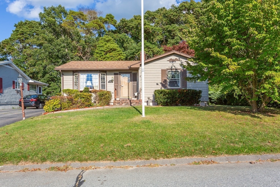
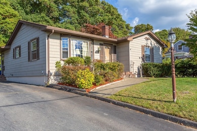
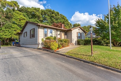
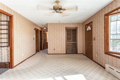
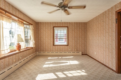
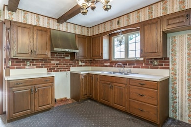
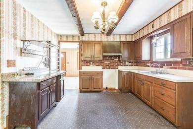
Step into this charming 3-bedroom ranch home. Built in 1964, with a solid structure and good bones, this house is ready for your personal touch. The home features classic cast-iron baseboard heating and low-maintenance vinyl siding. Unwind in the cozy three-season sunroom located just off of the main living area. The yard includes a quaint patio and a convenient storage shed for all of your outdoor gear. With its classic layout, a welcoming yard and a location just minutes from the highway and route 6, this property is a rare find. Seller does not occupy the property. Buyers to do their due diligence. Open house on Sunday, 10/5 from 11am to 1pm.
| Date | Type | Sale Price | Title Company |
|---|---|---|---|
| Quit Claim Deed | $415,000 | -- | |
| Land Court Massachusetts | -- | -- | |
| Land Court Massachusetts | -- | -- | |
| Deed | -- | -- |
| Date | Status | Loan Amount | Loan Type |
|---|---|---|---|
| Open | $394,250 | New Conventional |
| Date | Event | Price | List to Sale | Price per Sq Ft |
|---|---|---|---|---|
| 12/05/2025 12/05/25 | Sold | $415,000 | +3.8% | $363 / Sq Ft |
| 10/08/2025 10/08/25 | Pending | -- | -- | -- |
| 10/03/2025 10/03/25 | For Sale | $399,900 | -- | $350 / Sq Ft |
| Year | Tax Paid | Tax Assessment Tax Assessment Total Assessment is a certain percentage of the fair market value that is determined by local assessors to be the total taxable value of land and additions on the property. | Land | Improvement |
|---|---|---|---|---|
| 2025 | $36 | $381,600 | $170,600 | $211,000 |
| 2024 | $3,279 | $355,300 | $170,600 | $184,700 |
| 2023 | $3,136 | $315,200 | $149,400 | $165,800 |
| 2022 | $2,965 | $290,100 | $138,900 | $151,200 |
| 2021 | $2,817 | $249,500 | $125,600 | $123,900 |
| 2020 | $2,759 | $249,500 | $125,600 | $123,900 |
| 2019 | $2,629 | $225,300 | $104,200 | $121,100 |
| 2018 | $4,694 | $214,900 | $99,200 | $115,700 |
| 2017 | $4,565 | $209,400 | $99,200 | $110,200 |
| 2016 | $2,482 | $203,800 | $99,200 | $104,600 |
| 2015 | $2,456 | $202,100 | $99,200 | $102,900 |
J
Seller's Agent in 2025
Jane Fagundes
Century 21 Signature Properties
(508) 758-2619
1 in this area
2 Total Sales
R
Buyer's Agent in 2025
Robert Bonanno
Keller Williams South Watuppa
(401) 743-7224
1 in this area
3 Total Sales
Source: MLS Property Information Network (MLS PIN)
MLS Number: 73439305
APN: FAIR-000026-000000-000123
Disclaimer: Certain information contained herein is derived from information provided by parties other than Homes.com. All information provided is deemed reliable, but is not guaranteed to be accurate and should be independently verified.
![]() The property listing data and information, or the Images, set forth herein were provided to MLS Property Information Network, Inc. from third party sources, including sellers, lessors and public records, and were compiled by MLS Property Information Network, Inc. The property listing data and information, and the Images, are for the personal, non-commercial use of consumers having a good faith interest in purchasing or leasing listed properties of the type displayed to them and may not be used for any purpose other than to identify prospective properties which such consumers may have a good faith interest in purchasing or leasing. MLS Property Information Network, Inc. and its subscribers disclaim any and all representations and warranties as to the accuracy of the property listing data and information, or as to the accuracy of any of the Images, set forth herein.
The property listing data and information, or the Images, set forth herein were provided to MLS Property Information Network, Inc. from third party sources, including sellers, lessors and public records, and were compiled by MLS Property Information Network, Inc. The property listing data and information, and the Images, are for the personal, non-commercial use of consumers having a good faith interest in purchasing or leasing listed properties of the type displayed to them and may not be used for any purpose other than to identify prospective properties which such consumers may have a good faith interest in purchasing or leasing. MLS Property Information Network, Inc. and its subscribers disclaim any and all representations and warranties as to the accuracy of the property listing data and information, or as to the accuracy of any of the Images, set forth herein.
Ask me questions while you tour the home.