
Seller's Agent in 2019
Letitia Bennett
RE/MAX
(812) 239-4746
109 Total Sales
Estimated Value: $216,000 - $248,000
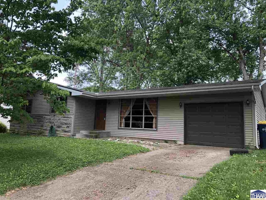
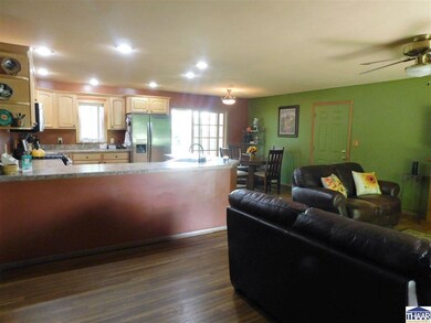
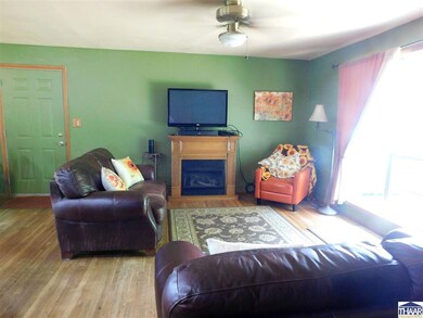
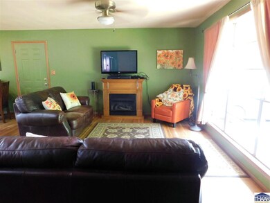
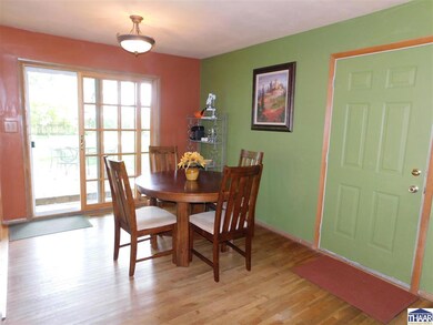
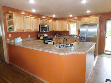
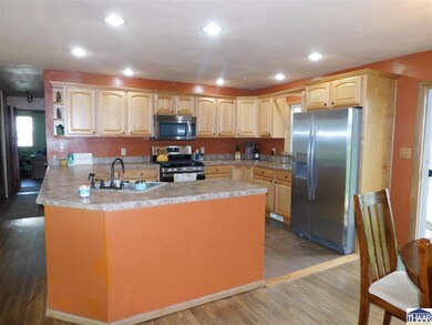
Lincolnshire 4 bedroom ranch with partial basement awaits your inspection today. This open concept main living area has a beautiful updated kitchen, formal dining room and 12x19 living room. This home features hardwood and ceramic floors throughout and 1 1/2 bathrooms. The 80x146 lot is fenced and there is a nice sized deck for relaxing this summer. This subdivision is between 2 beautiful parks, Deming and Dobbs and close to East side shopping, restaurants and highways. The subdivision has an association pool and playground area if owner wants to join. Call today for your private showing. The 4th bedroom would make a perfect office. New HVAC installed in 2016.
Last Agent to Sell the Property
REMAX R.E.A. License #RB14025133 Listed on: 06/04/2019
Co-Listed By
ARLENE MANWARING
COLDWELL BANKER REAL ESTATE GROUP License #RB14018257
Last Buyer's Agent
HOUSE JANE ROWE REALTY
JANE ROWE REALTY
| Date | Buyer | Sale Price | Title Company |
|---|---|---|---|
| Mills Stacey L | -- | Integrity Title Services |
| Date | Status | Borrower | Loan Amount |
|---|---|---|---|
| Open | Mills Stacey L | $125,130 |
| Date | Event | Price | List to Sale | Price per Sq Ft |
|---|---|---|---|---|
| 08/01/2019 08/01/19 | Sold | $129,000 | -4.4% | $100 / Sq Ft |
| 07/03/2019 07/03/19 | Pending | -- | -- | -- |
| 06/04/2019 06/04/19 | For Sale | $134,900 | -- | $105 / Sq Ft |
| Year | Tax Paid | Tax Assessment Tax Assessment Total Assessment is a certain percentage of the fair market value that is determined by local assessors to be the total taxable value of land and additions on the property. | Land | Improvement |
|---|---|---|---|---|
| 2024 | $1,686 | $157,500 | $50,700 | $106,800 |
| 2023 | $1,625 | $152,400 | $50,700 | $101,700 |
| 2022 | $1,534 | $143,500 | $50,700 | $92,800 |
| 2021 | $1,438 | $134,800 | $49,700 | $85,100 |
| 2020 | $1,404 | $131,300 | $48,400 | $82,900 |
| 2019 | $1,402 | $131,700 | $47,500 | $84,200 |
| 2018 | $1,949 | $129,900 | $48,800 | $81,100 |
| 2017 | $1,173 | $117,300 | $33,600 | $83,700 |
| 2016 | $1,120 | $112,000 | $32,100 | $79,900 |
| 2014 | $1,048 | $104,800 | $30,600 | $74,200 |
| 2013 | $1,048 | $105,800 | $30,900 | $74,900 |
Seller's Agent in 2019
Letitia Bennett
RE/MAX
(812) 239-4746
109 Total Sales
A
Seller Co-Listing Agent in 2019
ARLENE MANWARING
COLDWELL BANKER REAL ESTATE GROUP
H
Buyer's Agent in 2019
HOUSE JANE ROWE REALTY
JANE ROWE REALTY
Source: Terre Haute Area Association of REALTORS®
MLS Number: 89354
APN: 84-07-19-380-009.000-009