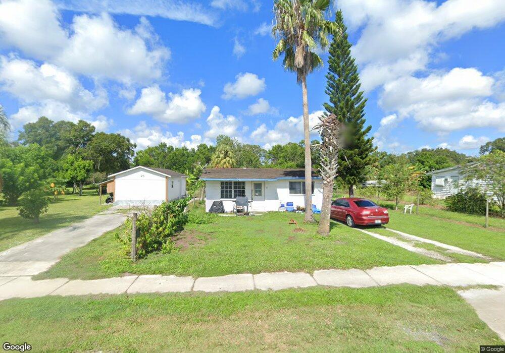
17 S 10th Ave Arcadia, FL 34266
Estimated Value: $128,690 - $166,000
2
Beds
1
Bath
1,048
Sq Ft
$145/Sq Ft
Est. Value
About This Home
This home is located at 17 S 10th Ave, Arcadia, FL 34266 and is currently estimated at $151,897, approximately $144 per square foot. 17 S 10th Ave is a home located in DeSoto County with nearby schools including Memorial Elementary School, DeSoto Middle School, and DeSoto County High School.
Ownership History
Date
Name
Owned For
Owner Type
Purchase Details
Closed on
Apr 16, 2010
Sold by
Federal Home Loan Mortgage Corporation
Bought by
Aguado Audel
Current Estimated Value
Purchase Details
Closed on
Apr 8, 2010
Sold by
Chase Home Finance Llc
Bought by
Federal Home Loan Mortgage Corp
Purchase Details
Closed on
Feb 18, 2010
Sold by
Brown Ronald Henry and Brown Debra Lee
Bought by
Chase Home Finance Llc
Purchase Details
Closed on
Apr 10, 2006
Sold by
Destiny Investment Enterprises Of South
Bought by
Brown Ronald Henry and Brown Debra Lee
Create a Home Valuation Report for This Property
The Home Valuation Report is an in-depth analysis detailing your home's value as well as a comparison with similar homes in the area
Home Values in the Area
Average Home Value in this Area
Purchase History
| Date | Buyer | Sale Price | Title Company |
|---|---|---|---|
| Aguado Audel | $17,500 | New House Title | |
| Federal Home Loan Mortgage Corp | -- | New House Title | |
| Chase Home Finance Llc | -- | None Available | |
| Brown Ronald Henry | -- | Desoto Abstract & Title Co |
Source: Public Records
Tax History
| Year | Tax Paid | Tax Assessment Tax Assessment Total Assessment is a certain percentage of the fair market value that is determined by local assessors to be the total taxable value of land and additions on the property. | Land | Improvement |
|---|---|---|---|---|
| 2024 | $2,051 | $94,253 | $6,000 | $88,253 |
| 2023 | $1,938 | $91,178 | $6,000 | $85,178 |
| 2022 | $1,815 | $68,518 | $0 | $0 |
| 2021 | $1,674 | $62,940 | $6,000 | $56,940 |
| 2020 | $1,577 | $58,114 | $6,000 | $52,114 |
| 2019 | $1,496 | $56,703 | $6,000 | $50,703 |
| 2018 | $1,387 | $50,522 | $0 | $50,522 |
| 2017 | $1,031 | $42,636 | $0 | $42,636 |
| 2016 | $1,221 | $39,842 | $0 | $39,842 |
| 2015 | $1,187 | $37,953 | $0 | $37,953 |
| 2014 | $1,167 | $37,361 | $0 | $37,361 |
Source: Public Records
Map
Nearby Homes
- 103 S Roger Ave
- 101 S Roger Ave
- 1198 SE Mills Ave
- 133 S Sumter Ave
- 1188 SE 7th Ave
- 606 E Oak St
- 607 E Oak St
- 0 SE Carlstrom Field Rd
- 1327 SE Vermont Ave
- 146 N Hernando Ave
- 0 S Hillsborough Ave
- 1208 E Maple St
- 1998 SE 1st Ave
- 418 N 16th Ave
- 245 S Brevard Ave
- 1030 SW Palm Dr
- 103 N Brevard Ave
- 117 N Brevard Ave
- 0 E Effie St E Unit A4533269
- 1298 SE Lake Rd
- 19 S 10th Ave
- 15 S 10th Ave
- 207 S Roger Ave
- 211 S Roger Ave
- 211 S Rogers Ave
- 21 S 10th Ave
- 214 S Roger Ave
- 212 S Roger Ave
- 919 E Myrtle St
- 1527 SE Baker St
- 110 S Roger Ave
- N 10th Ave
- 127 S Luther Ave
- 1003 E Oak St
- 1025 SE 9th Ave
- 125 S Luther Ave
- 820 E Myrtle St
- 208 S Luther Ave
- 210 S Luther Ave
- 16 S 12th Ave
Your Personal Tour Guide
Ask me questions while you tour the home.